File:MappaVerona1849.jpg
Jump to navigation
Jump to search
Size of this preview: 800 × 582 pixels. Other resolutions: 320 × 233 pixels | 640 × 465 pixels | 1,024 × 745 pixels | 1,280 × 931 pixels | 1,986 × 1,444 pixels.
Original file (1,986 × 1,444 pixels, file size: 936 KB, MIME type: image/jpeg)
Captions
Captions
Add a one-line explanation of what this file represents
Summary
[edit]
| Title |
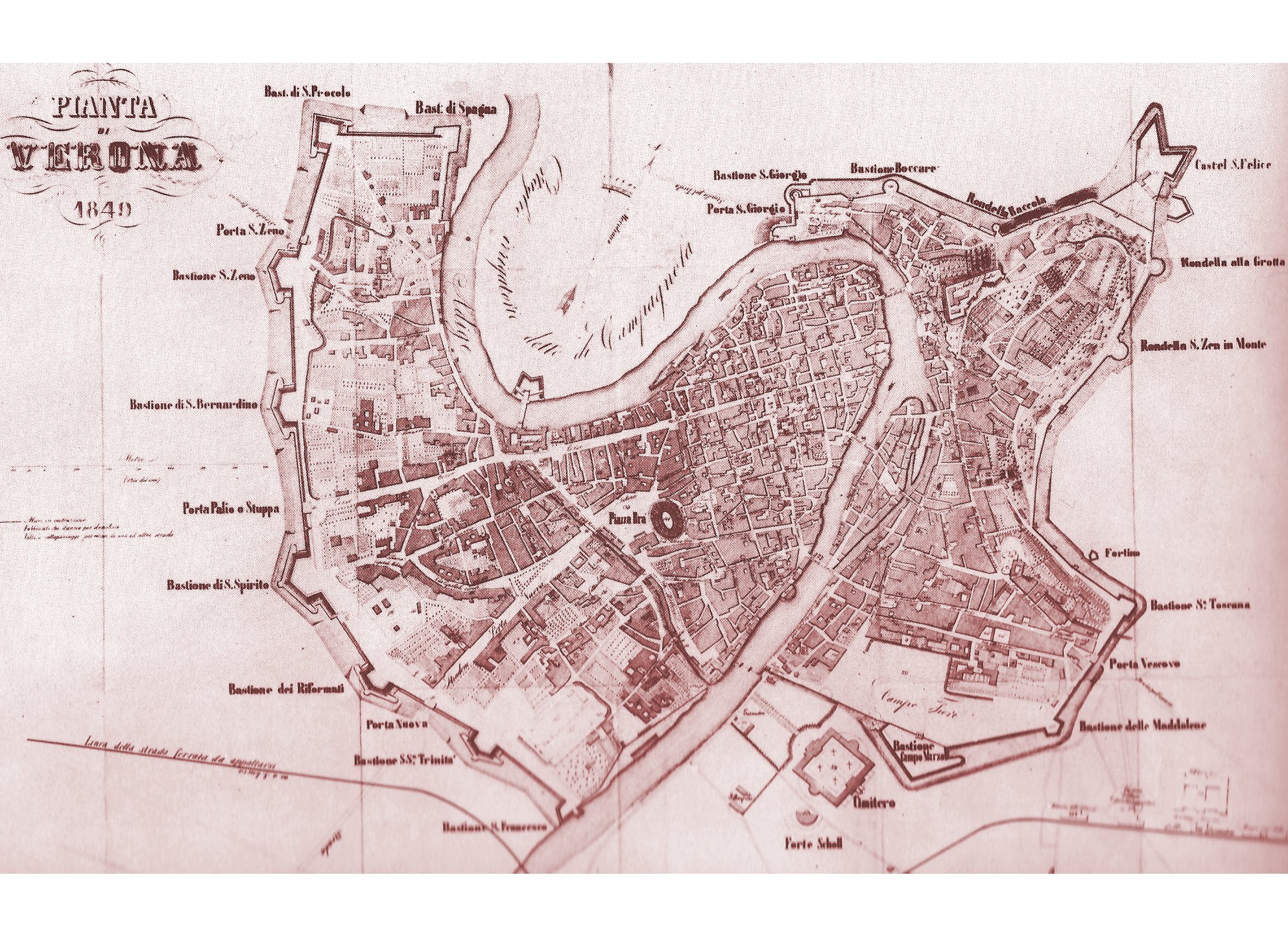
Verona in 1849 |
| Description |
Italiano: Mappa storica della città di Verona nel 1849 English: Verona's (Italy) historical map, 1849 |
| Date | 3 May 2010 (original upload date) |
| Source | Vittorio Jacobacci, La piazzaforte di Verona sotto la dominazione austriaca 1814-1866, Verona, Cassa di Risparmio di Verona Vicenza e Belluno, dicembre 1980. ISBN non esistente |
| Creator |
Unknown author |
| Permission (Reusing this file) |
PD-OLD |
| Geotemporal data | |
| Date depicted | |
| Map location | Verona, Italy |
| Georeferencing | If inappropriate please set warp_status = skip to hide. |
| Bibliographic data | |
| Language | Italian |
Licensing
[edit]
|
This work is in the public domain in its country of origin and other countries and areas where the copyright term is the author's life plus 70 years or fewer. | |
| This file has been identified as being free of known restrictions under copyright law, including all related and neighboring rights. | |
Original upload log
[edit]
The original description page was here. All following user names refer to it.wikipedia.
- 2010-05-03 21:16 Adert 1986×1444× (957975 bytes) Fonte: "La piazzaforte di Verona sotto la dominazione austriaca 1814-1866 (edizione 1980)" Mappa di Verona nel 1948
File history
Click on a date/time to view the file as it appeared at that time.
| Date/Time | Thumbnail | Dimensions | User | Comment | |
|---|---|---|---|---|---|
| current | 12:38, 15 April 2014 | | 1,986 × 1,444 (936 KB) | Adert (talk | contribs) | Transferred from it.wikipedia |
You cannot overwrite this file.
File usage on Commons
The following page uses this file:
- File:MappaVerona1948.jpg (file redirect)
File usage on other wikis
The following other wikis use this file:
- Usage on it.wikipedia.org