File:Maricopa County Incorporated and Planning areas Peoria highlighted.svg
跳转到导航
跳转到搜索

此SVG文件的PNG预览的大小:694 × 599像素。 其他分辨率:278 × 240像素 | 556 × 480像素 | 889 × 768像素 | 1,185 × 1,024像素 | 2,371 × 2,048像素 | 940 × 812像素。
原始文件 (SVG文件,尺寸为940 × 812像素,文件大小:1.05 MB)
说明
说明
添加一行文字以描述该文件所表现的内容
摘要
[编辑]
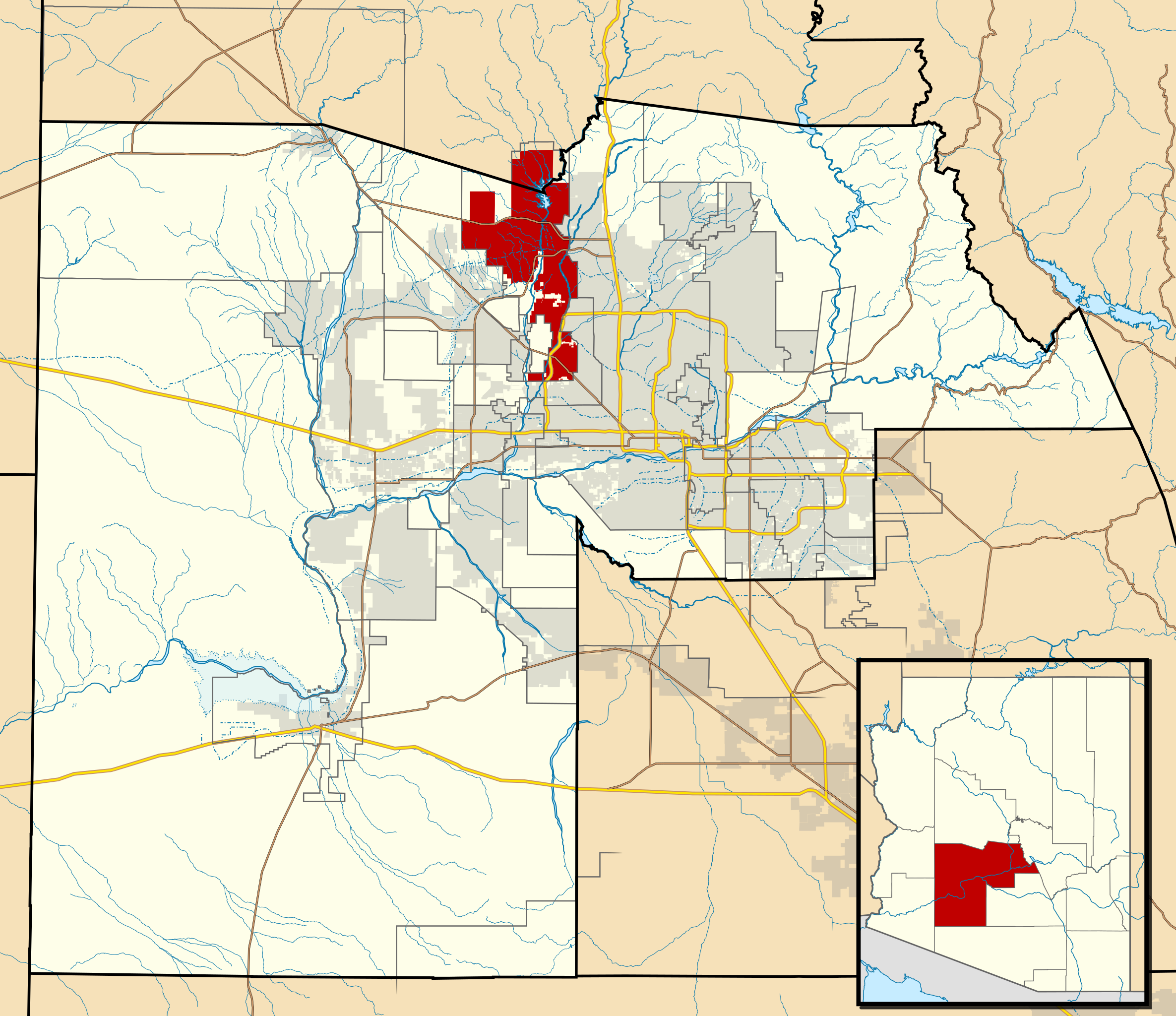
| 描述 | This map shows the incorporated areas and Indian reservation boundaries in Maricopa County, Arizona, along with water bodies and major highways and roads. Peoria is highlighted in red. Other incorporated cities are shown in gray, planning area borders for these cities and Indian reservation borders are shown as solid black lines. Changes from Previous Version: Updated the maps to include water bodies and to make "less boring" than the plain black/white/gray maps. Format was updated to match standards laid out by WikiProject Maps/Conventions. Map data is based on data from the following Webpage: Maricopa County Interactive GIS Map. I created this map in Inkscape. |
| 日期 | |
| 来源 | My own work, based on government information |
| 作者 | Ixnayonthetimmay |
| 授权 (二次使用本文件) |
Public Domain |
| 其他版本 | See Category:Maps of Maricopa County for other versions of this image. |
许可协议
[编辑]
| 我,本作品著作权人,释出本作品至公有领域。这适用于全世界。 在一些国家这可能不合法;如果是这样的话,那么: 我无条件地授予任何人以任何目的使用本作品的权利,除非这些条件是法律规定所必需的。 |
文件历史
点击某个日期/时间查看对应时刻的文件。
| 日期/时间 | 缩略图 | 大小 | 用户 | 备注 | |
|---|---|---|---|---|---|
| 当前 | 2011年5月20日 (五) 06:39 | | 940 × 812(1.05 MB) | Ixnayonthetimmay(留言 | 贡献) | Uploading new version |
| 2008年8月30日 (六) 04:33 |  | 900 × 800(413 KB) | Ixnayonthetimmay(留言 | 贡献) | == Summary == {{Information |Description=This map shows the incorporated areas and unincorporated areas in Maricopa County, Arizona. [[:en:Paloma, Arizona|Pa | |
| 2007年9月16日 (日) 00:17 |  | 900 × 800(384 KB) | Ixnayonthetimmay(留言 | 贡献) | {{Information |Description= |Source= |Date= |Author= |Permission= |other_versions= }} | |
| 2007年5月28日 (一) 10:10 |  | 900 × 780(329 KB) | Ixnayonthetimmay(留言 | 贡献) | ||
| 2007年5月22日 (二) 00:54 |  | 900 × 780(318 KB) | Ixnayonthetimmay(留言 | 贡献) | ||
| 2007年1月30日 (二) 05:21 |  | 904 × 758(189 KB) | Ixnayonthetimmay(留言 | 贡献) | {{Information |Description=This map shows the incorporated areas in Maricopa County, Arizona, highlighting Peoria in red. It also shows the boundaries for the mun |
您不可以覆盖此文件。
文件用途
没有页面使用本文件。
全域文件用途
以下其他wiki使用此文件:
- azb.wikipedia.org上的用途
- ceb.wikipedia.org上的用途
- de.wikipedia.org上的用途
- en.wikipedia.org上的用途
- eo.wikipedia.org上的用途
- fa.wikipedia.org上的用途
- fi.wikipedia.org上的用途
- ja.wikipedia.org上的用途
- ml.wikipedia.org上的用途
- nl.wikipedia.org上的用途
- pl.wikipedia.org上的用途
- pt.wikipedia.org上的用途
- sco.wikipedia.org上的用途
- sr.wikipedia.org上的用途
- sv.wikipedia.org上的用途
- sw.wikipedia.org上的用途
- ur.wikipedia.org上的用途
- vi.wikipedia.org上的用途
- zh.wikipedia.org上的用途