File:Maritime Peninsula in winter.png
Jump to navigation
Jump to search
Size of this preview: 390 × 599 pixels. Other resolutions: 156 × 240 pixels | 312 × 480 pixels | 839 × 1,289 pixels.
Original file (839 × 1,289 pixels, file size: 2.58 MB, MIME type: image/png)
Captions
Captions
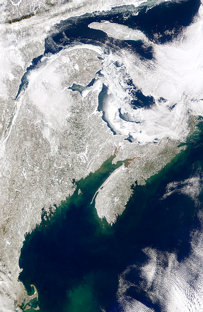
The Maritime Peninsula in winter, showing the Gulf of Saint Lawrence to the north and the Gulf of Maine to the south
Summary[edit]
| Description |
English: This SeaWiFS image shows the productive waters over George's Bank and Nantucket Shoals, the sediment muddied waters in the upper Bay of Fundy, sea ice in the Gulf of St. Lawrence, and the ice covered Lake Manicouagan formed around a former impact crater. |
| Date | |
| Source | NASA |
| Author | SeaWiFS Project, NASA/Goddard Space Flight Center, and ORBIMAGE |
Licensing[edit]
| This file is in the public domain in the United States because it was solely created by NASA. NASA copyright policy states that "NASA material is not protected by copyright unless noted". (See Template:PD-USGov, NASA copyright policy page or JPL Image Use Policy.) | ||
 |
Warnings:
|
File history
Click on a date/time to view the file as it appeared at that time.
| Date/Time | Thumbnail | Dimensions | User | Comment | |
|---|---|---|---|---|---|
| current | 02:08, 9 June 2019 | | 839 × 1,289 (2.58 MB) | Sangdeboeuf (talk | contribs) | Cropped |
| 02:06, 9 June 2019 |  | 949 × 1,646 (3.35 MB) | Sangdeboeuf (talk | contribs) | User created page with UploadWizard |
You cannot overwrite this file.
File usage on Commons
There are no pages that use this file.
File usage on other wikis
The following other wikis use this file:
- Usage on en.wikipedia.org