File:Mars gravitational field (MOLA dataset).png
跳至導覽
跳至搜尋
預覽大小:800 × 361 像素。 其他解析度:320 × 144 像素 | 640 × 289 像素 | 1,024 × 462 像素 | 1,280 × 578 像素 | 2,880 × 1,300 像素。
原始檔案 (2,880 × 1,300 像素,檔案大小:1.52 MB,MIME 類型:image/png)
說明
說明
添加單行說明來描述出檔案所代表的內容
摘要
[編輯]| 描述 |
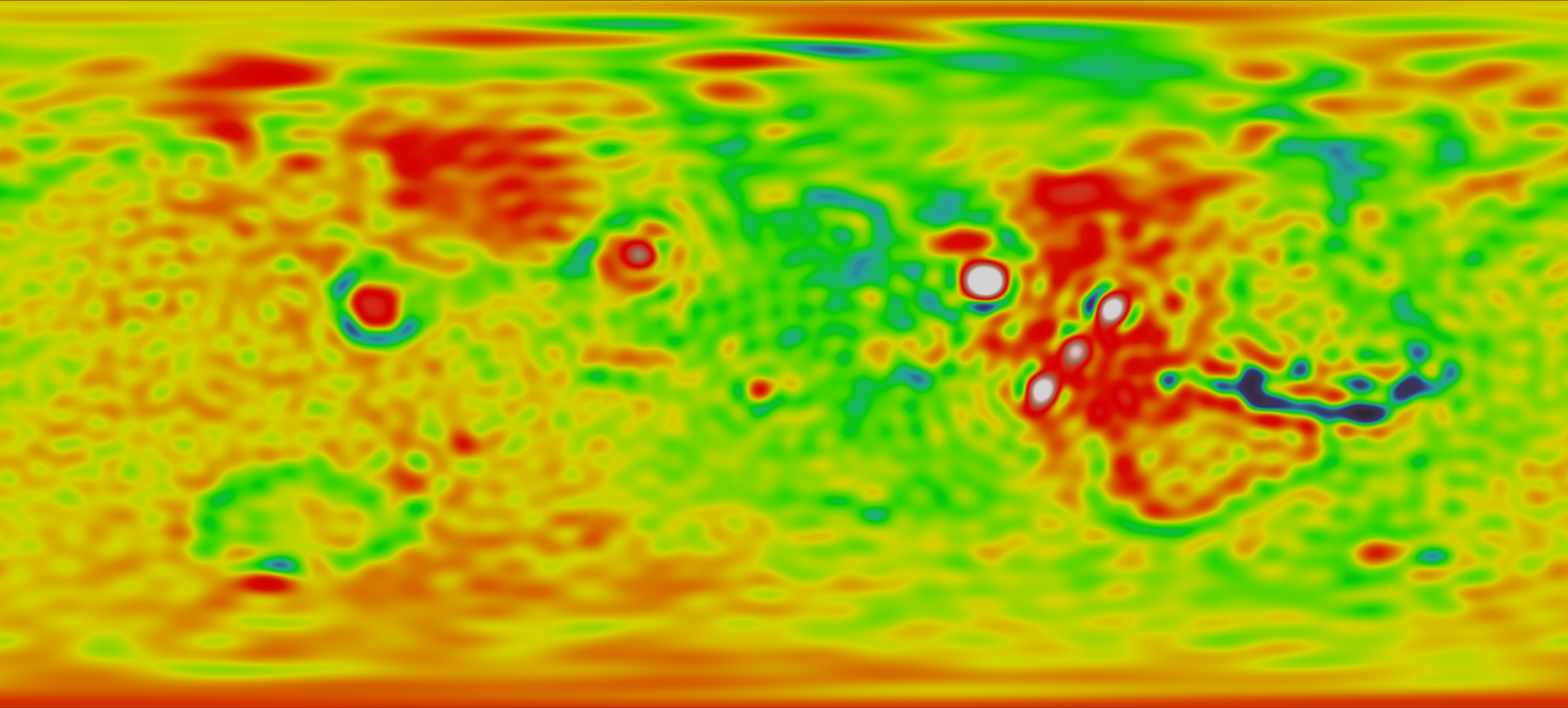
English: This map portrays observed data describing Mars's gravitational field. Seen here, white and red areas depict regions with the strongest gravitational force, while green and blue areas are the weakest. This image was generated by data reported by the Radio Science Experiment. |
| 日期 | Data collected between 1997-09-15 and 2000-01-31 |
| 來源 | |
| 作者 |
NASA - Goddard Space Flight Center |
| 其他版本 |
|
.png)
.png)
.png&action=edit§ion=1)
.jpg)
授權條款
[編輯].png&action=edit§ion=2)
| 本作品由NASA創作,屬於公有領域。根據NASA的版權政策:“NASA的創作除非另有聲明否則不受版權保護。”(參見:Template:PD-USGov/zh,NASA版權政策或JPL圖像使用政策) | ||
 |
警告:
|
檔案歷史
點選日期/時間以檢視該時間的檔案版本。
| 日期/時間 | 縮圖 | 尺寸 | 使用者 | 備註 | |
|---|---|---|---|---|---|
| 目前 | 2009年3月4日 (三) 21:42 | | 2,880 × 1,300(1.52 MB) | Tryphon(留言 | 貢獻) | == Summary == {{Information |Description={{en|1=This maps portrays observed data describing Mars's gravitational field. Seen here, white and red areas depict regions with the strongest gravitational force, while green and blue areas are the weakest. This |
無法覆蓋此檔案。
檔案用途
下列3個頁面有用到此檔案:
全域檔案使用狀況
以下其他 wiki 使用了這個檔案:
- fr.wikipedia.org 的使用狀況
- zh.wikipedia.org 的使用狀況
.png&oldid=859827813)