File:Matthew 2016-10-02 1545Z.jpg
跳至導覽
跳至搜尋
預覽大小:450 × 600 像素。 其他解析度:180 × 240 像素 | 360 × 480 像素 | 576 × 768 像素 | 768 × 1,024 像素 | 1,536 × 2,048 像素 | 5,760 × 7,680 像素。
原始檔案 (5,760 × 7,680 像素,檔案大小:11.74 MB,MIME 類型:image/jpeg)
說明
說明
添加單行說明來描述出檔案所代表的內容
摘要[編輯]
| 描述 |
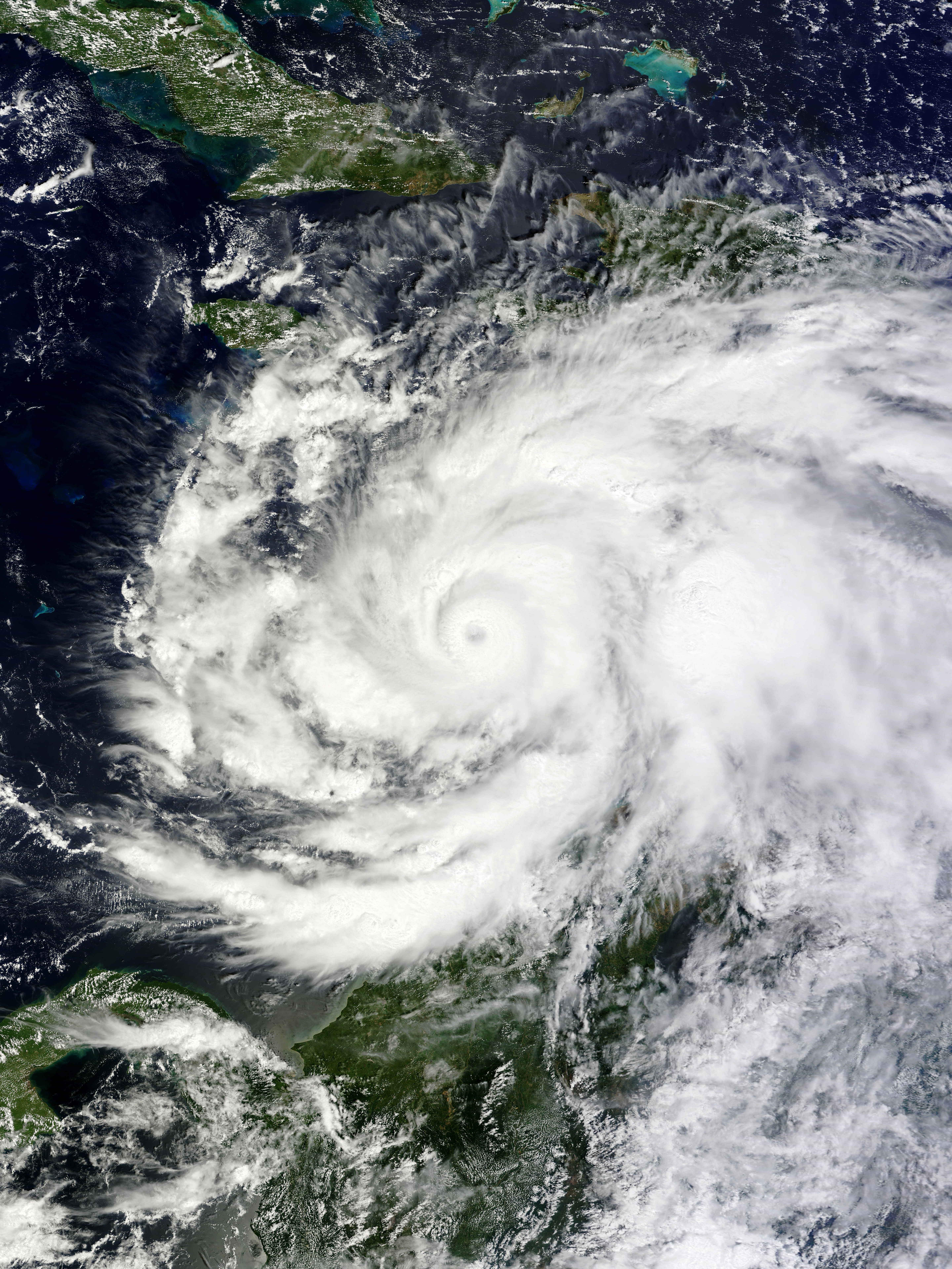
English: The Terra satellite acquired this true-color image of Hurricane Matthew over the Caribbean Sea on October 2, 2016, located between Colombia and the island of Hispaniola as a Category 4 hurricane. The storm later devastated Haiti, the Dominican Republic, Cuba, the Bahamas and the southeastern United States. |
| 日期 | |
| 來源 | EOSDIS Worldview |
| 作者 | MODIS image captured by NASA’s Terra satellite |
| 拍攝地點 | | 位於此地的本圖片與其他圖片: OpenStreetMap |
|---|
授權條款[編輯]
| 本作品由NASA創作,屬於公有領域。根據NASA的版權政策:“NASA的創作除非另有聲明否則不受版權保護。”(參見:Template:PD-USGov/zh,NASA版權政策或JPL圖像使用政策) | ||
 |
警告:
|
檔案歷史
點選日期/時間以檢視該時間的檔案版本。
| 日期/時間 | 縮圖 | 尺寸 | 用戶 | 備註 | |
|---|---|---|---|---|---|
| 目前 | 2016年10月8日 (六) 08:32 | | 5,760 × 7,680(11.74 MB) | Meow(對話 | 貢獻) | User created page with UploadWizard |
無法覆蓋此檔案。
檔案用途
全域檔案使用狀況
以下其他 wiki 使用了這個檔案:
- en.wikipedia.org 的使用狀況
- zh.wikipedia.org 的使用狀況