File:Mauritania relief location map.jpg
Jump to navigation
Jump to search

Size of this preview: 556 × 600 pixels. Other resolutions: 222 × 240 pixels | 445 × 480 pixels | 712 × 768 pixels | 949 × 1,024 pixels | 1,283 × 1,384 pixels.
Original file (1,283 × 1,384 pixels, file size: 257 KB, MIME type: image/jpeg)
Captions
Captions
Add a one-line explanation of what this file represents
Summary[edit]
| Camera location | | View this and other nearby images on: OpenStreetMap |
|---|
| Description |
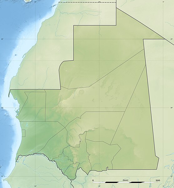
English: Blank physical map of Mauritania, for geo-location purposes.
Français : Carte physique vierge de la Mauritanie, destinée à la géolocalisation. Scale: 1:4,400,000 (precision: 1,100 m)
Geographic limits of the map:
|
||
| Date | |||
| Source |
Own work
|
||
| Author | Eric Gaba (Sting - fr:Sting) | ||
| Permission (Reusing this file) |
|
||
| Other versions |
|

Licensing[edit]
I, the copyright holder of this work, hereby publish it under the following licenses:
This file is licensed under the Creative Commons Attribution-Share Alike 3.0 Unported license.
- You are free:
- to share – to copy, distribute and transmit the work
- to remix – to adapt the work
- Under the following conditions:
- attribution – You must give appropriate credit, provide a link to the license, and indicate if changes were made. You may do so in any reasonable manner, but not in any way that suggests the licensor endorses you or your use.
- share alike – If you remix, transform, or build upon the material, you must distribute your contributions under the same or compatible license as the original.

|
Permission is granted to copy, distribute and/or modify this document under the terms of the GNU Free Documentation License, Version 1.2 or any later version published by the Free Software Foundation; with no Invariant Sections, no Front-Cover Texts, and no Back-Cover Texts. A copy of the license is included in the section entitled GNU Free Documentation License. |
You may select the license of your choice.
File history
Click on a date/time to view the file as it appeared at that time.
| Date/Time | Thumbnail | Dimensions | User | Comment | |
|---|---|---|---|---|---|
| current | 13:14, 19 July 2010 | | 1,283 × 1,384 (257 KB) | Sting (talk | contribs) | Color profile |
| 13:47, 23 November 2009 |  | 1,283 × 1,384 (256 KB) | Sting (talk | contribs) | == {{int:filedesc}} == {{Location|21|00|00|N|10|57|00|W|scale:7000000}} <br/> {{Information |Description={{en|Blank physical map of Mauritania, for geo-location purposes.}} {{fr|Carte physique vierge de la Mauritanie, |
You cannot overwrite this file.
File usage
The following 2 pages use this file:
Global file usage
The following other wikis use this file:
- Usage on af.wikipedia.org
- Usage on ar.wikipedia.org
- Usage on ast.wikipedia.org
- Usage on az.wikipedia.org
- Usage on ba.wikipedia.org
- Usage on be.wikipedia.org
- Usage on bg.wikipedia.org
- Usage on bn.wikipedia.org
- Usage on bs.wikipedia.org
- Usage on ceb.wikipedia.org
- Usage on ce.wikipedia.org
- Usage on ckb.wikipedia.org
- Usage on cs.wikipedia.org
- Usage on da.wikipedia.org
- Usage on de.wikipedia.org
- Arguin
- Mauretanien
- Ras Nouadhibou
- Vorlage:Positionskarte Mauretanien
- Aouelloul
- Wikipedia:Kartenwerkstatt/Positionskarten/Afrika
- Tenoumer
- Arguin-Sandbank
- Kijji
- Tidra
- Kediet Ijill
- Kiaone-Inseln
- Welterbe in Mauretanien
- Antike Ksur von Ouadane, Chinguetti, Tichitt und Oualata
- Liste von Kraftwerken in Mauretanien
- Nair (Arguin-Sandbank)
- Usage on de.wikivoyage.org
View more global usage of this file.