File:Mbarara District in Uganda.svg
Jump to navigation
Jump to search

Size of this PNG preview of this SVG file: 589 × 599 pixels. Other resolutions: 236 × 240 pixels | 472 × 480 pixels | 755 × 768 pixels | 1,007 × 1,024 pixels | 2,013 × 2,048 pixels | 1,441 × 1,466 pixels.
Original file (SVG file, nominally 1,441 × 1,466 pixels, file size: 367 KB)
Captions
Captions
Add a one-line explanation of what this file represents
Summary
[edit]
| Description |
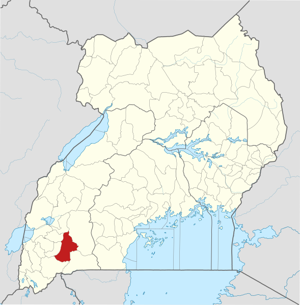
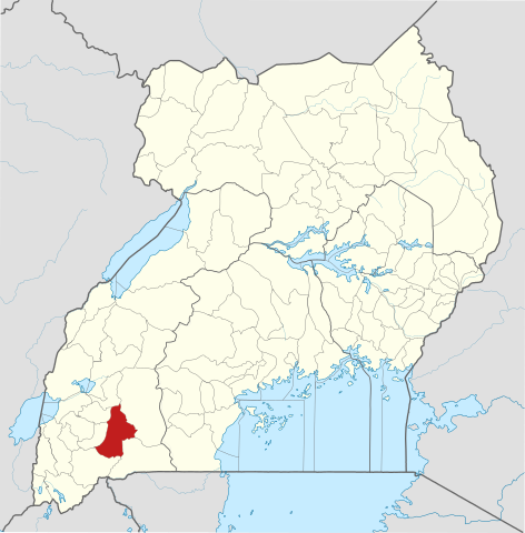
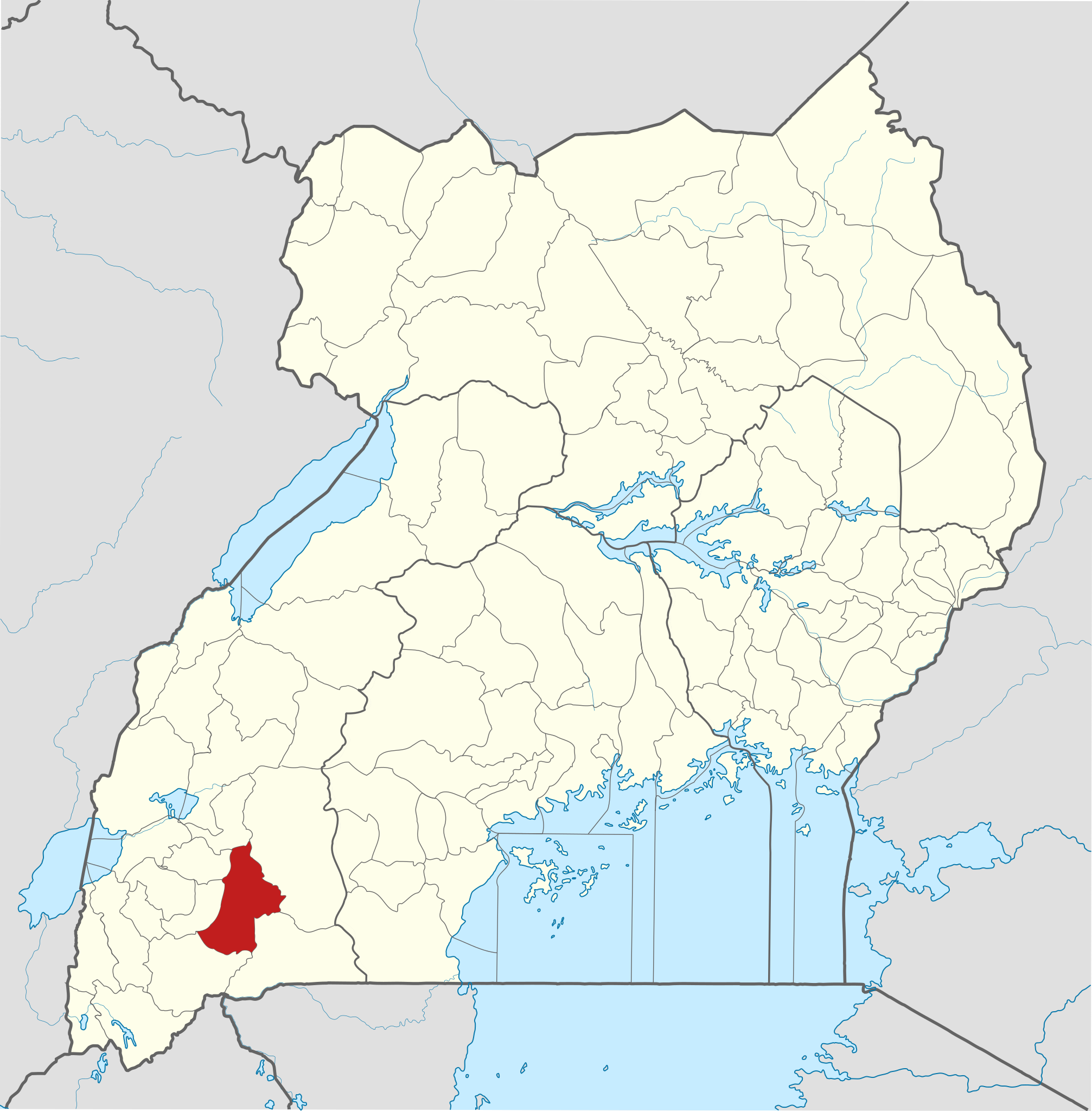
English: The location of Mbarara District in Uganda, showing district boundaries as they stood in June 2017. For other districts, see Category:SVG locator maps of Districts in Uganda (location map scheme). This map may be incomplete, and may contain errors. Don't rely solely on it for navigation. In particular, note that this map overlays a spherical pseudo-mercator projection on an equirectangular projection; it is far from technically perfect.
This W3C-unspecified vector image was created with Inkscape . |
|||||||||
| Date | ||||||||||
| Source |
Derivative of:
|
|||||||||
| Creator |
OpenStreetMap contributors, Jarry1250, NordNordWest |
|||||||||
| Permission (Reusing this file) |
This file is licensed under the Creative Commons Attribution-Share Alike 3.0 Unported license. Attribution: © OpenStreetMap contributors, Jarry1250, NordNordWest/Wikipedia
|
|||||||||
| Geotemporal data | ||||||||||
| Map location | Mbarara District, Uganda | |||||||||
| Spatial reference system | equirectangular | |||||||||
| Bounding box |
|
|||||||||
| Georeferencing | If inappropriate please set warp_status = skip to hide. | |||||||||
File history
Click on a date/time to view the file as it appeared at that time.
| Date/Time | Thumbnail | Dimensions | User | Comment | |
|---|---|---|---|---|---|
| current | 21:06, 25 June 2017 | | 1,441 × 1,466 (367 KB) | Jarry1250 (talk | contribs) | pattypan 17.05 |
You cannot overwrite this file.
File usage on Commons
The following page uses this file:
File usage on other wikis
The following other wikis use this file:
- Usage on de.wikipedia.org
- Usage on en.wikipedia.org
- Mbarara district
- Mbarara University
- Mbarara
- Roman Catholic Archdiocese of Mbarara
- Ntare School
- Mbarara High School
- Mbarara Hospital
- Bishop Stuart University
- Wikipedia:WikiProject Uganda/District templates
- Mbarara Airport
- Template:Mbarara District
- Mbarara–Kikagati Road
- Holy Innocents Children's Hospital
- Mbarara University School of Medicine
- Maryhill High School
- Nyakayojo Secondary School
- Mbarara–Ntungamo–Kabale–Katuna Road
- Masaka–Mbarara Road
- Mbarara–Ishaka Road
- Mbarara Regional Cancer Centre
- User:GerardM/Districts of Uganda
- Katete (Uganda)
- NSSF Mbarara Complex
- Mayanja Memorial Hospital
- Ruharo Mission Hospital
- Usage on es.wikipedia.org
- Usage on fr.wikipedia.org
- Usage on ha.wikipedia.org
- Usage on he.wikipedia.org
- Usage on id.wikipedia.org
- Usage on ig.wikipedia.org
- Usage on ja.wikipedia.org
- Usage on lg.wikipedia.org
- Usage on sw.wikipedia.org
- Usage on ts.wikipedia.org
- Usage on www.wikidata.org
- Usage on yo.wikipedia.org
- Usage on zh-min-nan.wikipedia.org
- Usage on zu.wikipedia.org