File:McKinney Stables, Cuba, New York - 20200719.jpg
Jump to navigation
Jump to search
Size of this preview: 800 × 480 pixels. Other resolutions: 320 × 192 pixels | 1,024 × 614 pixels | 1,280 × 768 pixels | 2,560 × 1,536 pixels | 3,747 × 2,248 pixels.
Original file (3,747 × 2,248 pixels, file size: 2.52 MB, MIME type: image/jpeg)
Captions
Captions
Add a one-line explanation of what this file represents
Summary
[edit]
| Description |
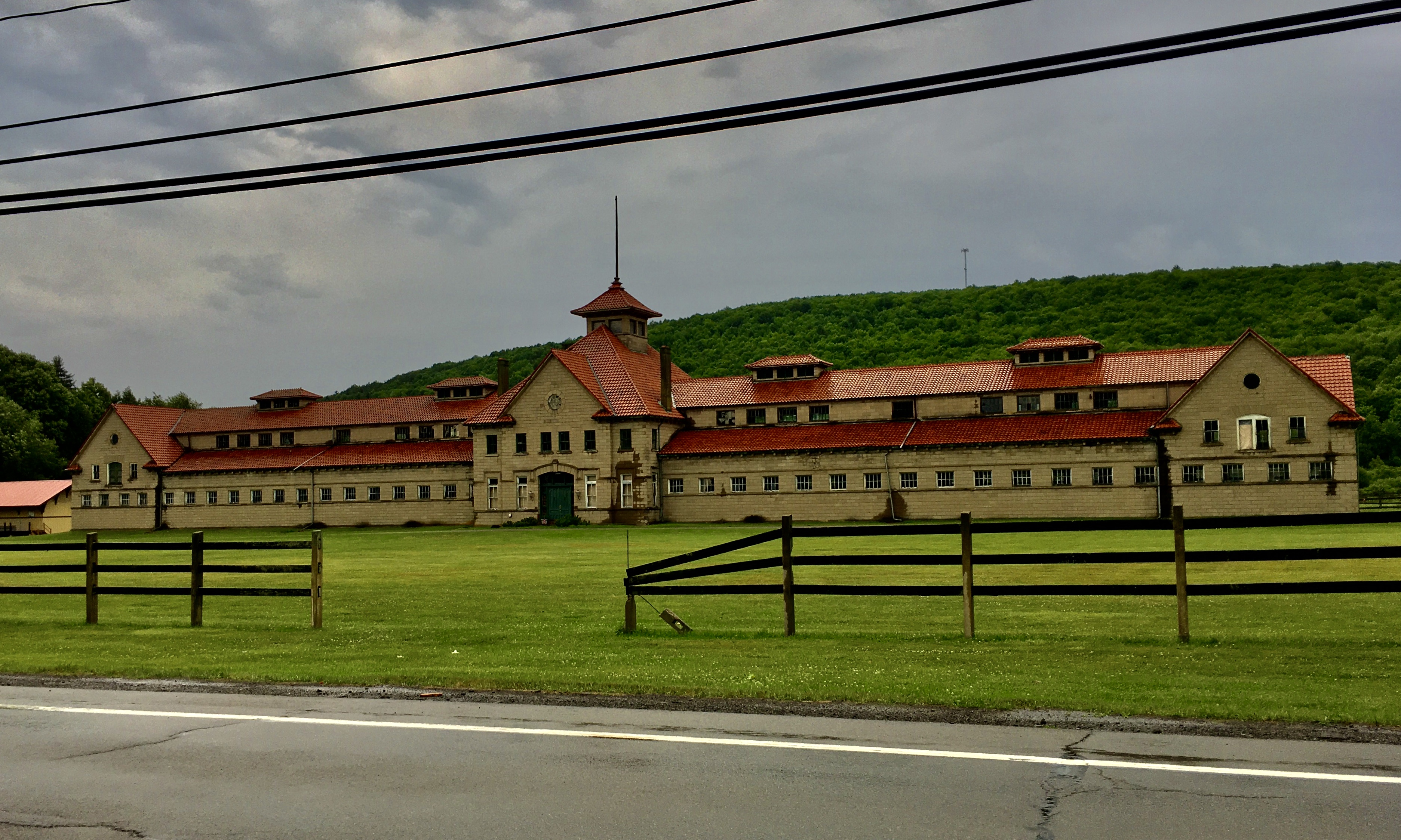
English: The McKinney Stables of Empire City Farms, 105 South Street, Cuba, New York, July 2020. A work of Buffalo-based architect John H. Coxhead, this enormous horse barn extends 347 feet in length and was constructed of concrete blocks produced on-site via an innovative casting process, accented with concrete trim, and topped with a steeply-pitched hip roof in terra cotta tile lending something of a Mediterranean influence. Notable among its architectural features are the identical gables above the entrance and atop the pavilion at the end of each wing, with prominent cornice returns at the bottom of each eave and an oculus window contained within, as well as the segmental-arched architrave above the main entrance topped with a decorative keystone, and the cupola with an unusual pagoda-like roof that crowns the façade at center. Locally renowned as a breeder of Jersey cattle and novel Shetland ponies, the enormous Empire City Farms was located in the neighboring town of New Hudson and was owned by Joseph McGraw (1812-1892) and his son-in-law William Simpson (1837-1916), the latter of whom was an avid aficionado of horse racing and had the stable seen here built in 1909 to house his prize racehorses after the stables at New Hudson were lost to a devastating fire five years earlier. The 99 acres of land on which the building sits were used for grazing and exercising the horses. After the sale of Empire City Farms a few years after Simpson's death, the building was used for a short period as the home of the printing business owned by son Frederick Simpson (1873-1956), and also for a short period in the 1980s saw use for its originally intended purpose housing Arabian stallions, but has otherwise stood vacant for most of the past century. |
| Date | Taken on 19 July 2020, 16:45:01 |
| Source | Own work |
| Author | Andre Carrotflower |
| Camera location | | View this and other nearby images on: OpenStreetMap |
|---|
Licensing
[edit]
I, the copyright holder of this work, hereby publish it under the following license:
This file is licensed under the Creative Commons Attribution-Share Alike 4.0 International license.
- You are free:
- to share – to copy, distribute and transmit the work
- to remix – to adapt the work
- Under the following conditions:
- attribution – You must give appropriate credit, provide a link to the license, and indicate if changes were made. You may do so in any reasonable manner, but not in any way that suggests the licensor endorses you or your use.
- share alike – If you remix, transform, or build upon the material, you must distribute your contributions under the same or compatible license as the original.
File history
Click on a date/time to view the file as it appeared at that time.
| Date/Time | Thumbnail | Dimensions | User | Comment | |
|---|---|---|---|---|---|
| current | 05:52, 5 August 2020 | | 3,747 × 2,248 (2.52 MB) | Andre Carrotflower (talk | contribs) | Uploaded own work with UploadWizard |
You cannot overwrite this file.
File usage on Commons
There are no pages that use this file.
File usage on other wikis
The following other wikis use this file:
- Usage on en.wikipedia.org
- Usage on www.wikidata.org
Metadata
Categories:
- July 2020 in New York (state)
- John Hopper Coxhead
- Cuba, New York
- Barns on the National Register of Historic Places in New York (state)
- Built in New York (state) in 1909
- Concrete buildings in New York (state)
- Neo-Renaissance architecture in New York (state)
- Buildings in Allegany County, New York
- National Register of Historic Places in Allegany County, New York