File:Mendocino Indian Reservation.jpg
Jump to navigation
Jump to search
Size of this preview: 452 × 599 pixels. Other resolutions: 181 × 240 pixels | 362 × 480 pixels | 579 × 768 pixels | 772 × 1,024 pixels | 1,544 × 2,048 pixels | 4,861 × 6,447 pixels.
Original file (4,861 × 6,447 pixels, file size: 21.64 MB, MIME type: image/jpeg)
Captions
Captions
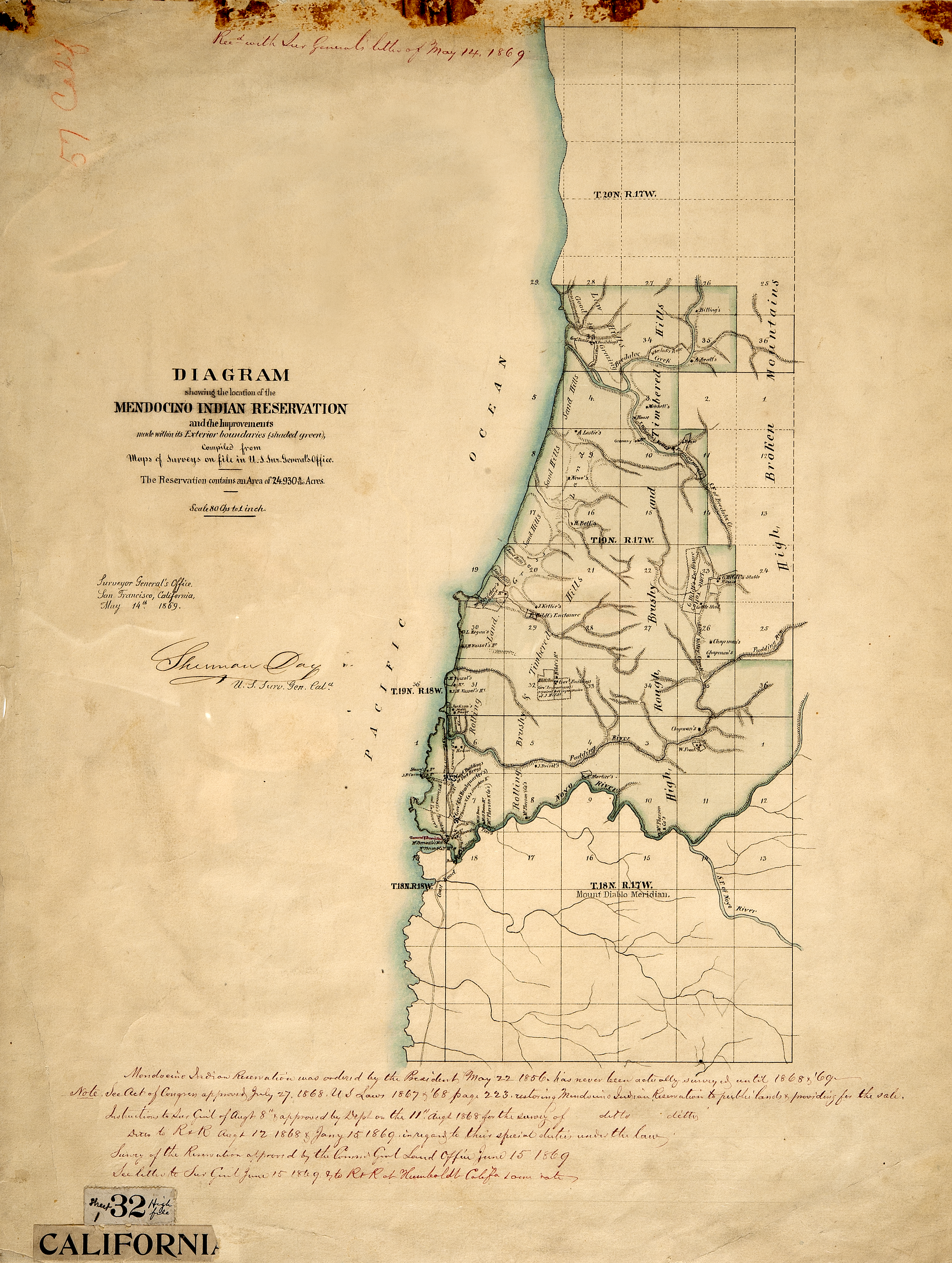
Diagram of Mendocino Indian Reservation in 1856 by the U.S. Surveyor General Office in year 1856
Summary
[edit]
| Description |
English: This map was released in 1869. It represents a land survey of the Mendocino Indian Reservation which was in operation from 1856 through 1864, and was officially closed in 1866. The reservations headquarters and it's onsite military fort were located on what is now the town of Fort Bragg, California. Unlike many other reservations, the ownership of this land was retained by the federal government. In 1869 lands were put up for sale, and sold off to the (non- Indian) public for $1.25 an acre. |
| Date | |
| Source | national archives |
| Author | surveyors general office |
Licensing
[edit]
This work is in the public domain in the United States because it is a work prepared by an officer or employee of the United States Government as part of that person’s official duties under the terms of Title 17, Chapter 1, Section 105 of the US Code.
Note: This only applies to original works of the Federal Government and not to the work of any individual U.S. state, territory, commonwealth, county, municipality, or any other subdivision. This template also does not apply to postage stamp designs published by the United States Postal Service since 1978. (See § 313.6(C)(1) of Compendium of U.S. Copyright Office Practices). It also does not apply to certain US coins; see The US Mint Terms of Use.
|
 | |
| This file has been identified as being free of known restrictions under copyright law, including all related and neighboring rights. | ||
File history
Click on a date/time to view the file as it appeared at that time.
| Date/Time | Thumbnail | Dimensions | User | Comment | |
|---|---|---|---|---|---|
| current | 04:56, 14 February 2012 | | 4,861 × 6,447 (21.64 MB) | Rickh4949 (talk | contribs) |
You cannot overwrite this file.
File usage on Commons
The following page uses this file:
File usage on other wikis
The following other wikis use this file:
- Usage on en.wikipedia.org
- Usage on www.wikidata.org