File:Mentawai Islands Map.png
Jump to navigation
Jump to search

Size of this preview: 521 × 600 pixels. Other resolutions: 208 × 240 pixels | 417 × 480 pixels | 667 × 768 pixels | 889 × 1,024 pixels | 1,360 × 1,566 pixels.
Original file (1,360 × 1,566 pixels, file size: 96 KB, MIME type: image/png)
Captions
Captions
Add a one-line explanation of what this file represents
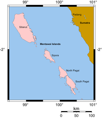
| Description | Map of the Mentawai Islands drawn by MichaelJLowe, based upon public domain map from [1]. |
| Date | |
| Source | self drawn |
| Author | MichaelJLowe |
| Permission (Reusing this file) |
This file is licensed under the Creative Commons Attribution-Share Alike 2.5 Generic license. Attribution: Michael J. Lowe
|
File history
Click on a date/time to view the file as it appeared at that time.
| Date/Time | Thumbnail | Dimensions | User | Comment | |
|---|---|---|---|---|---|
| current | 11:42, 13 April 2007 | | 1,360 × 1,566 (96 KB) | MichaelJLowe (talk | contribs) | {{Information |Description=Map of the Mentawai Islands drawn by MichaelJLowe, based upon public domain map from [http://www.aquarius.geomar.de/omc]. |Source=self drawn |Date=2007-04 |Author=[[:en:User:Mic |
You cannot overwrite this file.
File usage on Commons
There are no pages that use this file.
File usage on other wikis
The following other wikis use this file:
- Usage on ca.wikipedia.org
- Usage on da.wikipedia.org
- Usage on en.wikipedia.org
- Usage on fr.wikipedia.org
- Usage on he.wikipedia.org
- Usage on ilo.wikipedia.org
- Usage on it.wikipedia.org
- Usage on lt.wikipedia.org
- Usage on nl.wikipedia.org
- Usage on pl.wikipedia.org
- Usage on pt.wikipedia.org
- Usage on ru.wikipedia.org
- Usage on vi.wikipedia.org