File:Mergui Archipelago.jpg

Original file (4,572 × 4,572 pixels, file size: 3.91 MB, MIME type: image/jpeg)
Captions
Captions
| DescriptionMergui Archipelago.jpg |
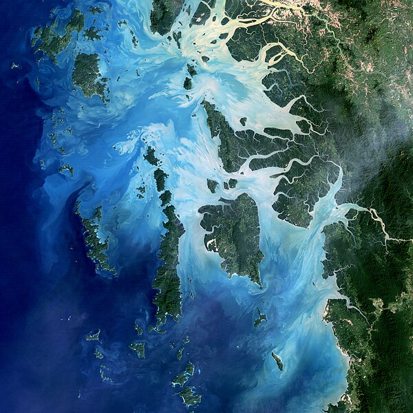
Mergui Archipelago, Myanmar NASA image acquired December 14, 2004 In the southernmost reaches of Burma (Myanmar), along the border with Thailand, lies the Mergui Archipelago. The archipelago in the Andaman Sea is made up of more than 800 islands surrounded by extensive coral reefs. Landsat image created by Michael Taylor, Landsat Project Science Office. Caption by Laura Rocchio. Instrument: Landsat 5 - TM Credit:NASA Earth Obsevatory |
||
| Date | |||
| Source | Flickr: Mergui Archipelago | ||
| Author | NASA Goddard Space Flight Center | ||
| Permission (Reusing this file) |
This file is licensed under the Creative Commons Attribution 2.0 Generic license.
|
File history
Click on a date/time to view the file as it appeared at that time.
| Date/Time | Thumbnail | Dimensions | User | Comment | |
|---|---|---|---|---|---|
| current | 05:21, 18 June 2014 |  | 4,572 × 4,572 (3.91 MB) | Flickr upload bot (talk | contribs) | Uploaded from http://flickr.com/photo/24662369@N07/8240805973 using Flickr upload bot |
You cannot overwrite this file.
File usage on Commons
The following 2 pages use this file:
- File:Mergui Archipelago (8240805973).jpg (file redirect)
- File:R Mergui Archipelago (8240805973).jpg (file redirect)
File usage on other wikis
The following other wikis use this file:
- Usage on da.wikipedia.org
- Usage on it.wiktionary.org
- Usage on ja.wikipedia.org
- Usage on uk.wikipedia.org
Metadata
This file contains additional information such as Exif metadata which may have been added by the digital camera, scanner, or software program used to create or digitize it. If the file has been modified from its original state, some details such as the timestamp may not fully reflect those of the original file. The timestamp is only as accurate as the clock in the camera, and it may be completely wrong.
| Orientation | Normal |
|---|---|
| Horizontal resolution | 72 dpi |
| Vertical resolution | 72 dpi |
| Software used | Adobe Photoshop CS6 (Macintosh) |
| File change date and time | 14:24, 29 November 2012 |
| Color space | Uncalibrated |
| Date and time of digitizing | 10:01, 29 March 2012 |
| Date metadata was last modified | 09:24, 29 November 2012 |
| Unique ID of original document | xmp.did:16DAB14D09206811979C8084C0102193 |