File:Mexico Coahuila topographic location map.png
Jump to navigation
Jump to search

Size of this preview: 419 × 600 pixels. Other resolutions: 168 × 240 pixels | 335 × 480 pixels | 726 × 1,039 pixels.
Original file (726 × 1,039 pixels, file size: 172 KB, MIME type: image/png)
Captions
Captions
Add a one-line explanation of what this file represents
Summary[edit]
| Description |
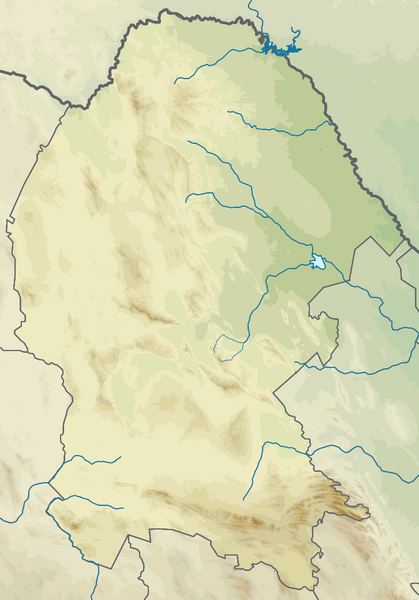
English: Topographic location map of Coahuila, Mexico. Elevation legend is on the category page.
Same map limits as the administrative version: File:Mexico Coahuila location map.svg. |
| Date | |
| Source | Own work |
| Author | GrandEscogriffe |
Licensing[edit]
I, the copyright holder of this work, hereby publish it under the following license:
This file is licensed under the Creative Commons Attribution-Share Alike 4.0 International license.
- You are free:
- to share – to copy, distribute and transmit the work
- to remix – to adapt the work
- Under the following conditions:
- attribution – You must give appropriate credit, provide a link to the license, and indicate if changes were made. You may do so in any reasonable manner, but not in any way that suggests the licensor endorses you or your use.
- share alike – If you remix, transform, or build upon the material, you must distribute your contributions under the same or compatible license as the original.
File history
Click on a date/time to view the file as it appeared at that time.
| Date/Time | Thumbnail | Dimensions | User | Comment | |
|---|---|---|---|---|---|
| current | 13:27, 25 August 2023 | | 726 × 1,039 (172 KB) | GrandEscogriffe (talk | contribs) | Uploaded own work with UploadWizard |
You cannot overwrite this file.
File usage on Commons
There are no pages that use this file.
File usage on other wikis
The following other wikis use this file:
- Usage on es.wikipedia.org
- El Coahuilón
- Reserva Ecológica Sierra y Cañón de Jimulco
- Área de protección de flora y fauna Maderas del Carmen
- Wikiproyecto:Ilustración/Taller de Cartografía/Realizaciones/América del Norte
- Sierra de Zapalinamé
- Plantilla:Mapa de localización de Coahuila
- Sierra La Fragua
- Cerro de la Viga
- Sierra de la Marta
- Sierra El Tarillal
- Cerro Rancho Nuevo
- Sierra Catana
- Sierra de Las Bayas
- Sierra La Madera
- Sierra Las Alazanas
- Sierra del Carmen
- Sierra El Caballo
- Cerro El Centinela (Torreón)
- Sierra El Álamo
- Mesa de Catujanos
- Cerro Marte
- Sierra La Concordia (Saltillo)
- Usage on fr.wikipedia.org
- Usage on he.wikipedia.org