File:Milejczyce (gmina) location map.png
Jump to navigation
Jump to search

Size of this preview: 800 × 517 pixels. Other resolutions: 320 × 207 pixels | 640 × 414 pixels | 1,024 × 662 pixels | 1,196 × 773 pixels.
Original file (1,196 × 773 pixels, file size: 167 KB, MIME type: image/png)
Captions
Captions
Add a one-line explanation of what this file represents
| Description |
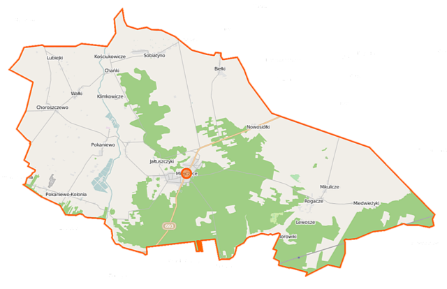
Polski: Mapa gminy Milejczyce, Polska
English: Map of Gmina Milejczyce, Poland |
|||||||||
| Date | ||||||||||
| Source | You may find a page on the OpenStreetMap wiki page for Milejczyce (gmina) | |||||||||
| Creator |
OpenStreetMap contributors OpenStreetMap contributors |
|||||||||
| Permission (Reusing this file) |
OpenStreetMap data is available under the Open Database License (details). Map tiles are licensed under the Creative Commons Attribution-ShareAlike 2.0 license (CC-BY-SA 2.0).
This file is licensed under the Creative Commons Attribution-Share Alike 2.0 Generic license.
|
|||||||||
| Geotemporal data | ||||||||||
| Bounding box |
|
|||||||||
| Georeferencing | If inappropriate please set warp_status = skip to hide. | |||||||||
File history
Click on a date/time to view the file as it appeared at that time.
| Date/Time | Thumbnail | Dimensions | User | Comment | |
|---|---|---|---|---|---|
| current | 10:07, 16 September 2014 | | 1,196 × 773 (167 KB) | VanWiel (talk | contribs) | |
| 06:32, 24 June 2014 |  | 1,196 × 773 (192 KB) | VanWiel (talk | contribs) | {{OpenStreetMap | name = Milejczyce (gmina) | location = Milejczyce (gmina) | description = {{pl|Mapa gminy Milejczyce, Polska}} {{en|Map of Gmina Milejczyce, Poland}} | top = 52.5976 | left = 22.... |
You cannot overwrite this file.
File usage on Commons
There are no pages that use this file.
File usage on other wikis
The following other wikis use this file:
- Usage on be-tarask.wikipedia.org
- Usage on lt.wikipedia.org
- Usage on pl.wikipedia.org
- Milejczyce
- Milejczyce (gmina)
- Biełki
- Borowiki (powiat siemiatycki)
- Choroszczewo
- Gołubowszczyzna
- Klimkowicze
- Kościukowicze
- Lewosze
- Lubiejki
- Miedwieżyki
- Mikulicze (Polska)
- Pokaniewo
- Rogacze (powiat siemiatycki)
- Sobiatyno
- Wałki (wieś)
- Nowosiółki (powiat siemiatycki)
- Grabarka (gmina Milejczyce)
- Pokaniewo-Kolonia
- Chańki
- Jałtuszczyki
- Synagoga w Milejczycach
- Choroszczewo-Kolonia
- Osinki (Sobiatyno)
- Cerkiew Narodzenia Najświętszej Maryi Panny w Rogaczach
- Borowiki (przystanek kolejowy)
- Cmentarz żydowski w Milejczycach
- Parafia św. Barbary w Milejczycach
- Parafia Narodzenia Najświętszej Maryi Panny w Rogaczach
- Cerkiew św. Barbary w Milejczycach
- Cerkiew Świętych Apostołów Piotra i Pawła w Sobiatynie
- Parafia św. Stanisława w Milejczycach
- Cerkiew św. Mikołaja w Milejczycach
- Kościół św. Stanisława w Milejczycach
- Cmentarz żołnierzy radzieckich w Milejczycach
- Cmentarz w Milejczycach
- Cerkiew św. Apostoła Tomasza w Milejczycach
- Moduł:Mapa/dane/Milejczyce (gmina)
- Usage on pl.wikibooks.org
_location_map.png&oldid=519982339)