File:Military Installations acound Camp Kinser (1973).png
Jump to navigation
Jump to search

Size of this preview: 800 × 551 pixels. Other resolutions: 320 × 220 pixels | 640 × 441 pixels | 1,024 × 705 pixels | 1,280 × 881 pixels | 1,630 × 1,122 pixels.
Original file (1,630 × 1,122 pixels, file size: 2.79 MB, MIME type: image/png)
Captions
Captions
Military Installations acound Camp Kinser (1973)
Summary
[edit].png&action=edit§ion=1)
| Description |
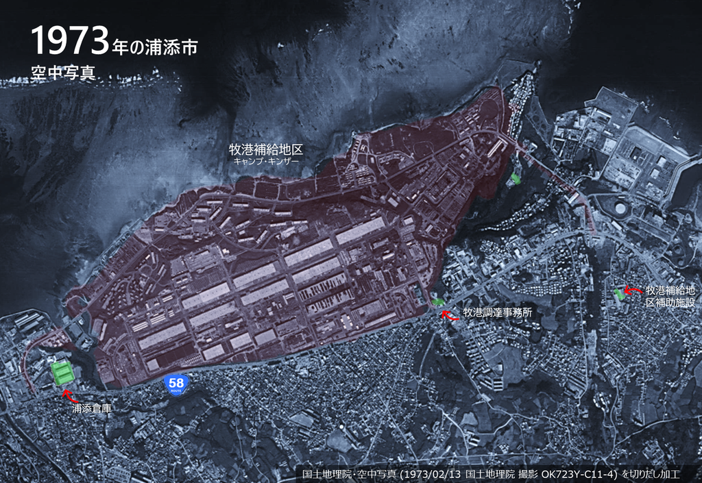
English: Approximate Locations: Machinato Service Area, Machinato Service Area Annex, Machinato Purchasing and Contracting Office, Urasoe Warehouse |
| Date | |
| Source | 国土地理院 (Geospatial Information Authority of Japan) |
| Author | 国土地理院・空中写真 (1973/02/13 国土地理院 撮影 OK723Y-C11-4) を切りだし加工 |
Licensing
[edit].png&action=edit§ion=2)

|
This work is licensed under the Government of Japan Standard Terms of Use (Ver.2.0). The Terms of Use are compatible with the Creative Commons Attribution License 4.0 International. For the terms of use of this work, see this license page.
|
This file is licensed under the Creative Commons Attribution 4.0 International license.
Attribution: 国土地理院 (Geospatial Information Authority of Japan)
- You are free:
- to share – to copy, distribute and transmit the work
- to remix – to adapt the work
- Under the following conditions:
- attribution – You must give appropriate credit, provide a link to the license, and indicate if changes were made. You may do so in any reasonable manner, but not in any way that suggests the licensor endorses you or your use.
File history
Click on a date/time to view the file as it appeared at that time.
| Date/Time | Thumbnail | Dimensions | User | Comment | |
|---|---|---|---|---|---|
| current | 16:37, 15 September 2022 | | 1,630 × 1,122 (2.79 MB) | Alain Parks (talk | contribs) | Uploaded a work by 国土地理院・空中写真 (1973/02/13 国土地理院 撮影 OK723Y-C11-4) を切りだし加工 from 国土地理院 (Geospatial Information Authority of Japan) with UploadWizard |
You cannot overwrite this file.
File usage on Commons
There are no pages that use this file.
File usage on other wikis
The following other wikis use this file:
- Usage on ja.wikipedia.org
.png&oldid=696504013)