File:Milky Way Map Cartesian Coordinate System nogrid.png
Jump to navigation
Jump to search

Size of this preview: 600 × 600 pixels. Other resolutions: 240 × 240 pixels | 480 × 480 pixels | 768 × 768 pixels | 1,024 × 1,024 pixels | 2,048 × 2,048 pixels | 14,850 × 14,850 pixels.
Original file (14,850 × 14,850 pixels, file size: 241.22 MB, MIME type: image/png)
Captions
Captions
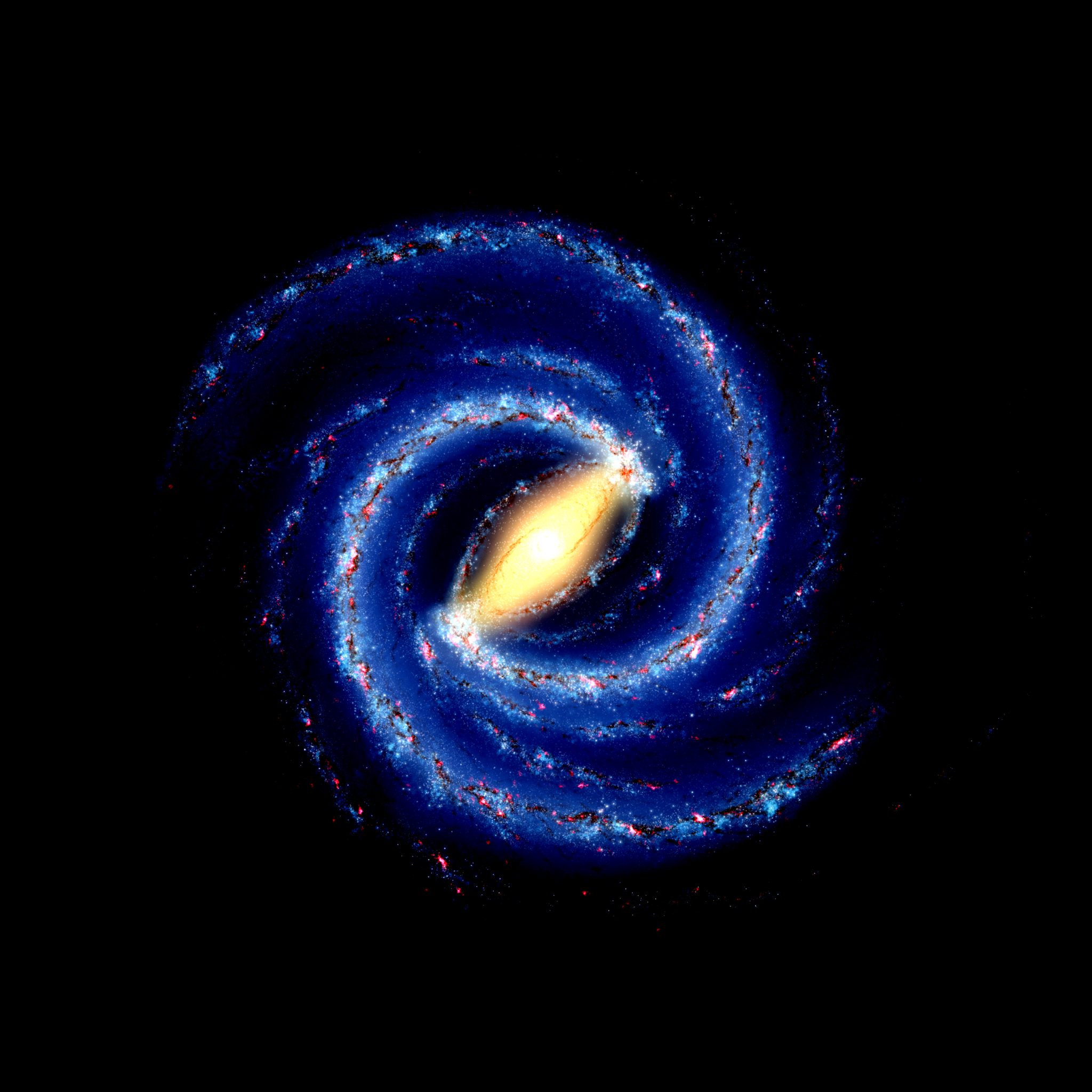
An artist's impression of the Milky Way, with very high contrast and saturation
Summary[edit]
| Warning | The original file is very high-resolution. It might not load properly or could cause your browser to freeze when opened at full size. |
|---|
| Description |
English: Background for a map of an artist's impression of the Milky Way. Recommended grid spacing: 5000 ly. 545 pixels ≙ 5000 light years. Image resolution: exactly 50 pixels per millimeter. |
| Date | |
| Source | Derivative work based on File:Ssc2008-10a1.tif, with File:236084main MilkyWay-full-annotated.jpg used as a transparent upscaled layer during the creation process, to get the distances correctly |
| Author | NASA/JPL-Caltech/R. Hurt (SSC/Caltech); derivative work by Tobias ToBeFree Frei, tfrei.de |
| Other versions |
|


Licensing[edit]
| This file is made available under the Creative Commons CC0 1.0 Universal Public Domain Dedication. | |
| The person who associated a work with this deed has dedicated the work to the public domain by waiving all of their rights to the work worldwide under copyright law, including all related and neighboring rights, to the extent allowed by law. You can copy, modify, distribute and perform the work, even for commercial purposes, all without asking permission.
|
File history
Click on a date/time to view the file as it appeared at that time.
| Date/Time | Thumbnail | Dimensions | User | Comment | |
|---|---|---|---|---|---|
| current | 08:30, 7 January 2022 | | 14,850 × 14,850 (241.22 MB) | ToBeFree (talk | contribs) | Uploaded a work by NASA/JPL-Caltech/R. Hurt (SSC/Caltech); derivative work by Tobias ToBeFree Frei, tfrei.de from Derivative work based on File:Ssc2008-10a1.tif, with File:236084main MilkyWay-full-annotated.jpg used as a transparent upscaled layer during the creation process, to get the distances correctly with UploadWizard |
You cannot overwrite this file.
File usage on Commons
The following 7 pages use this file:
- File:Milky Way Map Cartesian Coordinate System.png
- File:Milky Way Map Cartesian Coordinate System A4.png
- File:Milky Way Map Cartesian Coordinate System A4 nogrid.png
- File:Milky Way Map Cartesian Coordinate System A5.png
- File:Milky Way Map Cartesian Coordinate System A5 nogrid.png
- File:Milky Way Map Cartesian Coordinate System nogrid.png
- File:Milky Way Map Near Sol 2022 neutral A5.png