File:Možděnice, CZ180318-039.jpg
Original file (4,586 × 2,710 pixels, file size: 5.24 MB, MIME type: image/jpeg)
Captions
Summary
[edit]DescriptionMožděnice, CZ180318-039.jpg |
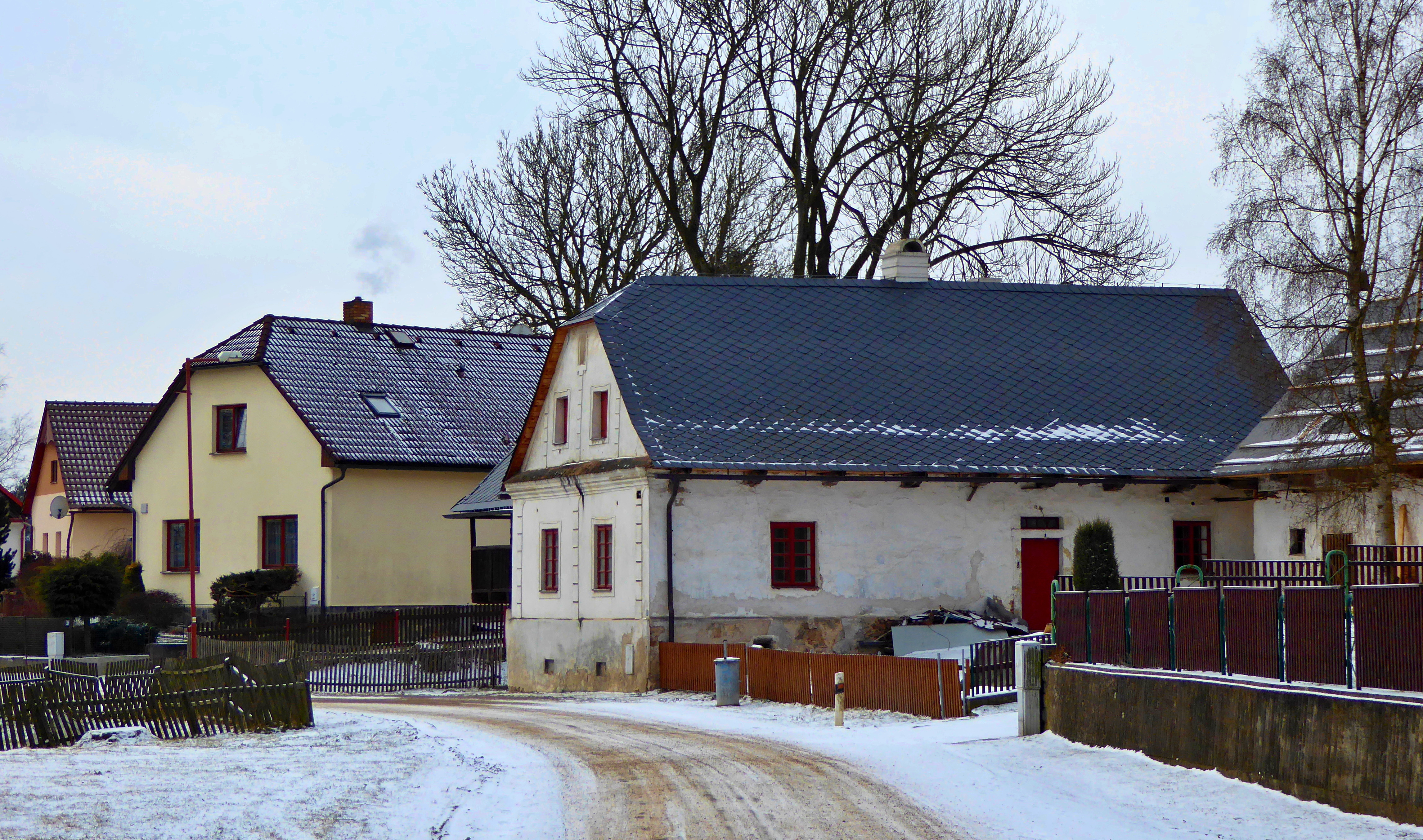
English: The habitation part of she a former forge (in the center of the photo, with a white façade), a building from the years 1830 - 1840 (former forge from half of the 18th century), the village of "Vysočina", part "Možděnice". Photo location: Czechia, Pardubice Region, municipality Vysočina, the hamlet of "Možděnice", "Stružinecká" knoll hill.
Čeština: Obytná část bývalé kovárny (uprostřed fotografie, s bílou fasádou), stavba z let 1830 – 1840 (bývalá kovárna z poloviny 18. století), obec Vysočina, část Možděnice. Foto lokace: Česko, Pardubický kraj, obec Vysočina, vesnice Možděnice, Stružinecká pahorkatina (200°). |
Date | |
Source | Own work |
Author | Josef Kreuz (PEPan) |
Camera location | 49° 45′ 51.19″ N, 15° 47′ 42.35″ E | View this and other nearby images on: OpenStreetMap | 49.764219; 15.795097 |
---|
Zdroje informací:
[edit]- Obec Vysočina – webové stránky, viz
- Národní památkový ústav, památkový katalog – bývalá kovárna s obytnou částí, Možděnice čp. 3, viz
Licensing
[edit]- You are free:
- to share – to copy, distribute and transmit the work
- to remix – to adapt the work
- Under the following conditions:
- attribution – You must give appropriate credit, provide a link to the license, and indicate if changes were made. You may do so in any reasonable manner, but not in any way that suggests the licensor endorses you or your use.
- share alike – If you remix, transform, or build upon the material, you must distribute your contributions under the same or compatible license as the original.
File history
Click on a date/time to view the file as it appeared at that time.
Date/Time | Thumbnail | Dimensions | User | Comment | |
---|---|---|---|---|---|
current | 12:32, 27 March 2018 | 4,586 × 2,710 (5.24 MB) | PEPan (talk | contribs) | User created page with UploadWizard |
You cannot overwrite this file.
File usage on Commons
There are no pages that use this file.
File usage on other wikis
The following other wikis use this file:
- Usage on cs.wikipedia.org
Metadata
This file contains additional information such as Exif metadata which may have been added by the digital camera, scanner, or software program used to create or digitize it. If the file has been modified from its original state, some details such as the timestamp may not fully reflect those of the original file. The timestamp is only as accurate as the clock in the camera, and it may be completely wrong.
Camera manufacturer | Panasonic |
---|---|
Camera model | DMC-TZ60 |
Author | Josef Kreuz |
Copyright holder |
|
Exposure time | 1/640 sec (0.0015625) |
F-number | f/4.6 |
ISO speed rating | 100 |
Date and time of data generation | 10:21, 18 March 2018 |
Lens focal length | 13.2 mm |
User comments | EN: The habitation part of she a former forge (in the center of the photo, with a white façade), a building from the years 1830 - 1840 (former forge from half of the 18th century), the village of "Vysočina", part "Možděnice". Photo location: Czechia, Pardubice Region, municipality Vysočina, the hamlet of "Možděnice", "Stružinecká" knoll hill.
CZ: Obytná část bývalé kovárny (uprostřed fotografie, s bílou fasádou), stavba z let 1830 – 1840 (bývalá kovárna z poloviny 18. století), obec Vysočina, část Možděnice. Foto lokace: Česko, Pardubický kraj, obec Vysočina, vesnice Možděnice, Stružinecká pahorkatina (200°). Externí odkaz:
http://pamatkovykatalog.cz?element=12789301&action=element&presenter=ElementsResults Keywords: Možděnice |
Latitude | 49° 45′ 51.19″ N |
Longitude | 15° 47′ 42.35″ E |
Short title |
|
Image title |
|
Label | Yellow |
City shown | Vysočina |
Compression scheme | Uncompressed |
Pixel composition | RGB |
Orientation | Normal |
Horizontal resolution | 180 dpi |
Vertical resolution | 180 dpi |
Data arrangement | chunky format |
Software used | Zoner Photo Studio 18 |
File change date and time | 13:19, 27 March 2018 |
Y and C positioning | Centered |
Exposure Program | Landscape mode (for landscape photos with the background in focus) |
Exif version | 2.3 |
Date and time of digitizing | 10:21, 18 March 2018 |
Meaning of each component |
|
Image compression mode | 4 |
APEX exposure bias | 0 |
Maximum land aperture | 4.40625 APEX (f/4.6) |
Metering mode | Pattern |
Light source | Unknown |
Flash | Flash did not fire, compulsory flash suppression |
Supported Flashpix version | 1 |
Color space | sRGB |
Sensing method | One-chip color area sensor |
File source | Digital still camera |
Scene type | A directly photographed image |
Custom image processing | Normal process |
Exposure mode | Auto exposure |
White balance | Auto white balance |
Digital zoom ratio | 0 |
Focal length in 35 mm film | 86 mm |
Scene capture type | Standard |
Scene control | None |
Contrast | Normal |
Saturation | Normal |
Sharpness | Normal |
GPS time (atomic clock) | 09:19 |
Receiver status | Measurement in progress |
Measurement mode | 2-dimensional measurement |
Measurement precision | Fair (1.1) |
Geodetic survey data used | WGS-84 |
Name of GPS area | 䌀栀爀甀搀椀洀 |
GPS date | 18 March 2018 |
GPS tag version | 0.0.3.2 |
Keywords | Možděnice |
Writer | Josef Kreuz |
Province or state shown | Pardubický kraj |
Country shown | Česko |
Code for country shown | CZ |
Sublocation of city shown | Možděnice |