File:Montanchez.(Cáceres)DSCN0154.jpg

Original file (3,264 × 2,448 pixels, file size: 1.15 MB, MIME type: image/jpeg)
Captions
Captions
Summary
[edit]DSCN0154.jpg&action=edit§ion=1)
| Description |
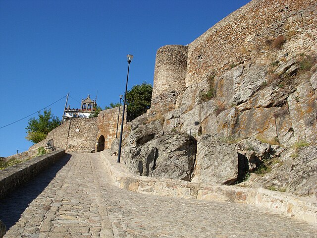
Español: El Castillo está coronado por el Monte Viejo (Montancil o Monte Tances). Considerables pendientes y frecuentes quiebros de sus calles.
Sierra Altitud: 734 m. Situación: 39.225658 -6.154807 Distancia: 48 Km de Cáceres. Rumbo: 97º E Comarca: Comarca de Montanchez. Mancomunidad: Sierra de Montanchez. Pueblos cercanos: Abalá del Caudillo, Torre de Santa María, Zarza de Montanchez, Valdemorales, Almoharín, Arroyomolinos, Alcuescar, Casas de Don Antonio Alrededores cercanos: EL QUEMADO, RECUERA, NACIMIENTO DEL RIO SALOR, el pocito, prado barbudo, el hornillo. GOOGLE MAPS ESPAÑA BUSCAR POR Mapas creados por los usuarios 109111079184700244089 |
| Source | http://farm5.static.flickr.com/4131/5064325506_bd36f304da.jpg |
| Author | Cotallo-nonocot |
| Camera location | | View this and other nearby images on: OpenStreetMap |
|---|
DSCN0154.jpg¶ms=039.225068_N_-006.154120_E_globe:Earth_type:camera_alt:728_source:exif_&language=en)
Pueblos Extremeños.
Licensing
[edit]DSCN0154.jpg&action=edit§ion=2)

|
Permission is granted to copy, distribute and/or modify this document under the terms of the GNU Free Documentation License, Version 1.2 or any later version published by the Free Software Foundation; with no Invariant Sections, no Front-Cover Texts, and no Back-Cover Texts. A copy of the license is included in the section entitled GNU Free Documentation License. |
- You are free:
- to share – to copy, distribute and transmit the work
- to remix – to adapt the work
- Under the following conditions:
- attribution – You must give appropriate credit, provide a link to the license, and indicate if changes were made. You may do so in any reasonable manner, but not in any way that suggests the licensor endorses you or your use.
- share alike – If you remix, transform, or build upon the material, you must distribute your contributions under the same or compatible license as the original.
File history
Click on a date/time to view the file as it appeared at that time.
| Date/Time | Thumbnail | Dimensions | User | Comment | |
|---|---|---|---|---|---|
| current | 09:14, 19 October 2010 | | 3,264 × 2,448 (1.15 MB) | Cotallo-nonocot (talk | contribs) | {{Information |Description={{es|1=El Castillo está coronada por el Monte Viejo (Montancil o Monte Tances) . Sus vinos y jamones ibéricos tienen fama reconocida. Considerables pendientes y los frecuentes quiebros de sus calles. Sierra Altitud : |
You cannot overwrite this file.
File usage on Commons
There are no pages that use this file.
File usage on other wikis
The following other wikis use this file:
- Usage on es.wikipedia.org
DSCN0154.jpg&oldid=620987389)