File:Montbrison cassini Loire.jpg
Jump to navigation
Jump to search

Size of this preview: 800 × 445 pixels. Other resolutions: 320 × 178 pixels | 640 × 356 pixels | 1,024 × 570 pixels | 1,504 × 837 pixels.
Original file (1,504 × 837 pixels, file size: 509 KB, MIME type: image/jpeg)
Captions
Captions
Add a one-line explanation of what this file represents
Summary
[edit]
| Description |
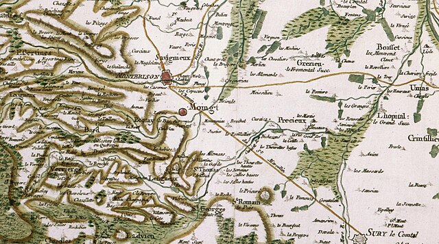
Français : Carte de Cassini, département de la Loire : Montbrison et environs, dont au nord-ouest Essertines (Essertines-en-Châtelneuf) ; au nord-est : Grézieux-le-Fromental et Boisset-lès-Montrond ; à l'est : Précieux et L'Hôpital-le-Grand ; au sud-est : Sury-le-Comtal. |
| Date | 18th century |
| Source | https://www.geoportail.gouv.fr/donnees/carte-de-cassini |
| Author | Carte de Cassini |
Licensing
[edit]
|
This work is in the public domain in its country of origin and other countries and areas where the copyright term is the author's life plus 70 years or fewer. This work is in the public domain in the United States because it was published (or registered with the U.S. Copyright Office) before January 1, 1929. | |
| This file has been identified as being free of known restrictions under copyright law, including all related and neighboring rights. | |
File history
Click on a date/time to view the file as it appeared at that time.
| Date/Time | Thumbnail | Dimensions | User | Comment | |
|---|---|---|---|---|---|
| current | 19:56, 20 May 2022 | | 1,504 × 837 (509 KB) | Pueblo89 (talk | contribs) | Uploaded a work by Carte de Cassini from https://www.geoportail.gouv.fr/donnees/carte-de-cassini with UploadWizard |
You cannot overwrite this file.
File usage on Commons
The following page uses this file:
File usage on other wikis
The following other wikis use this file:
- Usage on nl.wikipedia.org