File:Montenegro motorways.JPG
Jump to navigation
Jump to search
Size of this preview: 446 × 599 pixels. Other resolutions: 178 × 240 pixels | 357 × 480 pixels | 571 × 768 pixels | 762 × 1,024 pixels | 1,453 × 1,953 pixels.
Original file (1,453 × 1,953 pixels, file size: 458 KB, MIME type: image/jpeg)
Captions
Captions
Add a one-line explanation of what this file represents

|
This transport map image could be re-created using vector graphics as an SVG file. This has several advantages; see Commons:Media for cleanup for more information. If an SVG form of this image is available, please upload it and afterwards replace this template with
{{vector version available|new image name}}.
It is recommended to name the SVG file “Montenegro motorways.svg”—then the template Vector version available (or Vva) does not need the new image name parameter. |


Summary
[edit]
| Description |
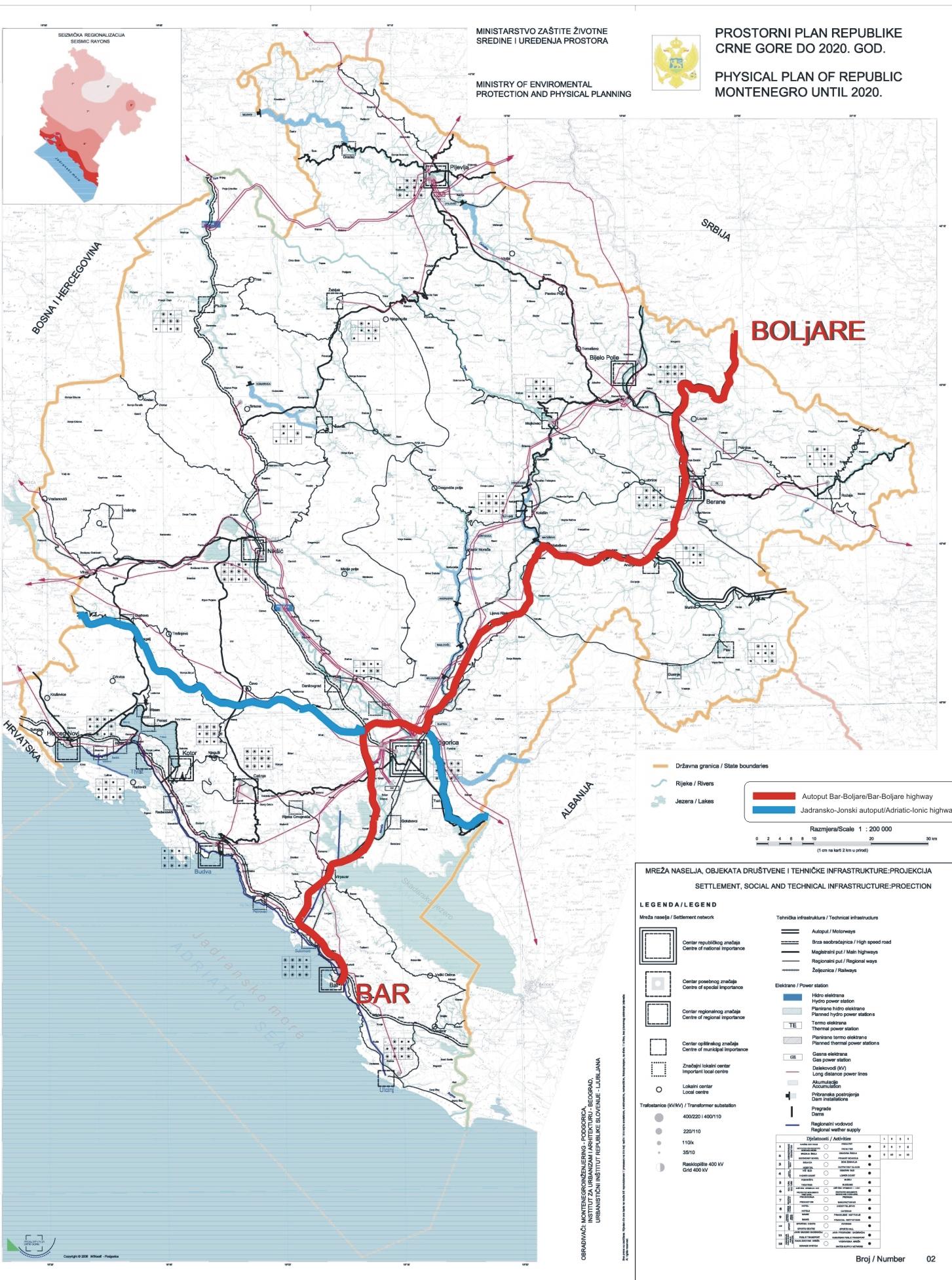
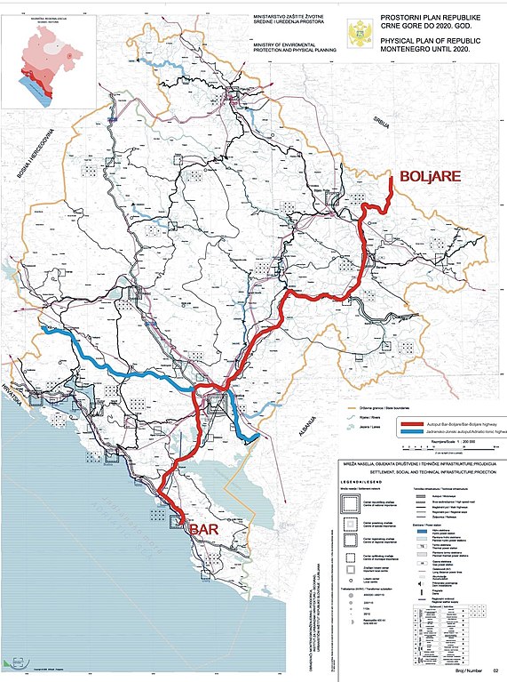
English: Excerpt from Spatial Plan of Montenegro for 2020.
Српски / srpski: Izvod iz Prostornog Plana Crne Gore do 2020 godine. |
| Date | |
| Source | Government of Montenegro |
| Author | Government of Montenegro |
Licensing
[edit]
I, the copyright holder of this work, hereby publish it under the following license:
| This file is made available under the Creative Commons CC0 1.0 Universal Public Domain Dedication. | |
| The person who associated a work with this deed has dedicated the work to the public domain by waiving all of their rights to the work worldwide under copyright law, including all related and neighboring rights, to the extent allowed by law. You can copy, modify, distribute and perform the work, even for commercial purposes, all without asking permission.
|
File history
Click on a date/time to view the file as it appeared at that time.
| Date/Time | Thumbnail | Dimensions | User | Comment | |
|---|---|---|---|---|---|
| current | 13:37, 22 October 2010 | | 1,453 × 1,953 (458 KB) | Nije bitno... (talk | contribs) | {{Information |Description={{en|1=Excerpt from Spatial Plan of Montenegro for 2020. }} {{sr|1=Izvod iz Prostornog Plana Crne Gore do 2020 godine.}} |Source=Government of Montenegro |Author=Government of Montenegro |Date=2006-12-06 |Permission= |other_vers |
You cannot overwrite this file.
File usage
The following page uses this file:
Global file usage
The following other wikis use this file:
- Usage on cs.wikipedia.org
- Usage on de.wikipedia.org
- Usage on en.wikipedia.org
- Usage on hr.wikipedia.org
- Usage on it.wikipedia.org
- Usage on lv.wikipedia.org
- Usage on mk.wikipedia.org
- Usage on nl.wikipedia.org
- Usage on pl.wikipedia.org
- Usage on ro.wikipedia.org
- Usage on ru.wikipedia.org
- Usage on sq.wikipedia.org
- Usage on sr.wikipedia.org
- Usage on te.wikipedia.org
- Usage on uk.wikipedia.org
- Usage on www.wikidata.org
- Usage on zh.wikipedia.org