File:MontlakeBridgeCenterLock.png
跳转到导航
跳转到搜索

本预览的尺寸:800 × 528像素。 其他分辨率:320 × 211像素 | 640 × 423像素 | 1,024 × 676像素 | 1,280 × 845像素 | 2,400 × 1,585像素。
原始文件 (2,400 × 1,585像素,文件大小:162 KB,MIME类型:image/png)
说明
说明
添加一行文字以描述该文件所表现的内容
摘要
[编辑]| 描述 |
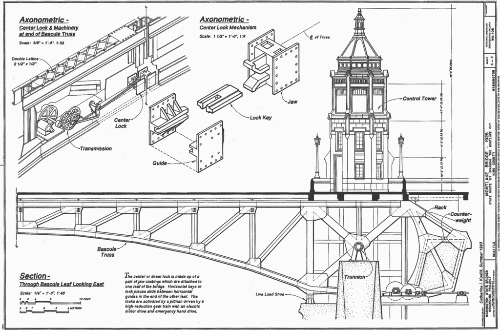
Montlake Bridge, Spanning Montlake Cut at State Route 513, Seattle, King County, WA Note: this version features the original HABS border, to illustrate HABS archival material. |
||||
| 日期 | |||||
| 来源 |
|
||||
| 作者 | Delineated by Catherine I. Kudlk | ||||
| 授权 (二次使用本文件) |
|
||||
| 其他版本 |
|

| 物体位置 | | 在以下服务上查看本图像和附近其他图像: OpenStreetMap |
|---|
文件历史
点击某个日期/时间查看对应时刻的文件。
| 日期/时间 | 缩略图 | 大小 | 用户 | 备注 | |
|---|---|---|---|---|---|
| 当前 | 2007年1月1日 (一) 05:51 | | 2,400 × 1,585(162 KB) | Cacophony(留言 | 贡献) | {{Information |Description=Montlake Bridge, Spanning Montlake Cut at State Route 513, Seattle, King County, WA<br>'''Note: this version features the original HABS border, to illustrate HABS archival material.''' |Source=[http://memory.loc.gov/cgi-bin/ampa |
您不可以覆盖此文件。
文件用途
全域文件用途
以下其他wiki使用此文件:
- en.wikipedia.org上的用途
- zh.wikipedia.org上的用途