File:Monument 5de Regiment Lanciers 1.jpg
Jump to navigation
Jump to search

Size of this preview: 448 × 600 pixels. Other resolutions: 179 × 240 pixels | 358 × 480 pixels | 574 × 768 pixels | 765 × 1,024 pixels | 2,250 × 3,012 pixels.
Original file (2,250 × 3,012 pixels, file size: 2.19 MB, MIME type: image/jpeg)
Captions
Captions
Add a one-line explanation of what this file represents
Summary
[edit]
| Description |
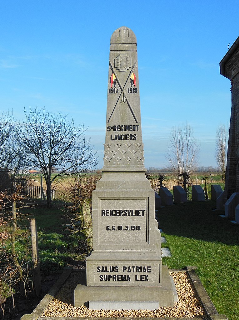
Nederlands: Een zuil op een sokkel met afbeelding van een wapenschild, lansen en opschriften ter herinnering aan de wapenfeiten van het 5de Lanciersmonument |
| Date | |
| Source | Own work |
| Author | Frans90245 |
| Camera location | | View this and other nearby images on: OpenStreetMap |
|---|
Reigersvliet is een waterloop waarbij zwaar slag geleverd werd. Het opschrift “Salus patriae suprema lex” in het Latijn betekent “Het heil van het vaderland is de hoogste wet”
Licensing
[edit]
I, the copyright holder of this work, hereby publish it under the following license:
This file is licensed under the Creative Commons Attribution-Share Alike 4.0 International license.
- You are free:
- to share – to copy, distribute and transmit the work
- to remix – to adapt the work
- Under the following conditions:
- attribution – You must give appropriate credit, provide a link to the license, and indicate if changes were made. You may do so in any reasonable manner, but not in any way that suggests the licensor endorses you or your use.
- share alike – If you remix, transform, or build upon the material, you must distribute your contributions under the same or compatible license as the original.
File history
Click on a date/time to view the file as it appeared at that time.
| Date/Time | Thumbnail | Dimensions | User | Comment | |
|---|---|---|---|---|---|
| current | 13:23, 4 September 2019 | | 2,250 × 3,012 (2.19 MB) | Frans90245 (talk | contribs) | User created page with UploadWizard |
You cannot overwrite this file.
File usage on Commons
There are no pages that use this file.
File usage on other wikis
The following other wikis use this file:
- Usage on fr.wikipedia.org
- Usage on nl.wikipedia.org