File:Moor und Gewässer Giriz Rottenschwil.jpg
Jump to navigation
Jump to search
Size of this preview: 800 × 573 pixels. Other resolutions: 320 × 229 pixels | 640 × 458 pixels | 1,024 × 733 pixels | 1,280 × 916 pixels | 2,560 × 1,832 pixels | 3,328 × 2,382 pixels.
Original file (3,328 × 2,382 pixels, file size: 3.91 MB, MIME type: image/jpeg)
Captions
Captions
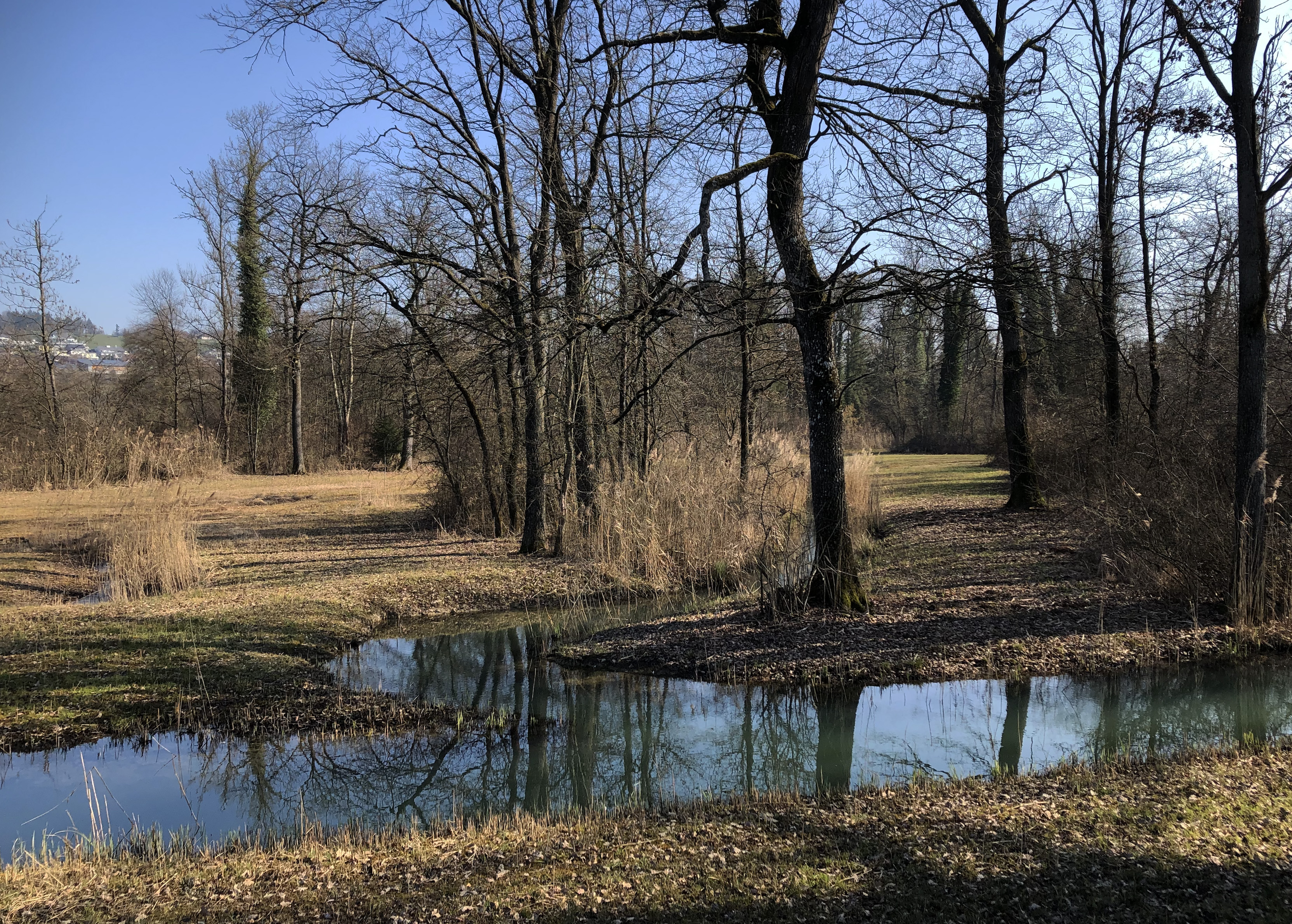
Giriz natural reserve at Rottenschwil, canton Aargau, Switzerland (WDPA 347372)
Summary
[edit]
| Description |
Deutsch: Das Naturschutzgebiet Giriz bei Rottenschwil, Kanton Aargau, Schweiz, ist in drei Bundesinventaren verzeichnet.
Français : La réserve naturelle de Giriz près de Rottenschwil, dans le canton d'Argovie, est répertoriée dans trois inventaires fédéraux suisses.
English: The Giriz nature reserve near Rottenschwil, Canton Aargau, is listed in three Swiss federal inventories. |
||||||
| Protected | Amphibian Spawing Area of National Importance Giriz (Swisstopo).
Fenland of National Importance Swisstopo Giriz Rottenschwil (Swisstopo).
Alluvial zone of national importance Still Rüss-Rickenbach (Swisstopo).
|
||||||
| Date | |||||||
| Source | Own work | ||||||
| Author | Arkelin |
| Object location | | View this and other nearby images on: OpenStreetMap |
|---|
Licensing
[edit]
I, the copyright holder of this work, hereby publish it under the following license:
This file is licensed under the Creative Commons Attribution-Share Alike 4.0 International license.
- You are free:
- to share – to copy, distribute and transmit the work
- to remix – to adapt the work
- Under the following conditions:
- attribution – You must give appropriate credit, provide a link to the license, and indicate if changes were made. You may do so in any reasonable manner, but not in any way that suggests the licensor endorses you or your use.
- share alike – If you remix, transform, or build upon the material, you must distribute your contributions under the same or compatible license as the original.
File history
Click on a date/time to view the file as it appeared at that time.
| Date/Time | Thumbnail | Dimensions | User | Comment | |
|---|---|---|---|---|---|
| current | 17:00, 12 July 2023 | | 3,328 × 2,382 (3.91 MB) | Arkelin (talk | contribs) | Uploaded own work with UploadWizard |
You cannot overwrite this file.
File usage on Commons
The following page uses this file:
File usage on other wikis
The following other wikis use this file:
- Usage on de.wikipedia.org
- Wikipedia:WikiProjekt Schweiz/Kulturgüterschutzinventar/AG/Bezirk Bremgarten
- Wikipedia:WikiProjekt Schweiz/Kulturgüterschutzinventar/AG/Bezirk Laufenburg
- Wikipedia:WikiProjekt Schweiz/Kulturgüterschutzinventar/AG/Bezirk Muri
- Wikipedia:WikiProjekt Schweiz/Kulturgüterschutzinventar/ZH/Bezirk Affoltern
- Bundesinventar der Auengebiete von nationaler Bedeutung
- Auengebiete von nationaler Bedeutung im Kanton Zürich
- Naturschutzgebiet Giriz Rottenschwil
- Usage on www.wikidata.org