File:Moscow-downtownmap.jpg
Spring til navigation
Spring til søgning

Størrelse af denne forhåndsvisning: 482 × 599 pixels. Andre opløsninger: 193 × 240 pixels | 386 × 480 pixels | 1.004 × 1.248 pixels.
Oprindelig fil (1.004 × 1.248 billedpunkter, filstørrelse: 247 KB, MIME-type: image/jpeg)
Captions
Captions
Tilføj en kort forklaring på en enkelt linje om hvad filen viser
|

|
Dette billede (eller alle billederne i denne artikel eller kategori) bør genskabes ved hjælp af vektorgrafik som en SVG-fil. Dette har flere fordele; se Commons:Media for cleanup for mere information. Hvis der eksisterer en SVG-version af dette billede, så vær venlig at lægge den op. Efter en SVG-version er blevet lagt op, så erstat denne skabelon med {{Vector version available|nyt billedes navn.svg}} på denne side.
|


Beskrivelse[redigér]
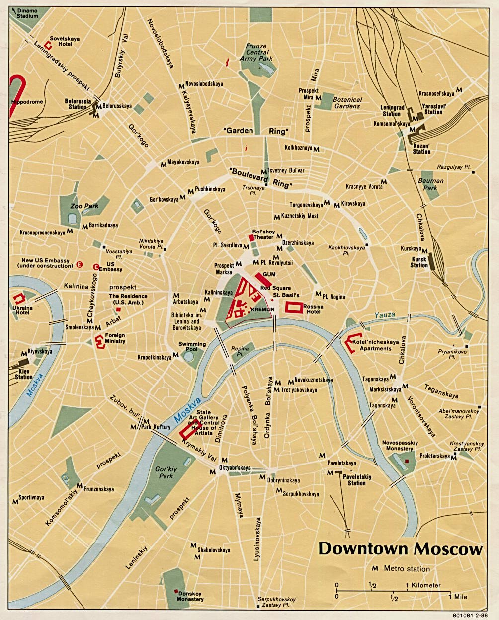
This is a map of downtown Moscow showing the concentric circles and radii formed by the city's streets. This image was taken from the University of Texas's Perry-Castañeda Library: Map Collection. It was created in 1988 by the Central Intelligence Agency, making it ineligible for copyright.
| This image is a work of a Central Intelligence Agency employee, taken or made as part of that person's official duties. As a Work of the United States Government, this image or media is in the public domain in the United States.
|

|
Filhistorik
Klik på en dato/tid for at se filen som den så ud på det tidspunkt.
| Dato/tid | Miniaturebillede | Dimensioner | Bruger | Kommentar | |
|---|---|---|---|---|---|
| nuværende | 20. sep. 2006, 15:29 | | 1.004 × 1.248 (247 KB) | Santac (diskussion | bidrag) | {{SVG}} {{badjpeg}} This is a map of downtown Moscow showing the concentric circles and radii formed by the city's streets. This image was taken from the University of Texas's [http://www.lib.utexas.edu/maps/world_cities/moscow.jpg Perry-Castañ |
Du kan ikke overskrive denne fil.
Filanvendelse
Der er ingen sider der bruger denne fil.
Global filanvendelse
Følgende andre wikier anvender denne fil:
- Anvendelser på da.wikipedia.org