File:Mount Umunhum aerial view, 2011.jpg
Jump to navigation
Jump to search
Size of this preview: 800 × 514 pixels. Other resolutions: 320 × 206 pixels | 640 × 412 pixels | 1,024 × 658 pixels | 1,280 × 823 pixels | 3,123 × 2,008 pixels.
Original file (3,123 × 2,008 pixels, file size: 1.69 MB, MIME type: image/jpeg)
Captions
Captions
Add a one-line explanation of what this file represents
Summary[edit]
| Description |
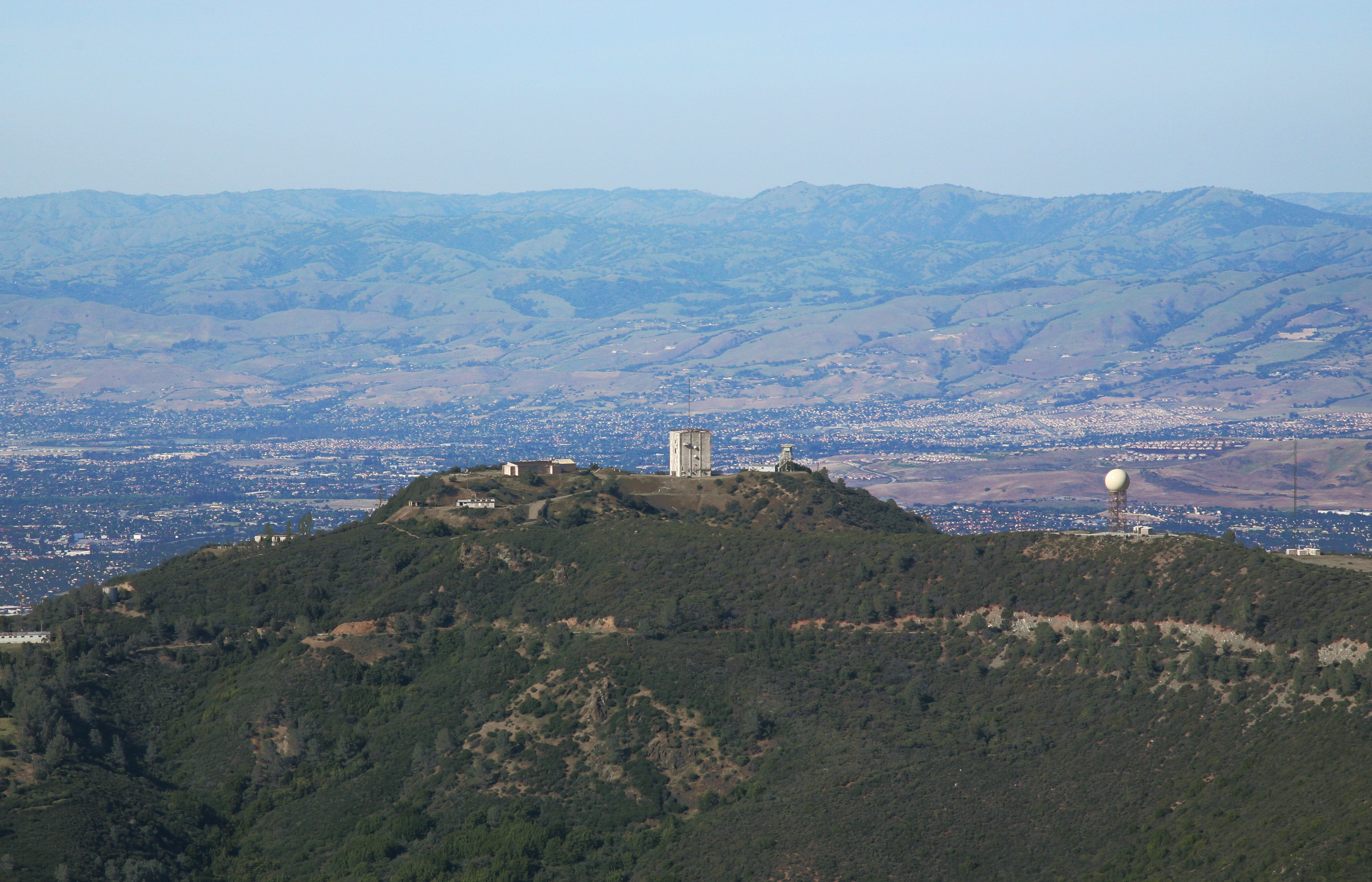
Mt Umunhum - one of the highest peaks in the coastal range overlooking San Jose and Silicon Valley. It used to be an early-warning radar site (the 5 story building on the peak) which was closed in 1980. The land eventually became part of the Sierra Azul open space preserve. In 2017, the road and hiking trails to the top were reopened and accessible to the public. This is the view seen by an aviator coming in from the coast towards the Bay Area, cresting the Santa Cruz mountains with San Jose just beyond. In winter there may be a dusting of snow around the peak. |
| Date | |
| Source | Sentinel over Silicon Valley |
| Author | Jitze Couperus from Los Altos Hills, California, USA |
Licensing[edit]
This file is licensed under the Creative Commons Attribution 2.0 Generic license.
- You are free:
- to share – to copy, distribute and transmit the work
- to remix – to adapt the work
- Under the following conditions:
- attribution – You must give appropriate credit, provide a link to the license, and indicate if changes were made. You may do so in any reasonable manner, but not in any way that suggests the licensor endorses you or your use.
| This image was originally posted to Flickr by jitze at https://flickr.com/photos/40648743@N00/5391659976 (archive). It was reviewed on 21 November 2017 by FlickreviewR 2 and was confirmed to be licensed under the terms of the cc-by-2.0. |
File history
Click on a date/time to view the file as it appeared at that time.
| Date/Time | Thumbnail | Dimensions | User | Comment | |
|---|---|---|---|---|---|
| current | 21:30, 21 November 2017 | | 3,123 × 2,008 (1.69 MB) | Cristiano Tomás (talk | contribs) | Transferred from Flickr via Flickr2Commons |
You cannot overwrite this file.
File usage on Commons
The following page uses this file:
- File:Sentinel over Silicon Valley (5391659976).jpg (file redirect)
.jpg&redirect=no)
File usage on other wikis
The following other wikis use this file:
- Usage on en.wikipedia.org