File:Msk1991.svg
Jump to navigation
Jump to search

Size of this PNG preview of this SVG file: 751 × 600 pixels. Other resolutions: 301 × 240 pixels | 601 × 480 pixels | 962 × 768 pixels | 1,280 × 1,022 pixels | 2,560 × 2,045 pixels | 1,600 × 1,278 pixels.
Original file (SVG file, nominally 1,600 × 1,278 pixels, file size: 192 KB)
Captions
Captions
Add a one-line explanation of what this file represents
Summary[edit]
| Description |
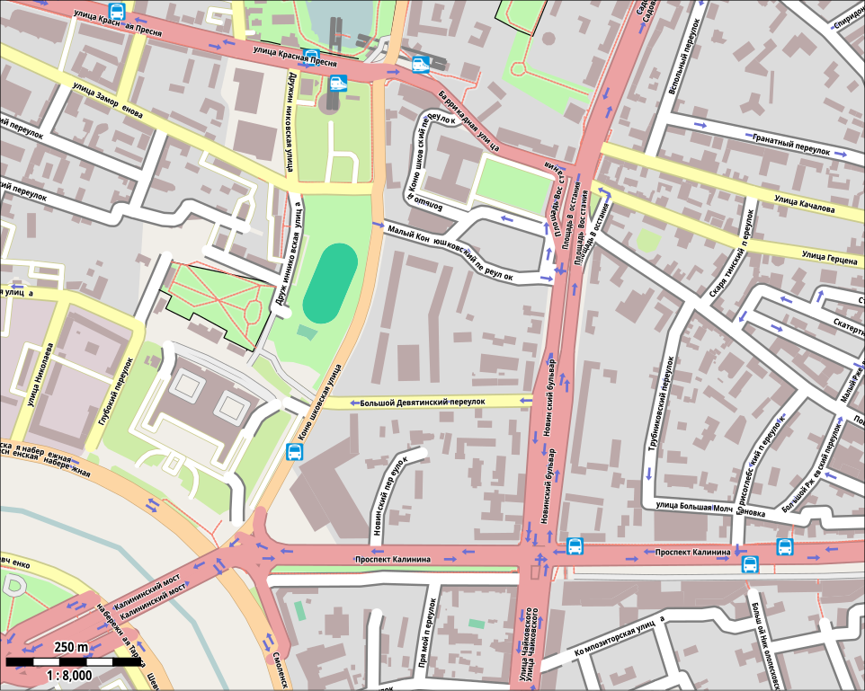
English: Moscow. Map of Prospekt Kalinina by 1991 state.
Русский: Москва, карта окрестностей проспекта Калинина с названиями улиц на 1991 год. |
| Date | |
| Source | Own work based on openstreetmap.org |
| Author | OpenStreetMap contribtors |
| Permission (Reusing this file) |
This file is licensed under the Creative Commons Attribution-Share Alike 2.0 Generic license.
|
Licensing[edit]
This file is licensed under the Creative Commons Attribution-Share Alike 2.0 Generic license.
- You are free:
- to share – to copy, distribute and transmit the work
- to remix – to adapt the work
- Under the following conditions:
- attribution – You must give appropriate credit, provide a link to the license, and indicate if changes were made. You may do so in any reasonable manner, but not in any way that suggests the licensor endorses you or your use.
- share alike – If you remix, transform, or build upon the material, you must distribute your contributions under the same or compatible license as the original.
File history
Click on a date/time to view the file as it appeared at that time.
| Date/Time | Thumbnail | Dimensions | User | Comment | |
|---|---|---|---|---|---|
| current | 20:32, 16 September 2011 | | 1,600 × 1,278 (192 KB) | Svetlov Artem (talk | contribs) | Снёс новостройки. |
| 20:18, 16 September 2011 |  | 1,600 × 1,278 (193 KB) | Svetlov Artem (talk | contribs) | Калининский мост, улица Чайковского, площадь Восстания, улицы Качалова и Герцена. export-svg bounds=37.5672175352506,55.7503290026324,37.593200979244,55.7619897924437 map-scale=8000 file= | |
| 20:07, 16 September 2011 |  | 1,600 × 1,278 (191 KB) | Svetlov Artem (talk | contribs) | export-svg bounds=37.5672175352506,55.7503290026324,37.593200979244,55.7619897924437 map-scale=8000 file="output/msk1991.svg" scale=2 | |
| 19:55, 16 September 2011 |  | 2,664 × 1,785 (308 KB) | Svetlov Artem (talk | contribs) | export-svg zoom=15 file="output/msk1991.svg" scale=3 | |
| 19:46, 16 September 2011 |  | 1,778 × 1,189 (396 KB) | Svetlov Artem (talk | contribs) | {{Information |Description ={{en|1=Moscow. Map of Prospekt Kalinina by 1991 state.}} {{ru|1=Москва, карта окрестностей проспекта Калинина с названиями улиц на 1991 год.}} |Source =http |
You cannot overwrite this file.
File usage on Commons
There are no pages that use this file.
File usage on other wikis
The following other wikis use this file:
- Usage on ru.wikipedia.org