File:Mt.Koshikidake.jpg
Jump to navigation
Jump to search

Size of this preview: 800 × 600 pixels. Other resolutions: 320 × 240 pixels | 640 × 480 pixels | 1,024 × 768 pixels | 1,280 × 960 pixels | 2,048 × 1,536 pixels.
Original file (2,048 × 1,536 pixels, file size: 666 KB, MIME type: image/jpeg)
Captions
Captions
Add a one-line explanation of what this file represents
Summary[edit]
| Description |
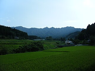
English: Mt.Koshiki (Koshiki-dake) as seen from the north by east in the border between Oita and Kumamoto prefectures, Kyushu, Japan.
日本語: 越敷岳を北微東から望む。大分県と熊本県に跨る九州百名山の一峰。竹田市から撮影。 |
| Date | |
| Source | Own work |
| Author | As6022014 |
| Camera location | | View this and other nearby images on: OpenStreetMap |
|---|
Licensing[edit]
| I, the copyright holder of this work, release this work into the public domain. This applies worldwide. In some countries this may not be legally possible; if so: I grant anyone the right to use this work for any purpose, without any conditions, unless such conditions are required by law. |
File history
Click on a date/time to view the file as it appeared at that time.
| Date/Time | Thumbnail | Dimensions | User | Comment | |
|---|---|---|---|---|---|
| current | 08:15, 25 June 2010 | | 2,048 × 1,536 (666 KB) | As6022014 (talk | contribs) | {{Information |Description={{en|1=Mt.Koshikidake}} {{ja|1=越敷岳}} |Source=own work |Author=As6022014 |Date=2010-06-25 |Permission= |other_versions= }} Category:Mountains of Oita prefecture Category:Mountains of Kumamoto prefecture |
You cannot overwrite this file.
File usage on Commons
There are no pages that use this file.
File usage on other wikis
The following other wikis use this file:
- Usage on ja.wikipedia.org