File:Mudshale with burrows (Raccoon Shale Member, Cuyahoga Formation, Lower Mississippian; Moots Run, Licking County, east-central Ohio, USA) (15006842194).jpg
Original file (3,399 × 3,046 pixels, file size: 2.94 MB, MIME type: image/jpeg)
Captions
Captions
Summary[edit]
_(15006842194).jpg&action=edit§ion=1)
| Description |
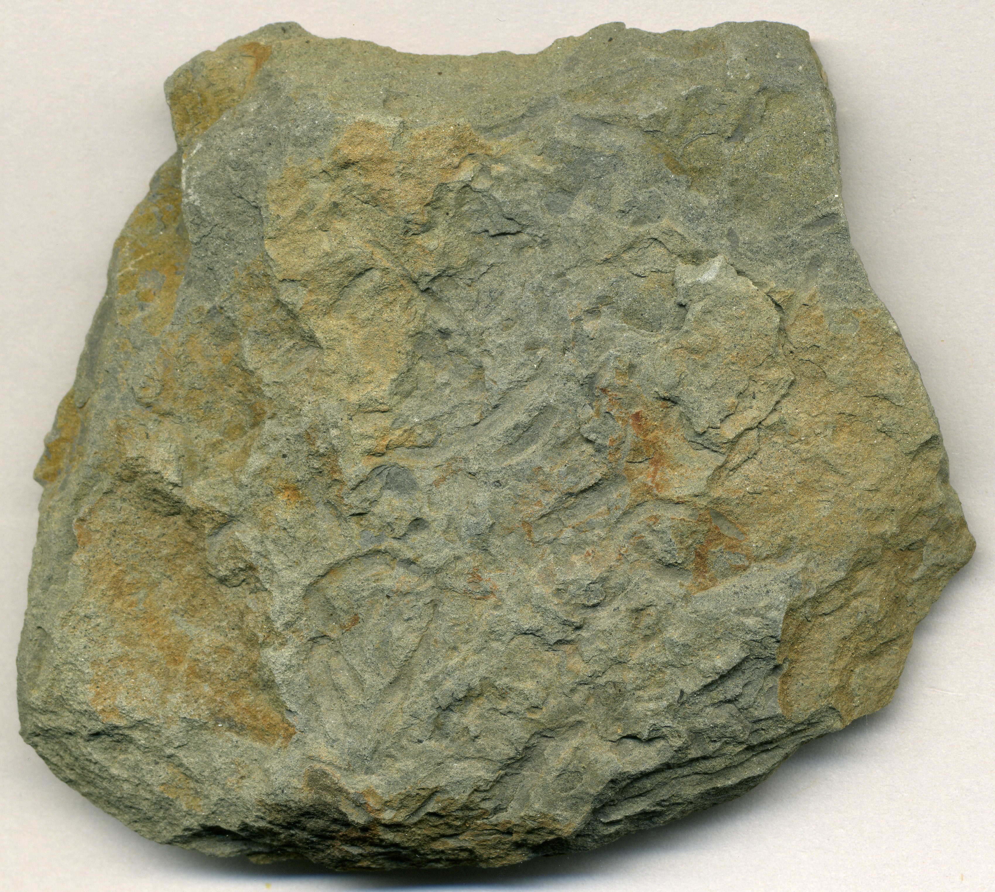
Gray mudshale with burrows (6.8 cm across at its widest) from the Mississippian of Ohio, USA. The Raccoon Shale is a widespread, Early Mississippian-aged marine unit in central and western Licking County (east-central Ohio). It is the uppermost-preserved member of the Cuyahoga Formation (the overlying Black Hand Sandstone was formerly considered a member of this formation as well). The unit is named after Raccoon Creek (this sample is from the type locality at Moots Run, a tributary of Raccoon Creek), which drains southeastward and eastward through northwestern and central Licking County (Johnstown-Alexandria-Granville-Newark area). Observed lithologies in the Raccoon Shale include relatively soft, dark-colored mudshales (weathering to medium to light gray) and interbedded, moderately hard quartzose siltstones. Interbedded quartzose sandstones become common near the top of the unit (formerly miscorrelated with the Black Hand Sandstone). The Raccoon Shale has relatively few fossils, but trace fossils are most commonly encountered (relatively simple burrows made by invertebrates). Scarce body fossils, such as complete conulariids, also occur. The Raccoon Shale has environmental significance. Uranium and radium decay from the unit generates radon gas, which is why Licking County has the highest indoor radon levels in the entire state of Ohio. The highest recorded indoor radon level in a 2002 study was 20 times higher than the level set by the American government's Environmental Protection Agency for mitigation action. Stratigraphy: Raccoon Shale Member, upper Cuyahoga Formation, Kinderhookian Stage, lower Lower Mississippian Locality: Moots Run (type locality of the Raccoon Shale), immediately upstream from Morse Road bridge, due east of Goddard Corners, west of Granville, west-central Licking County, east-central Ohio, USA (40° 03' 38.39" North, 82° 36' 04.91" West) Reference: Lackmeyer, C. 2002. Radon levels in Granville and Alexandria: an assessment of geologic factors. Denison Journal of the Geosciences 16(Fall 2002):36-41. |
| Date | |
| Source | Mudshale with burrows (Raccoon Shale Member, Cuyahoga Formation, Lower Mississippian; Moots Run, Licking County, east-central Ohio, USA) |
| Author | James St. John |
Licensing[edit]
_(15006842194).jpg&action=edit§ion=2)
- You are free:
- to share – to copy, distribute and transmit the work
- to remix – to adapt the work
- Under the following conditions:
- attribution – You must give appropriate credit, provide a link to the license, and indicate if changes were made. You may do so in any reasonable manner, but not in any way that suggests the licensor endorses you or your use.
| This image was originally posted to Flickr by James St. John at https://flickr.com/photos/47445767@N05/15006842194 (archive). It was reviewed on 7 December 2019 by FlickreviewR 2 and was confirmed to be licensed under the terms of the cc-by-2.0. |
File history
Click on a date/time to view the file as it appeared at that time.
| Date/Time | Thumbnail | Dimensions | User | Comment | |
|---|---|---|---|---|---|
| current | 17:57, 7 December 2019 | | 3,399 × 3,046 (2.94 MB) | Ser Amantio di Nicolao (talk | contribs) | Transferred from Flickr via #flickr2commons |
You cannot overwrite this file.
File usage on Commons
There are no pages that use this file.
_(15006842194).jpg&oldid=506745583)