File:Mussertpaal N228 Montfoort 03.JPG
Jump to navigation
Jump to search

Size of this preview: 450 × 600 pixels. Other resolutions: 180 × 240 pixels | 360 × 480 pixels | 576 × 768 pixels | 768 × 1,024 pixels | 1,536 × 2,048 pixels | 2,976 × 3,968 pixels.
Original file (2,976 × 3,968 pixels, file size: 2.55 MB, MIME type: image/jpeg)
Captions
Captions
Add a one-line explanation of what this file represents
Summary[edit]
| Description |
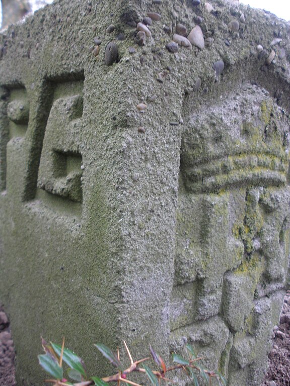
Nederlands: Een zogenaamde Mussertpaal aan de N228 in Montfoort in de bocht ter hoogte van de kruising met de Boslaan. Er staan twee van deze palen in de bocht. Deze markering is langs doorgaande wegen in de provincie Utrecht aangebracht op initiatief van Anton A. Mussert. Hij werkte van 1920 tot 1934 als ingenieur bij de Provinciale Waterstaat Utrecht. Op de achterkant van de grenspalen staan de initialen PG, voor Provinciale Grond. Het betreft een grensaanduiding tussen het Provinciale eigendom van de weg en particuliere grond. |
| Date | |
| Source | Own work |
| Author | Onderwijsgek |
Licensing[edit]
I, the copyright holder of this work, hereby publish it under the following license:
This file is licensed under the Creative Commons Attribution-Share Alike 3.0 Unported license.
- You are free:
- to share – to copy, distribute and transmit the work
- to remix – to adapt the work
- Under the following conditions:
- attribution – You must give appropriate credit, provide a link to the license, and indicate if changes were made. You may do so in any reasonable manner, but not in any way that suggests the licensor endorses you or your use.
- share alike – If you remix, transform, or build upon the material, you must distribute your contributions under the same or compatible license as the original.
File history
Click on a date/time to view the file as it appeared at that time.
| Date/Time | Thumbnail | Dimensions | User | Comment | |
|---|---|---|---|---|---|
| current | 10:03, 7 April 2012 | | 2,976 × 3,968 (2.55 MB) | Onderwijsgek (talk | contribs) |
You cannot overwrite this file.
File usage on Commons
There are no pages that use this file.
File usage on other wikis
The following other wikis use this file:
- Usage on nl.wikipedia.org