File:Myanmar states location.svg
跳转到导航
跳转到搜索

此SVG文件的PNG预览的大小:285 × 599像素。 其他分辨率:114 × 240像素 | 228 × 480像素 | 365 × 768像素 | 487 × 1,024像素 | 975 × 2,048像素 | 1,200 × 2,520像素。
原始文件 (SVG文件,尺寸为1,200 × 2,520像素,文件大小:669 KB)
说明
说明
添加一行文字以描述该文件所表现的内容
摘要[编辑]
| 描述 |
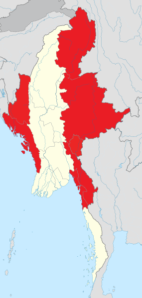
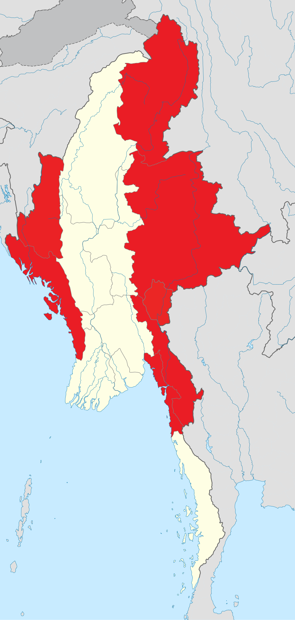
English: States of Myanmar are outlined in red. The regions can be described as ethnically predominantly Burman (Bamar), while the states, the zones and Wa Division are ethnic minority-dominant.
States (red);
Regions (white). Français : Les états du Myanmar sont affiché en rouge. Les régions peuvent être définies comme majoritairement peuplée par les Bamas, alors que les états, les zones et la division auto-administrée de Wa sont essentiellement peuplés d’ethnies minoritaires en Birmanie. |
| 日期 | |
| 来源 | 自己的作品, derived from File:Myanmar location map.svg and information from en:Administrative divisions of Burma. |
| 作者 | Quigley |
| 其他版本 |
本檔案衍生自: Myanmar location map.svg |
许可协议[编辑]
我,本作品著作权人,特此采用以下许可协议发表本作品:
本文件采用知识共享署名-相同方式共享 3.0 未本地化版本许可协议授权。
- 您可以自由地:
- 共享 – 复制、发行并传播本作品
- 修改 – 改编作品
- 惟须遵守下列条件:
- 署名 – 您必须对作品进行署名,提供授权条款的链接,并说明是否对原始内容进行了更改。您可以用任何合理的方式来署名,但不得以任何方式表明许可人认可您或您的使用。
- 相同方式共享 – 如果您再混合、转换或者基于本作品进行创作,您必须以与原先许可协议相同或相兼容的许可协议分发您贡献的作品。
文件历史
点击某个日期/时间查看对应时刻的文件。
| 日期/时间 | 缩略图 | 大小 | 用户 | 备注 | |
|---|---|---|---|---|---|
| 当前 | 2019年12月10日 (二) 17:38 | | 1,200 × 2,520(669 KB) | Goran tek-en(留言 | 贡献) | Changed color of Chinese strip as requested bu {{u|Kintetsubuffalo}} |
| 2012年2月5日 (日) 15:27 |  | 1,200 × 2,520(633 KB) | Quigley(留言 | 贡献) | fixed sea | |
| 2012年2月5日 (日) 15:17 |  | 1,200 × 2,520(681 KB) | Quigley(留言 | 贡献) |
您不可以覆盖此文件。
文件用途
全域文件用途
以下其他wiki使用此文件:
- blk.wikipedia.org上的用途
- bn.wikipedia.org上的用途
- cs.wikipedia.org上的用途
- en.wikipedia.org上的用途
- incubator.wikimedia.org上的用途
- my.wikipedia.org上的用途
- nl.wikipedia.org上的用途
- sat.wikipedia.org上的用途
- shn.wikipedia.org上的用途
- vi.wikipedia.org上的用途
- zh-min-nan.wikipedia.org上的用途
- zh.wikipedia.org上的用途