File:Myszyniec (gmina) location map.png
Jump to navigation
Jump to search

Size of this preview: 603 × 600 pixels. Other resolutions: 241 × 240 pixels | 483 × 480 pixels | 921 × 916 pixels.
Original file (921 × 916 pixels, file size: 152 KB, MIME type: image/png)
Captions
Captions
Add a one-line explanation of what this file represents
| Description |
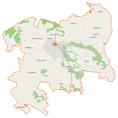
Polski: Mapa gminy Myszyniec, Polska
English: Map of Gmina Myszyniec, Poland |
|||||||||
| Date | ||||||||||
| Source | You may find a page on the OpenStreetMap wiki page for Myszyniec (gmina) | |||||||||
| Creator |
OpenStreetMap contributors OpenStreetMap contributors |
|||||||||
| Permission (Reusing this file) |
OpenStreetMap data is available under the Open Database License (details). Map tiles are licensed under the Creative Commons Attribution-ShareAlike 2.0 license (CC-BY-SA 2.0).
This file is licensed under the Creative Commons Attribution-Share Alike 2.0 Generic license.
|
|||||||||
| Geotemporal data | ||||||||||
| Bounding box |
|
|||||||||
| Georeferencing | If inappropriate please set warp_status = skip to hide. | |||||||||
File history
Click on a date/time to view the file as it appeared at that time.
| Date/Time | Thumbnail | Dimensions | User | Comment | |
|---|---|---|---|---|---|
| current | 07:42, 12 September 2014 | | 921 × 916 (152 KB) | VanWiel (talk | contribs) | |
| 09:39, 25 August 2014 |  | 921 × 916 (173 KB) | VanWiel (talk | contribs) | {{OpenStreetMap | name = Myszyniec (gmina) | location = Myszyniec (gmina) | description = {{pl|Mapa gminy Myszyniec, Polska}} {{en|Map of Gmina Myszyniec, Poland}} | top = 53.4533 | left = 21.1937... |
You cannot overwrite this file.
File usage on Commons
There are no pages that use this file.
File usage on other wikis
The following other wikis use this file:
- Usage on fr.wikipedia.org
- Usage on nl.wikipedia.org
- Usage on pl.wikipedia.org
- Myszyniec
- Myszyniec (gmina)
- Białusny Lasek (wieś)
- Charciabałda
- Cięćk
- Drężek
- Gadomskie
- Myszyniec-Koryta
- Myszyniec Stary
- Świdwiborek
- Wydmusy
- Wolkowe
- Wykrot (gmina Myszyniec)
- Zdunek (wieś)
- Krysiaki (województwo mazowieckie)
- Niedźwiedź (województwo mazowieckie)
- Olszyny (wieś w województwie mazowieckim)
- Pełty (województwo mazowieckie)
- Zalesie (powiat ostrołęcki)
- Bazylika kolegiacka Trójcy Przenajświętszej w Myszyńcu
- Cmentarz żydowski w Myszyńcu
- Myszyniec (stacja kolejowa)
- Parafia Trójcy Przenajświętszej w Myszyńcu
- Wykrot (przystanek kolejowy)
- Zawodzie (przystanek kolejowy)
- Myszyniec Stary (przystanek kolejowy)
- Wydmusy (przystanek kolejowy)
- Zalesie Myszynieckie
- Zdunek (osada leśna)
- Zawodzie (województwo mazowieckie)
- Olszyny (osada leśna w województwie mazowieckim)
- Białusny Lasek (osada leśna)
- Moduł:Mapa/dane/Myszyniec
- Moduł:Mapa/dane/Myszyniec (gmina)
- Browary (Myszyniec)
- Maciejowa Szyja
- Orły (Niedźwiedź)
- Budy (Charciabałda)
- Parafia Matki Bożej Królowej Korony Polskiej w Krysiakach
- Dzwonnica w Myszyńcu
- Usage on pl.wikibooks.org
_location_map.png&oldid=519984073)