File:N4 Cameroon OSM-fr.png
Jump to navigation
Jump to search

Size of this preview: 600 × 600 pixels. Other resolutions: 240 × 240 pixels | 480 × 480 pixels | 768 × 768 pixels | 1,024 × 1,024 pixels | 1,968 × 1,968 pixels.
Original file (1,968 × 1,968 pixels, file size: 3.64 MB, MIME type: image/png)
Captions
Captions
Add a one-line explanation of what this file represents
Summary
[edit]
| Description |
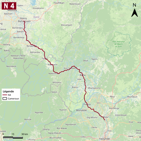
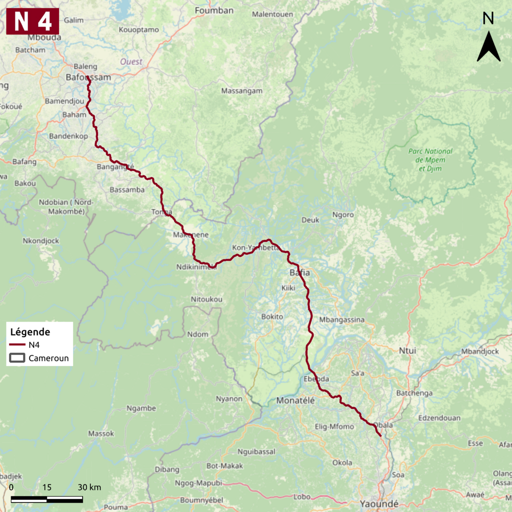
Français : Carte issue d'OpenStreetMap montrant la route nationale 4 au Cameroun.
Projection : WGS-84 / Pseudo-Mercator. Coordonnées approximatives des limites de la carte : |
| Date | |
| Source |
|
| Author |
Antimuonium Contributeurs d'OpenStreetMap |
Licensing
[edit]
| This work contains information from OpenStreetMap, which is made available under the Open Database License (ODbL).
The ODbL does not require any particular license for maps produced from ODbL data. Prior to 1 August 2020, map tiles produced by the OpenStreetMap Foundation were licensed under the CC-BY-SA-2.0 license. Maps produced by other people may be subject to other licences. |
File history
Click on a date/time to view the file as it appeared at that time.
| Date/Time | Thumbnail | Dimensions | User | Comment | |
|---|---|---|---|---|---|
| current | 21:25, 23 March 2023 | | 1,968 × 1,968 (3.64 MB) | Antimuonium (talk | contribs) | minor edit |
| 20:25, 15 July 2022 |  | 1,968 × 1,968 (3.68 MB) | Antimuonium (talk | contribs) | Uploaded a work by Contributeurs d'OpenStreetMap from openstreetmap.org with UploadWizard |
You cannot overwrite this file.
File usage on Commons
There are no pages that use this file.
File usage on other wikis
The following other wikis use this file:
- Usage on fr.wikipedia.org