File:NASA Worldwind, USGS imagery map, Tule Island, California.png
পরিভ্রমণে চলুন
অনুসন্ধানে চলুন

এই প্রাকদর্শনের আকার: ৬০০ × ৬০০ পিক্সেল। অন্যান্য আকারসমূহ: ২৪০ × ২৪০ পিক্সেল | ৬১১ × ৬১১ পিক্সেল।
মূল ফাইল (৬১১ × ৬১১ পিক্সেল, ফাইলের আকার: ৪৪৭ কিলোবাইট, এমআইএমই ধরন: image/png)
ক্যাপশনসমূহ
ক্যাপশন
এই ফাইল কি প্রতিনিধিত্ব করছে তার এক লাইন ব্যাখ্যা যোগ করুন
সারাংশ
[সম্পাদনা]
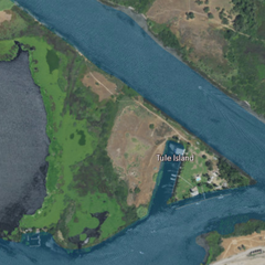
| বিবরণ | USGS aerial imagery of w:Tule Island, with w:Headreach Island to its northwest and McDonald Island to its southeast. | |||
| উৎস | NASA tool at worldwind.earth, USGS Topo Imagery map layer | |||
| লেখক | Self | |||
| অনুমতি (এ ফাইলের পুনঃব্যবহার) |
|
ফাইলের ইতিহাস
যেকোনো তারিখ/সময়ে ক্লিক করে দেখুন ফাইলটি তখন কী অবস্থায় ছিল।
| তারিখ/সময় | সংক্ষেপচিত্র | মাত্রা | ব্যবহারকারী | মন্তব্য | |
|---|---|---|---|---|---|
| বর্তমান | ০০:১৫, ২২ ফেব্রুয়ারি ২০২১ | | ৬১১ × ৬১১ (৪৪৭ কিলোবাইট) | JPxG (আলোচনা | অবদান) | {{Information |Description=USGS aerial imagery of w:Tule Island, with w:Headreach Island to its northwest and McDonald Island to its southeast. |Source=NASA tool at worldwind.earth, USGS Topo Imagery map layer |Date= |Author= |Permission={{PD-USGov-USGS}} |other_versions= }} Category:Islands of California Category:Sacramento–San Joaquin River Delta Category:Aerial photographs of river deltas Category:Aerial photographs of California |
আপনি এই ফাইলটি প্রতিস্থাপন করতে পারবেন না।
ফাইলের ব্যবহার
এই ফাইল ব্যবহার করে এমন কোনো পাতা নেই।
ফাইলের বৈশ্বিক ব্যবহার
নিচের অন্যান্য উইকিগুলো এই ফাইলটি ব্যবহার করে:
- bn.wikipedia.org-এ ব্যবহার
- en.wikipedia.org-এ ব্যবহার