File:NASA bathymetric world map.jpg
Jump to navigation
Jump to search
Size of this preview: 800 × 400 pixels. Other resolutions: 320 × 160 pixels | 640 × 320 pixels | 1,024 × 512 pixels | 1,280 × 640 pixels | 3,600 × 1,800 pixels.
Original file (3,600 × 1,800 pixels, file size: 1.9 MB, MIME type: image/jpeg)
Captions
Captions
Add a one-line explanation of what this file represents
Summary[edit]
| Description |
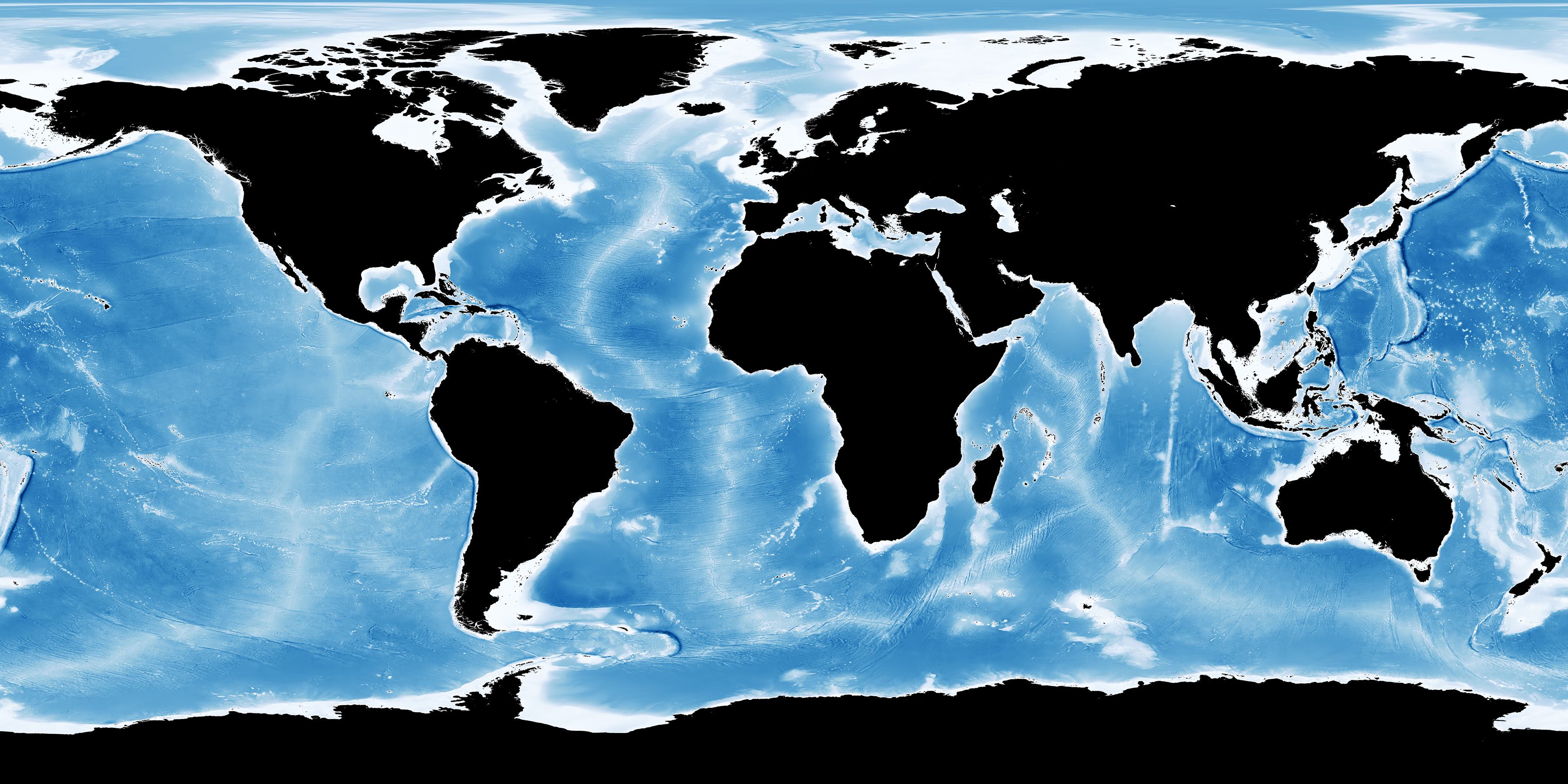
English: These images represent ocean depths between -8000m and 0m (surface). |
| Date | |
| Source | https://visibleearth.nasa.gov/view.php?id=73963 |
| Author | Credit: Imagery by Jesse Allen, NASA's Earth Observatory, using data from the General Bathymetric Chart of the Oceans (GEBCO) produced by the British Oceanographic Data Centre. |
Licensing[edit]
| This file is in the public domain in the United States because it was solely created by NASA. NASA copyright policy states that "NASA material is not protected by copyright unless noted". (See Template:PD-USGov, NASA copyright policy page or JPL Image Use Policy.) | ||
 |
Warnings:
|
File history
Click on a date/time to view the file as it appeared at that time.
| Date/Time | Thumbnail | Dimensions | User | Comment | |
|---|---|---|---|---|---|
| current | 08:40, 2 September 2018 | | 3,600 × 1,800 (1.9 MB) | Dbachmann (talk | contribs) | {{Information |description ={{en|1=These images represent ocean depths between -8000m and 0m (surface). Land regions are black in the colored versions. The full resolution of these images has been broken up into tiles as listed below. To understand the naming scheme please read about our global image grid.}} |date =2005 |source =https://visibleearth.nasa.gov/view.php?id=73963 |author =Credit: Imagery by Jesse Allen, NASA's Earth Observatory, using data from the Genera... |
You cannot overwrite this file.
File usage on Commons
There are no pages that use this file.