File:NATO Territory Map.svg
Jump to navigation
Jump to search

Size of this PNG preview of this SVG file: 709 × 324 pixels. Other resolutions: 320 × 146 pixels | 640 × 292 pixels | 1,024 × 468 pixels | 1,280 × 585 pixels | 2,560 × 1,170 pixels.
Original file (SVG file, nominally 709 × 324 pixels, file size: 480 KB)
Captions
Captions
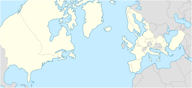
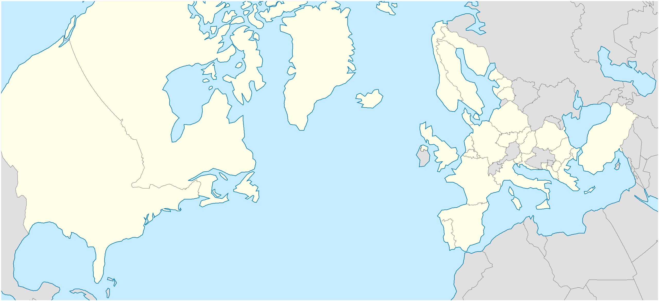
The territory of the NATO Alliance
Summary
[edit]
| Description |
English: A geographical projection of a map that highlights all member nations of the North Atlantic Treaty Organization (NATO).
Nederlands: Een geografische projectie waarin het gebied van alle lidstaten van de Noord-Atlantische Verdrags Organisatie (NAVO) wordt belicht. |
| Date | |
| Source | Own work - inspired by the work of Ssolbergj in File:NATO laea location map.svg. |
| Author | Woudsma |
| SVG development | This locator map was created with Inkscape. |
Licensing
[edit]
I, the copyright holder of this work, hereby publish it under the following license:
This file is licensed under the Creative Commons Attribution-Share Alike 4.0 International license.
- You are free:
- to share – to copy, distribute and transmit the work
- to remix – to adapt the work
- Under the following conditions:
- attribution – You must give appropriate credit, provide a link to the license, and indicate if changes were made. You may do so in any reasonable manner, but not in any way that suggests the licensor endorses you or your use.
- share alike – If you remix, transform, or build upon the material, you must distribute your contributions under the same or compatible license as the original.
File history
Click on a date/time to view the file as it appeared at that time.
| Date/Time | Thumbnail | Dimensions | User | Comment | |
|---|---|---|---|---|---|
| current | 03:07, 9 March 2024 | | 709 × 324 (480 KB) | Woudsma (talk | contribs) | Uploaded own work with UploadWizard |
You cannot overwrite this file.
File usage on Commons
There are no pages that use this file.
File usage on other wikis
The following other wikis use this file:
- Usage on en.wikipedia.org
- NATO
- Incirlik Air Base
- Allied Command Operations
- Allied Command Transformation
- Joint Warfare Centre
- Template:Location map
- Template:Location map/doc
- NATO School
- Joint Force Training Centre
- Mürted Airfield Command
- Joint Analysis and Lessons Learned Centre
- Template:Location map/sandbox
- Çiğli Air Base
- Ankara Güvercinlik Army Air Base
- Etimesgut Air Base
- Cengiz Topel Naval Air Station
- Kütahya Air Base
- Allied Land Command
- Allied Maritime Command
- Naval Striking and Support Forces NATO
- Template:NATO commands
- Module:Location map/data/NATO
- Module:Location map/data/NATO/doc
- European Union–NATO relations
- User:Mgkrupa/Code and Symbols
- User:Woudsma/NATO Commands Map