File:NJ 39-10 Rasht, Iran.jpg
Jump to navigation
Jump to search
Size of this preview: 789 × 599 pixels. Other resolutions: 316 × 240 pixels | 632 × 480 pixels | 1,011 × 768 pixels | 1,280 × 973 pixels | 2,560 × 1,945 pixels | 5,000 × 3,799 pixels.
Original file (5,000 × 3,799 pixels, file size: 2.5 MB, MIME type: image/jpeg)
Captions
Captions
Add a one-line explanation of what this file represents
Summary
[edit]
| Description |
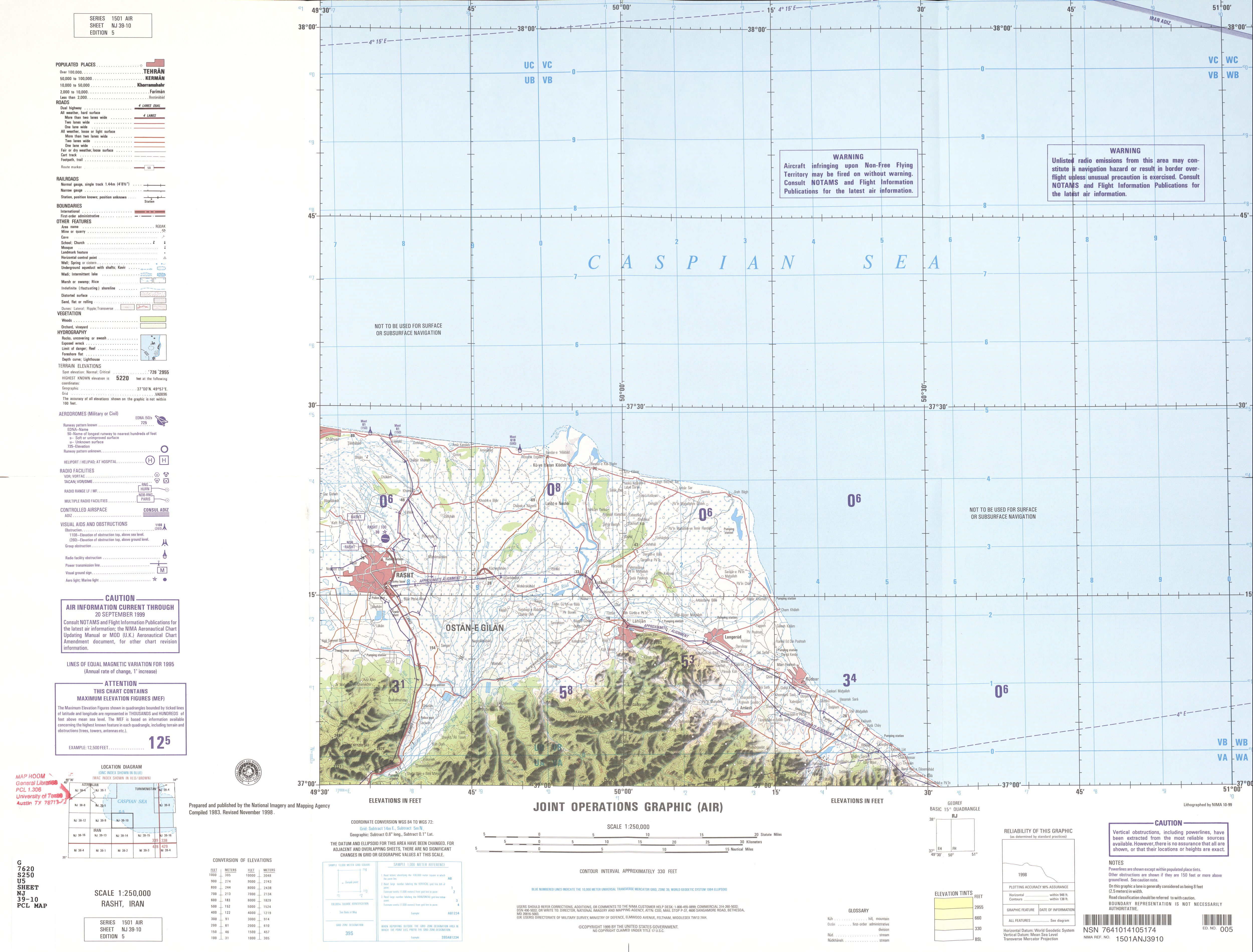
English: Rasht, Iran map (NJ 39-10)
فارسی: نقشهٔ رشت |
| Date | Compiled: 1983, Revised: November 1998 |
| Source | http://legacy.lib.utexas.edu/maps/jog/iran/ |
| Author |
|
Licensing
[edit]
This image is a work of the United States National Geospatial-Intelligence Agency or one of its predecessor agencies. As a work of the U.S. federal government, the image is in the public domain.
|
 |
File history
Click on a date/time to view the file as it appeared at that time.
| Date/Time | Thumbnail | Dimensions | User | Comment | |
|---|---|---|---|---|---|
| current | 08:16, 20 October 2019 | | 5,000 × 3,799 (2.5 MB) | Hanooz (talk | contribs) | Transferred from http://legacy.lib.utexas.edu/maps/jog/iran/txu-oclc-58750648-nj39-10.jpg |
You cannot overwrite this file.
File usage on Commons
The following page uses this file: