File:NPS crater-lake-precipitation-map.jpg
Jump to navigation
Jump to search

Size of this preview: 455 × 599 pixels. Other resolutions: 182 × 240 pixels | 364 × 480 pixels | 583 × 768 pixels | 1,166 × 1,536 pixels.
Original file (1,166 × 1,536 pixels, file size: 291 KB, MIME type: image/jpeg)
Captions
Captions
Add a one-line explanation of what this file represents
Summary
[edit]
| Description |
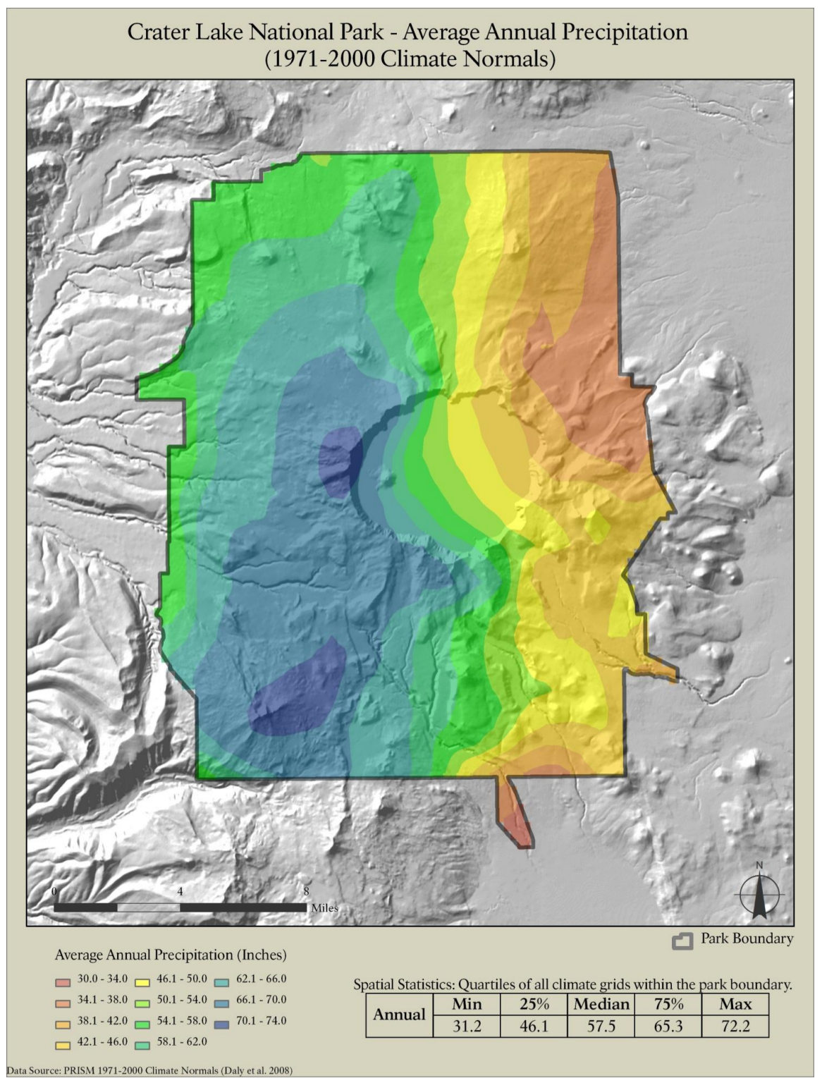
English: Crater Lake precipitation map, plotting out the average annual amount of precipitation the park receives. Note the rain shadow effect, with much less precipitation on the east side! |
| Date | |
| Source | U.S. National Park Service (http://npmaps.com/wp-content/uploads/crater-lake-precipitation-map.jpg) |
| Author | U.S. National Park Service, restoration/cleanup by Matt Holly |
Licensing
[edit]
| This image or media file contains material based on a work of a National Park Service employee, created as part of that person's official duties. As a work of the U.S. federal government, such work is in the public domain in the United States. See the NPS website and NPS copyright policy for more information. |
File history
Click on a date/time to view the file as it appeared at that time.
| Date/Time | Thumbnail | Dimensions | User | Comment | |
|---|---|---|---|---|---|
| current | 20:10, 16 May 2017 | | 1,166 × 1,536 (291 KB) | RKBot (talk | contribs) | =={{int:filedesc}}== {{Information |description= {{en|1=Crater Lake precipitation map, plotting out the average annual amount of precipitation the park receives. Note the rain shadow effect, with much less precipitation on the east side!}} |date= 2017-... |
You cannot overwrite this file.
File usage on Commons
The following page uses this file: