File:NPS devils-tower-geologic-map.jpg
Jump to navigation
Jump to search

Size of this preview: 526 × 600 pixels. Other resolutions: 210 × 240 pixels | 421 × 480 pixels | 673 × 768 pixels | 898 × 1,024 pixels | 1,796 × 2,048 pixels | 3,637 × 4,147 pixels.
Original file (3,637 × 4,147 pixels, file size: 2.99 MB, MIME type: image/jpeg)
Captions
Captions
Add a one-line explanation of what this file represents
Summary[edit]
| Description |
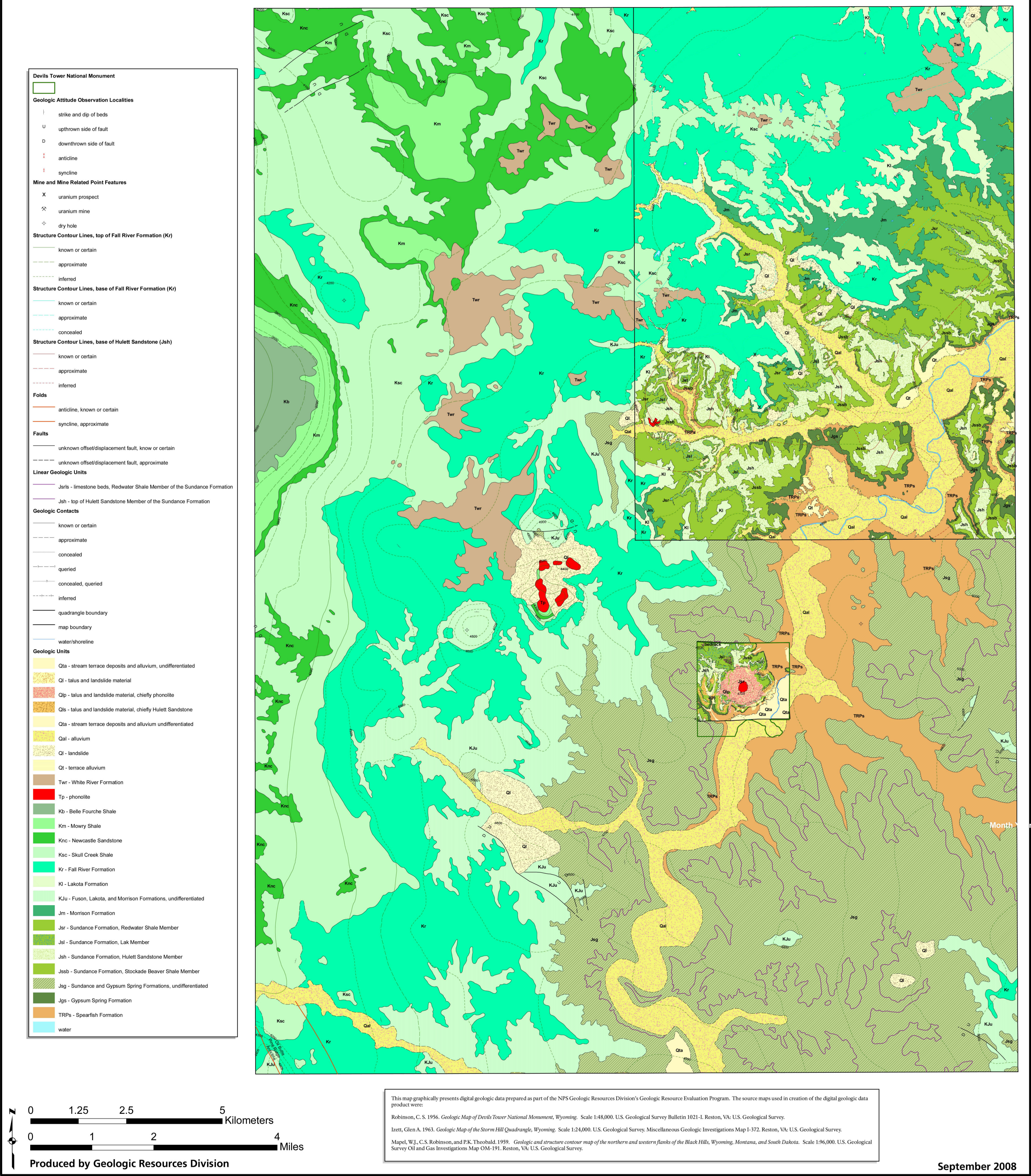
English: Geologic map of Devils Tower, which may not be incredibly useful for trip-planning but it’s certainly great for learning about the park! It includes the surrounding Wyoming region as well. |
| Date | |
| Source | U.S. National Park Service (http://npmaps.com/wp-content/uploads/devils-tower-geologic-map.jpg) |
| Author | U.S. National Park Service, restoration/cleanup by Matt Holly |
Licensing[edit]
| This image or media file contains material based on a work of a National Park Service employee, created as part of that person's official duties. As a work of the U.S. federal government, such work is in the public domain in the United States. See the NPS website and NPS copyright policy for more information. |
File history
Click on a date/time to view the file as it appeared at that time.
| Date/Time | Thumbnail | Dimensions | User | Comment | |
|---|---|---|---|---|---|
| current | 21:07, 16 May 2017 | | 3,637 × 4,147 (2.99 MB) | RKBot (talk | contribs) | =={{int:filedesc}}== {{Information |description= {{en|1=Geologic map of Devils Tower, which may not be incredibly useful for trip-planning but it’s certainly great for learning about the park! It includes the surrounding Wyoming region as well.}} |da... |
You cannot overwrite this file.
File usage on Commons
The following page uses this file:
Categories:
- Maps of Devils Tower National Monument
- Geological maps of Wyoming
- Maps of the White River Group (geology)
- Belle Fourche Formation
- Mowry Shale
- Newcastle Sandstone (U.S. geology)
- Skull Creek Shale
- Fall River Sandstone
- Lakota Formation
- Morrison Formation maps
- Sundance Formation (geology)
- Gypsum Springs Formation
- Spearfish Formation
- Morrison Formation in Wyoming
- Quaternary stream terrace deposits in Wyoming
- Quaternary alluvium in Wyoming
- Quaternary talus in Wyoming
- Quaternary landslide deposits in Wyoming
- Hulett Sandstone talus
- Hulett Sandstone landslide deposits
- Quaternary phonolitic talus in Wyoming
- Quaternary phonolitic landslide deposits in Wyoming
- Neogene phonolites in Wyoming
- Paleogene phonolites in Wyoming
- Fuson Member, Lakota Formation
- Redwater Shale
- Lak Member, Sundance Formation
- Hulett Sandstone Member, Sundance Formation
- Stockade Beaver Shale Member, Sundance Formation