File:NPS montezuma-castle-tuzigoot-regional-map.gif
Jump to navigation
Jump to search

Size of this preview: 800 × 588 pixels. Other resolutions: 320 × 235 pixels | 640 × 470 pixels | 1,024 × 752 pixels | 1,280 × 940 pixels | 1,559 × 1,145 pixels.
Original file (1,559 × 1,145 pixels, file size: 327 KB, MIME type: image/gif, 0.1 s)
Captions
Captions
Add a one-line explanation of what this file represents
Summary[edit]
| Description |
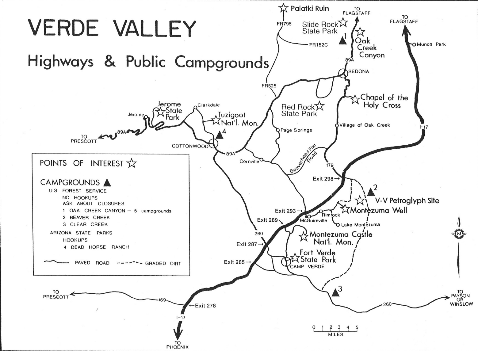
English: The Montezuma Castle regional map is hand-drawn and shows a lot of points of interest in the Verde Valley. You’ll find this handy if you’re going to a few sites nearby or in Sedona. |
| Date | |
| Source | U.S. National Park Service (http://npmaps.com/wp-content/uploads/montezuma-castle-tuzigoot-regional-map.gif) |
| Author | U.S. National Park Service, restoration/cleanup by Matt Holly |
Licensing[edit]
| This image or media file contains material based on a work of a National Park Service employee, created as part of that person's official duties. As a work of the U.S. federal government, such work is in the public domain in the United States. See the NPS website and NPS copyright policy for more information. |
File history
Click on a date/time to view the file as it appeared at that time.
| Date/Time | Thumbnail | Dimensions | User | Comment | |
|---|---|---|---|---|---|
| current | 01:05, 17 May 2017 | | 1,559 × 1,145 (327 KB) | RKBot (talk | contribs) | =={{int:filedesc}}== {{Information |description= {{en|1=The Montezuma Castle regional map is hand-drawn and shows a lot of points of interest in the Verde Valley. You’ll find this handy if you’re going to a few sites nearby or in Sedona.}} |date= 2... |
You cannot overwrite this file.
File usage on Commons
The following page uses this file: