File:NPS saint-croix-river-map-5-riverside-landing.jpg
Aller à la navigation
Aller à la recherche

Taille de cet aperçu : 770 × 600 pixels. Autres résolutions : 308 × 240 pixels | 617 × 480 pixels | 986 × 768 pixels | 1 280 × 997 pixels | 2 061 × 1 605 pixels.
Fichier d’origine (2 061 × 1 605 pixels, taille du fichier : 492 kio, type MIME : image/jpeg)
Légendes
Légendes
Ajoutez en une ligne la description de ce que représente ce fichier
Description[modifier]
| Description |
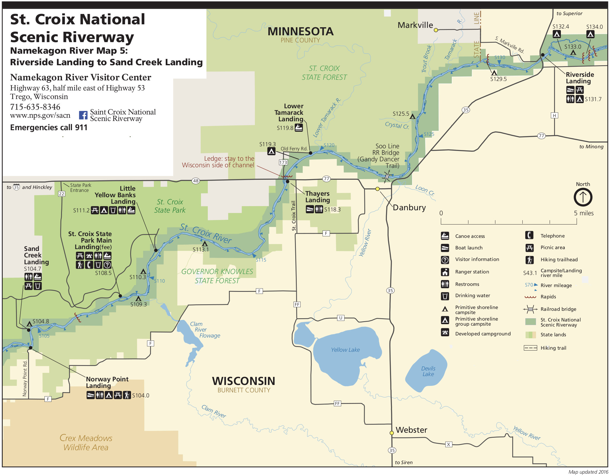
English: Map 5: Now we’re below the confluence! This map of Riverside Landing to Sand Creek Landing shows the Saint Croix River downstream of the confluence, adjacent to both Minnesota and Wisconsin. |
| Date | |
| Source | U.S. National Park Service (http://npmaps.com/wp-content/uploads/saint-croix-river-map-5-riverside-landing.jpg) |
| Auteur | U.S. National Park Service, restoration/cleanup by Matt Holly |
Conditions d’utilisation[modifier]
| Cette image ou ce document multimédia contiennent des éléments basés sur une œuvre d'un employé du National Park Service, créé dans le cadre des tâches officielles de cette personne. En tant qu'œuvre du Gouvernement fédéral des États-Unis, une telle œuvre se trouve dans le domaine public aux États-Unis. Voir NPS website et NPS copyright policy pour plus d'informations. |
Historique du fichier
Cliquer sur une date et heure pour voir le fichier tel qu'il était à ce moment-là.
| Date et heure | Vignette | Dimensions | Utilisateur | Commentaire | |
|---|---|---|---|---|---|
| actuel | 17 mai 2017 à 02:11 | | 2 061 × 1 605 (492 kio) | RKBot (d | contributions) | =={{int:filedesc}}== {{Information |description= {{en|1=Map 5: Now we’re below the confluence! This map of Riverside Landing to Sand Creek Landing shows the Saint Croix River downstream of the confluence, adjacent to both Minnesota and Wisconsin.}} |... |
Vous ne pouvez pas remplacer ce fichier.
Utilisations locales du fichier
La page suivante utilise ce fichier :
Utilisations du fichier sur d’autres wikis
Les autres wikis suivants utilisent ce fichier :
- Utilisation sur fr.wikipedia.org