File:NPS shenandoah-hawksbill-trail-map.gif
Jump to navigation
Jump to search
Size of this preview: 465 × 600 pixels. Other resolutions: 186 × 240 pixels | 372 × 480 pixels | 595 × 768 pixels | 1,194 × 1,540 pixels.
Original file (1,194 × 1,540 pixels, file size: 135 KB, MIME type: image/gif)
Captions
Captions
Add a one-line explanation of what this file represents
Summary[edit]
| Description |
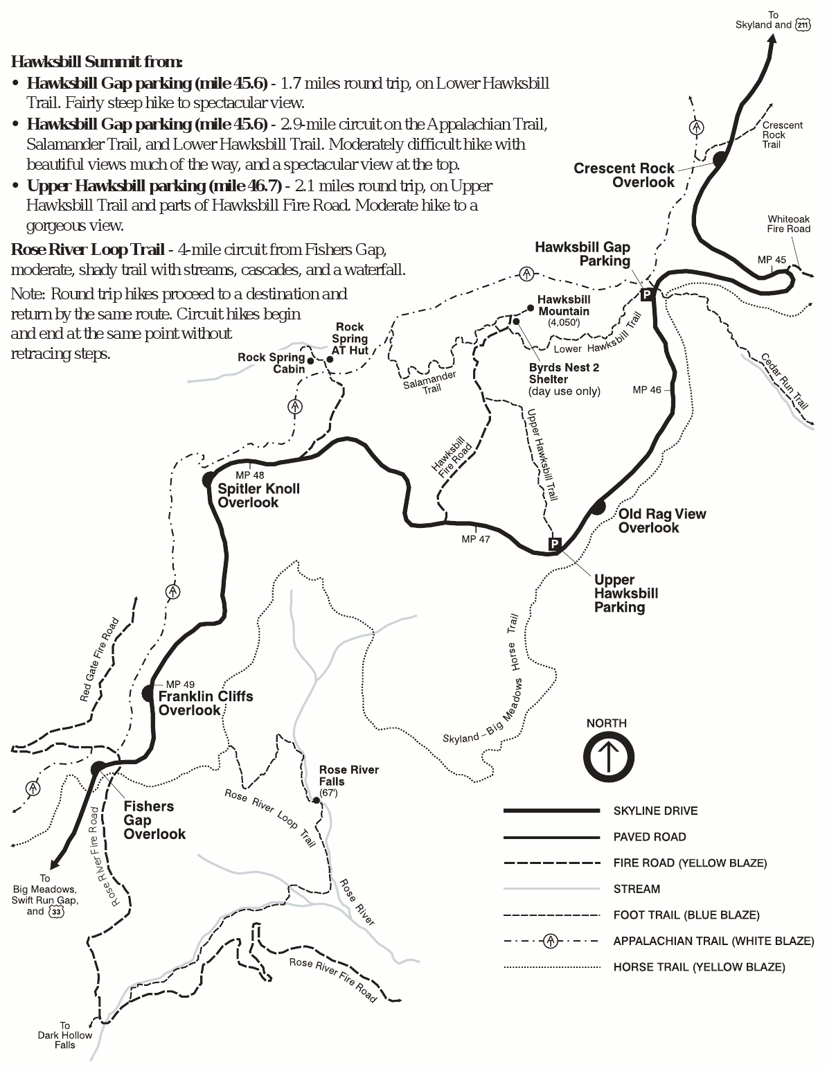
English: Hawksbill trail map, showing hiking trails to Hawksbill Mountain, Rose River Falls, and a few others accessed from Skyline Drive. You’ll also see the Rock Springs hut o the Appalachian Trail. |
| Date | |
| Source | U.S. National Park Service (http://npmaps.com/wp-content/uploads/shenandoah-hawksbill-trail-map.gif) |
| Author | U.S. National Park Service, restoration/cleanup by Matt Holly |
Licensing[edit]
| This image or media file contains material based on a work of a National Park Service employee, created as part of that person's official duties. As a work of the U.S. federal government, such work is in the public domain in the United States. See the NPS website and NPS copyright policy for more information. |
File history
Click on a date/time to view the file as it appeared at that time.
| Date/Time | Thumbnail | Dimensions | User | Comment | |
|---|---|---|---|---|---|
| current | 09:31, 17 May 2017 | | 1,194 × 1,540 (135 KB) | RKBot (talk | contribs) | =={{int:filedesc}}== {{Information |description= {{en|1=Hawksbill trail map, showing hiking trails to Hawksbill Mountain, Rose River Falls, and a few others accessed from Skyline Drive. You’ll also see the Rock Springs hut o the Appalachian Trail.}}... |
You cannot overwrite this file.
File usage on Commons
The following page uses this file: