File:NPS voyageurs-black-bay-ski-hiking-trail-map.jpg
Jump to navigation
Jump to search

Size of this preview: 800 × 547 pixels. Other resolutions: 320 × 219 pixels | 640 × 437 pixels | 1,024 × 700 pixels | 1,320 × 902 pixels.
Original file (1,320 × 902 pixels, file size: 145 KB, MIME type: image/jpeg)
Captions
Captions
Add a one-line explanation of what this file represents
Summary
[edit]
| Description |
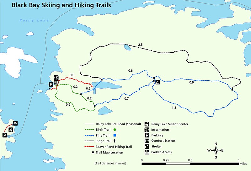
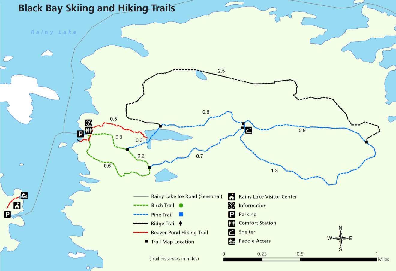
English: Black Bay ski and hiking trail map, showing the summer and winter trails located near the Rainy Lake Visitor Center. These are accessible via the ice road in winter and by boat in summer. |
| Date | |
| Source | U.S. National Park Service (http://npmaps.com/wp-content/uploads/voyageurs-black-bay-ski-hiking-trail-map.jpg) |
| Author | U.S. National Park Service, restoration/cleanup by Matt Holly |
Licensing
[edit]
| This image or media file contains material based on a work of a National Park Service employee, created as part of that person's official duties. As a work of the U.S. federal government, such work is in the public domain in the United States. See the NPS website and NPS copyright policy for more information. |
File history
Click on a date/time to view the file as it appeared at that time.
| Date/Time | Thumbnail | Dimensions | User | Comment | |
|---|---|---|---|---|---|
| current | 09:53, 17 May 2017 | | 1,320 × 902 (145 KB) | RKBot (talk | contribs) | =={{int:filedesc}}== {{Information |description= {{en|1=Black Bay ski and hiking trail map, showing the summer and winter trails located near the Rainy Lake Visitor Center. These are accessible via the ice road in winter and by boat in summer.}} |date=... |
You cannot overwrite this file.
File usage on Commons
The following page uses this file: