File:NYCS map 7.svg
跳至導覽
跳至搜尋

此 SVG 檔案的 PNG 預覽的大小:490 × 599 像素。 其他解析度:196 × 240 像素 | 393 × 480 像素 | 628 × 768 像素 | 838 × 1,024 像素 | 1,676 × 2,048 像素 | 648 × 792 像素。
原始檔案 (SVG 檔案,表面大小:648 × 792 像素,檔案大小:379 KB)
說明
說明
添加單行說明來描述出檔案所代表的內容
摘要
[編輯]
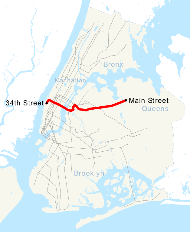
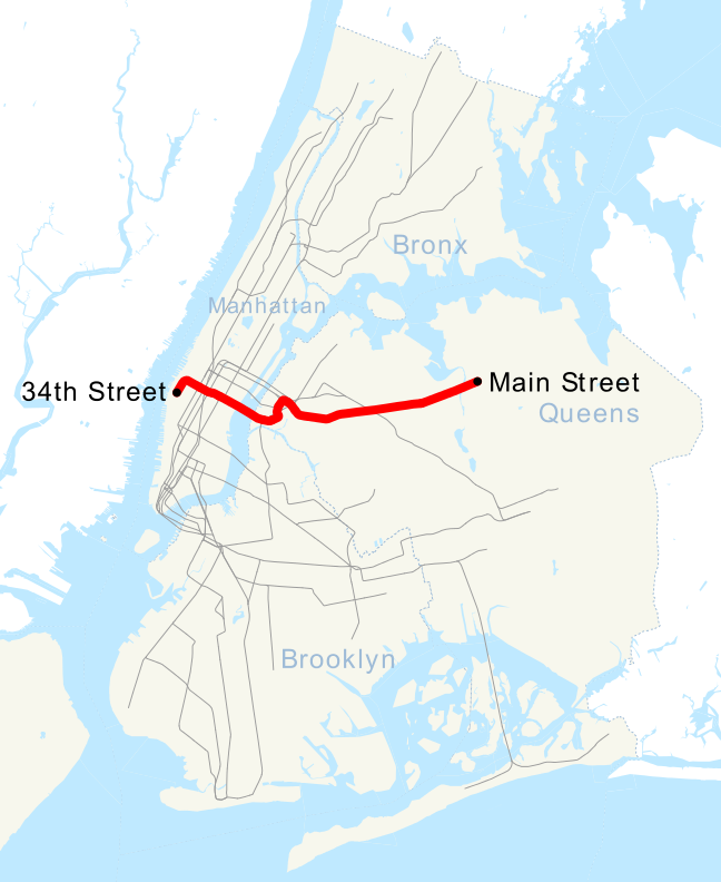
| 描述 | This is a map showing the New York City Subway's 7 service. It was created with TIGER/Line GIS data (water and boundaries) and my own data (subway lines and stations, traced on TIGER/Line road data). If you would like a copy of the subway data, email me. |
| 日期 | 2007年5月1日 (原始上傳日期) |
| 來源 | 无法识别来源。根据版权声明推断为其自己的作品。 |
| 作者 | 无法识别作者。根据版权声明推断作者为NE2。 |
授權條款
[編輯]
| 我,此作品的版權所有人,釋出此作品至公共領域。此授權條款在全世界均適用。 這可能在某些國家不合法,如果是的話: 我授予任何人有權利使用此作品於任何用途,除受法律約束外,不受任何限制。 |
檔案歷史
點選日期/時間以檢視該時間的檔案版本。
| 日期/時間 | 縮圖 | 尺寸 | 使用者 | 備註 | |
|---|---|---|---|---|---|
| 目前 | 2015年9月12日 (六) 06:49 | | 648 × 792(379 KB) | Jc86035(留言 | 貢獻) | moved text marker for 34th St |
| 2015年9月12日 (六) 06:38 |  | 648 × 792(377 KB) | Jc86035(留言 | 貢獻) | fixed text (sans-serif to Arial) to match and changed it to path, fixed/simplified path of 7 extension, cleaned up with SVGCleaner | |
| 2015年9月11日 (五) 19:27 |  | 648 × 792(380 KB) | DMacks(留言 | 貢獻) | remove "Times Square" label (previously-removed box had covered it) | |
| 2015年9月11日 (五) 15:29 |  | 648 × 792(390 KB) | DMacks(留言 | 貢獻) | remove white rectangle just above "Times Square" | |
| 2015年9月2日 (三) 15:45 |  | 648 × 792(390 KB) | FlushingLocal(留言 | 貢獻) | Reverted to version as of 15:43, 2 September 2015 | |
| 2015年9月2日 (三) 15:45 |  | 648 × 792(390 KB) | FlushingLocal(留言 | 貢獻) | Updated again to an issue with the original file. | |
| 2015年9月2日 (三) 15:43 |  | 648 × 792(390 KB) | FlushingLocal(留言 | 貢獻) | Updated 7 Train Map to 34 St - Hudson Yards as the new terminal and removed Times Square | |
| 2011年10月29日 (六) 10:48 |  | 648 × 792(464 KB) | Robot8A(留言 | 貢獻) | text to path because you can't see it properly in article | |
| 2007年5月1日 (二) 00:04 |  | 648 × 792(389 KB) | NE2(留言 | 貢獻) | == Summary == This is a map showing the New York City Subway's 7 service. It was created with TIGER/Line GIS data (water and boundaries) and my own data (subway lines and stations, traced on TIGER/Line road data). If you would like a copy of the subway da |
無法覆蓋此檔案。
檔案用途
下列7個頁面有用到此檔案:
- User:Chumwa/OgreBot/Public transport information/2015 September 1-10
- User:Chumwa/OgreBot/Public transport information/2015 September 11-20
- User:Chumwa/OgreBot/Transport Maps/2015 September 1-10
- User:Chumwa/OgreBot/Transport Maps/2015 September 11-20
- Category:7 (New York City Subway service)
- Category:IRT Flushing Line
- Category:Views from the IRT Flushing Line
全域檔案使用狀況
以下其他 wiki 使用了這個檔案:
- ca.wikipedia.org 的使用狀況
- de.wikipedia.org 的使用狀況
- en.wikipedia.org 的使用狀況
- es.wikipedia.org 的使用狀況
- et.wikipedia.org 的使用狀況
- fi.wikipedia.org 的使用狀況
- fr.wikipedia.org 的使用狀況
- he.wikipedia.org 的使用狀況
- ja.wikipedia.org 的使用狀況
- ko.wikipedia.org 的使用狀況
- lmo.wikipedia.org 的使用狀況
- nl.wikipedia.org 的使用狀況
- no.wikipedia.org 的使用狀況
- pl.wikipedia.org 的使用狀況
- pt.wikipedia.org 的使用狀況
- ru.wikipedia.org 的使用狀況
- www.wikidata.org 的使用狀況
- zh.wikipedia.org 的使用狀況