File:Nahant-Twin-Towers.jpg
Jump to navigation
Jump to search
Size of this preview: 800 × 536 pixels. Other resolutions: 320 × 215 pixels | 640 × 429 pixels | 1,024 × 687 pixels | 1,280 × 858 pixels | 2,000 × 1,341 pixels.
Original file (2,000 × 1,341 pixels, file size: 841 KB, MIME type: image/jpeg)
Captions
Captions
Add a one-line explanation of what this file represents
Summary[edit]
| Description |
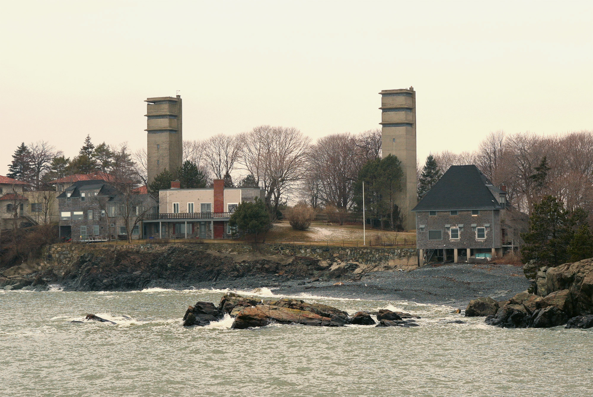
English: This photo, taken in February, 2010, looks west from the southwest tip of East Point, near the former platform of Battery 206 Gun 1. It shows the twin 8-story fire control towers along Swallow Cave Rd. in Nahant, MA. When they were built in 1943 the towers were each about 70 ft. tall, putting the observing instruments in their top levels almost 109 ft. above sea level. The tower on the right was designated Site 1A and that on the left Site 2A.
Today the towers are privately owned. They are perhaps the best-preserved pair of Coast Artillery towers in the United States. |
| Date | 25 September 2010 (original upload date) |
| Source | Own work |
| Author | Pgrig at English Wikipedia |
Licensing[edit]
Pgrig at English Wikipedia, the copyright holder of this work, hereby publishes it under the following license:
This file is licensed under the Creative Commons Attribution-Share Alike 3.0 Unported license.
Attribution: Pgrig at English Wikipedia
- You are free:
- to share – to copy, distribute and transmit the work
- to remix – to adapt the work
- Under the following conditions:
- attribution – You must give appropriate credit, provide a link to the license, and indicate if changes were made. You may do so in any reasonable manner, but not in any way that suggests the licensor endorses you or your use.
- share alike – If you remix, transform, or build upon the material, you must distribute your contributions under the same or compatible license as the original.
Original upload log[edit]
Transferred from en.wikipedia to Commons by Ktr101 using CommonsHelper.
The original description page was here. All following user names refer to en.wikipedia.
- 2010-09-25 14:14 Pgrig 2000×1341× (861579 bytes) This photo, taken in February, 2010, looks west from the southwest tip of East Point, near the former platform of Battery 206 Gun 1. It shows the twin 8-story fire control towers along Swallow Cave Rd. in Nahant, MA. When they were built in 1943 the tower
File history
Click on a date/time to view the file as it appeared at that time.
| Date/Time | Thumbnail | Dimensions | User | Comment | |
|---|---|---|---|---|---|
| current | 00:04, 30 June 2013 | | 2,000 × 1,341 (841 KB) | Ktr101 (talk | contribs) | {{Information |Description={{en|This photo, taken in February, 2010, looks west from the southwest tip of East Point, near the former platform of Battery 206 Gun 1. It shows the twin 8-story fire control towers along Swallow Cave Rd. in Nahant, MA. Whe... |
You cannot overwrite this file.
File usage on Commons
There are no pages that use this file.
File usage on other wikis
The following other wikis use this file:
- Usage on en.wikipedia.org