File:Nanchang Metro map sb zh-hans.pdf
跳至導覽
跳至搜尋

此 PDF 檔案的 JPG 預覽的大小:780 × 600 像素。 其他解析度:312 × 240 像素 | 624 × 480 像素 | 999 × 768 像素 | 1,280 × 985 像素 | 2,166 × 1,666 像素。
原始檔案 (2,166 × 1,666 像素,檔案大小:73 KB,MIME 類型:application/pdf)
說明
說明
添加單行說明來描述出檔案所代表的內容
| 描述 |
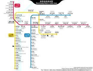
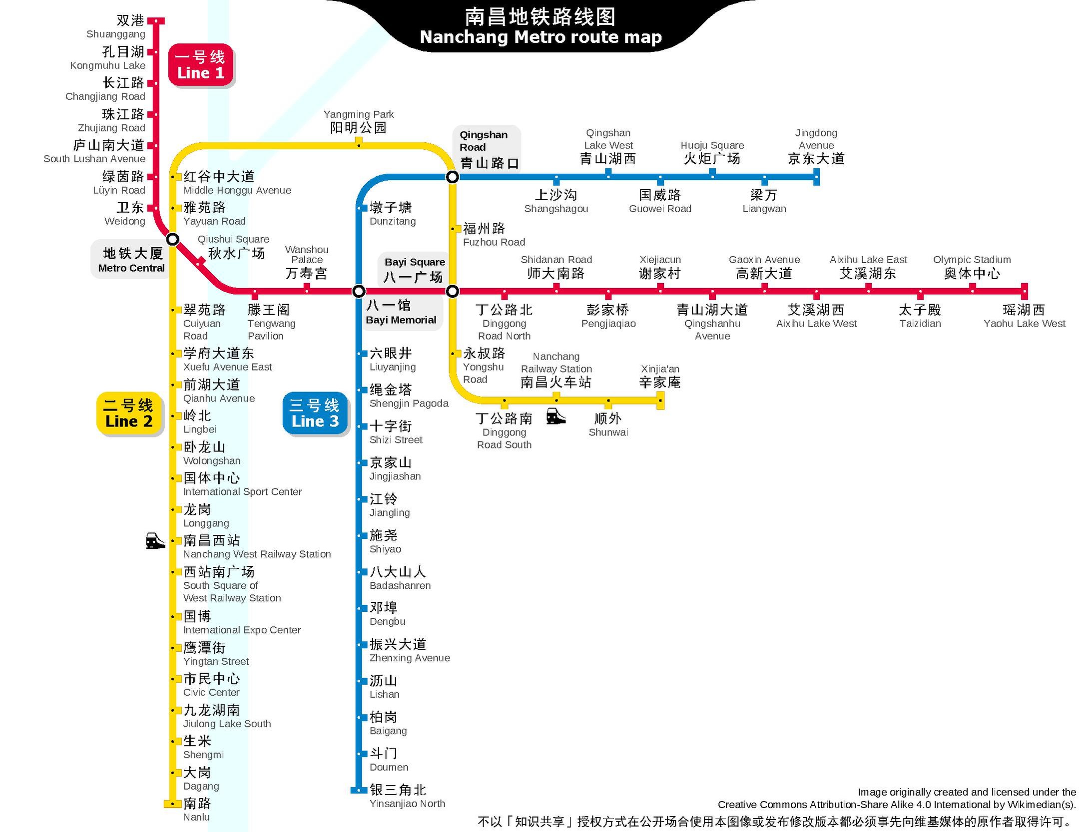
English: Nanchang Metro route map in PDF format.
中文:南昌地铁路线图,PDF格式。 |
|||
| 日期 | 2014年十二月12日, 01:50:20 (上傳日期) | |||
| 來源 | 自己的作品 | |||
| 作者 | Sameboat | |||
| 授權許可 (重用此檔案) |
此檔案採用共享創意 姓名標示-相同方式分享 4.0 國際授權條款。
|
|||
| 其他版本 |
|


檔案歷史
點選日期/時間以檢視該時間的檔案版本。
| 日期/時間 | 縮圖 | 尺寸 | 用戶 | 備註 | |
|---|---|---|---|---|---|
| 目前 | 2020年12月30日 (三) 01:12 |  | 2,166 × 1,666(73 KB) | Sameboat(對話 | 貢獻) | line 3 inaugurate |
| 2020年6月27日 (六) 00:51 |  | 2,166 × 1,666(128 KB) | Sameboat(對話 | 貢獻) | update line 2 | |
| 2018年7月2日 (一) 09:57 |  | 2,166 × 1,666(73 KB) | Sameboat(對話 | 貢獻) | minor | |
| 2017年8月20日 (日) 13:05 |  | 2,166 × 1,666(73 KB) | Sameboat(對話 | 貢獻) | 国博站 | |
| 2017年8月20日 (日) 00:57 | 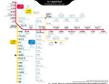 | 2,166 × 1,666(73 KB) | Sameboat(對話 | 貢獻) | Line 2 | |
| 2017年2月10日 (五) 05:00 | 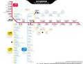 | 2,166 × 1,666(79 KB) | Sameboat(對話 | 貢獻) | Civil Centre -> Civic Center | |
| 2017年2月9日 (四) 03:09 |  | 2,166 × 1,666(79 KB) | Sameboat(對話 | 貢獻) | station names update | |
| 2016年8月11日 (四) 01:27 | 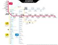 | 2,166 × 1,666(70 KB) | Sameboat(對話 | 貢獻) | Line 2 phase 2 and many other minor changes | |
| 2016年2月11日 (四) 10:11 | 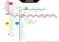 | 2,166 × 1,550(65 KB) | Sameboat(對話 | 貢獻) | Liantang | |
| 2016年2月5日 (五) 15:48 | 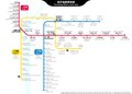 | 2,166 × 1,550(64 KB) | Sameboat(對話 | 貢獻) | Changnan |
無法覆蓋此檔案。
檔案用途
下列45個頁面有用到此檔案:
- User:Chumwa/OgreBot/Potential transport maps/2016 August 11-20
- User:Chumwa/OgreBot/Potential transport maps/2016 February 1-9
- User:Chumwa/OgreBot/Potential transport maps/2016 February 10-19
- User:Chumwa/OgreBot/Potential transport maps/2016 January 11-20
- User:Chumwa/OgreBot/Potential transport maps/2017 August 11-20
- User:Chumwa/OgreBot/Potential transport maps/2017 February 1-9
- User:Chumwa/OgreBot/Potential transport maps/2017 February 10-18
- User:Chumwa/OgreBot/Potential transport maps/2018 July 1-10
- User:Chumwa/OgreBot/Public transport information/2015 March 11-20
- User:Chumwa/OgreBot/Public transport information/2015 September 11-20
- User:Chumwa/OgreBot/Public transport information/2016 August 11-20
- User:Chumwa/OgreBot/Public transport information/2016 February 1-9
- User:Chumwa/OgreBot/Public transport information/2016 February 10-19
- User:Chumwa/OgreBot/Public transport information/2016 January 1-10
- User:Chumwa/OgreBot/Public transport information/2016 January 11-20
- User:Chumwa/OgreBot/Public transport information/2017 August 11-20
- User:Chumwa/OgreBot/Public transport information/2017 February 1-9
- User:Chumwa/OgreBot/Public transport information/2017 February 10-18
- User:Chumwa/OgreBot/Public transport information/2018 July 1-10
- User:Chumwa/OgreBot/Public transport information/2020 December 21-31
- User:Chumwa/OgreBot/Public transport information/2020 June 21-30
- User:Chumwa/OgreBot/Transport Maps/2015 March 11-20
- User:Chumwa/OgreBot/Transport Maps/2015 September 11-20
- User:Chumwa/OgreBot/Transport Maps/2016 August 11-20
- User:Chumwa/OgreBot/Transport Maps/2016 February 1-9
- User:Chumwa/OgreBot/Transport Maps/2016 February 10-19
- User:Chumwa/OgreBot/Transport Maps/2016 January 1-10
- User:Chumwa/OgreBot/Transport Maps/2016 January 11-20
- User:Chumwa/OgreBot/Transport Maps/2017 August 11-20
- User:Chumwa/OgreBot/Transport Maps/2017 February 1-9
- User:Chumwa/OgreBot/Transport Maps/2017 February 10-18
- User:Chumwa/OgreBot/Transport Maps/2018 July 1-10
- User:Chumwa/OgreBot/Transport Maps/2020 December 21-31
- User:Chumwa/OgreBot/Transport Maps/2020 June 21-30
- User:Chumwa/OgreBot/Travel and communication maps/2016 August 11-20
- User:Chumwa/OgreBot/Travel and communication maps/2016 February 1-9
- User:Chumwa/OgreBot/Travel and communication maps/2016 February 10-19
- User:Chumwa/OgreBot/Travel and communication maps/2016 January 11-20
- User:Chumwa/OgreBot/Travel and communication maps/2017 August 11-20
- User:Chumwa/OgreBot/Travel and communication maps/2017 February 1-9
- User:Chumwa/OgreBot/Travel and communication maps/2017 February 10-18
- User:Chumwa/OgreBot/Travel and communication maps/2018 July 1-10
- User:Liesel/Rail transport/2014 December 11-20
- File:Nanchang Metro map sb zh-hans.svg
- Category:Line 3, Nanchang Metro