File:Naufrage Evlalia (1969).jpg

Original file (1,755 × 1,275 pixels, file size: 418 KB, MIME type: image/jpeg)
Captions
Captions
Summary
[edit].jpg&action=edit§ion=1)
| Description |
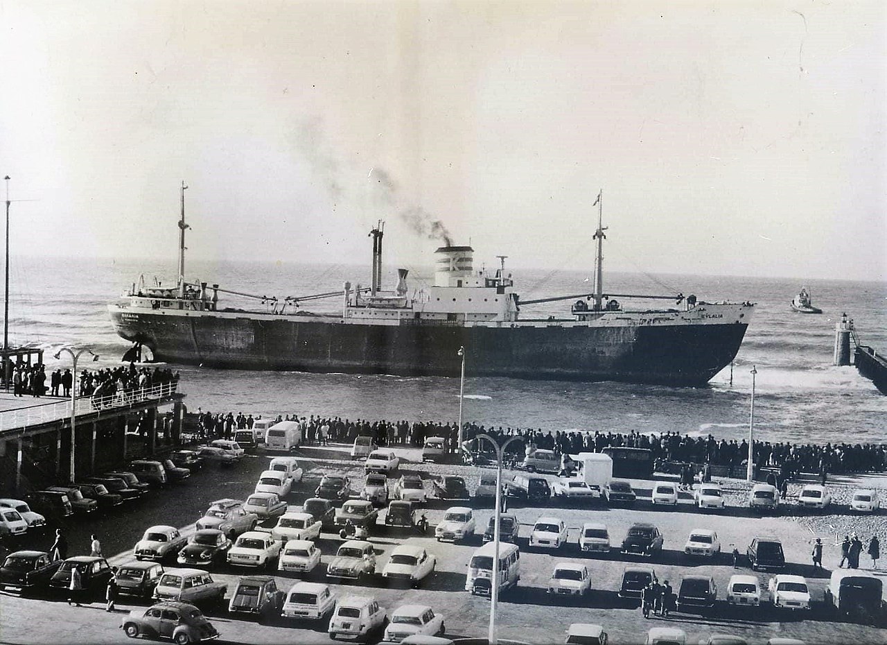
English: Greek cargo ship Evlalia grounded at Capbreton (Landes). The freighter ran aground near the estacade on December 5, 1969. He had confused Capbreton with the Adour estuary at Bayonne 20 km further south. It was an attraction for residents and tourists before being refloated a week later.
Français : Cargo grec Evlalia échoué à Capbreton (Landes). Le cargo s'est échoué près de l'estacade le 5 décembre 1969. Il avait confondu Capbreton avec l'estuaire de l'Adour à Bayonne 20 km plus au sud. Il a été une attraction pour les riverains et les touristes avant d'etre renfloué une semaine plus tard. |
||||
| Date | |||||
| Source | Vintage postcard | ||||
| Author | Unknown author | ||||
| Permission (Reusing this file) |
|
||||
| Camera location | | View this and other nearby images on: OpenStreetMap |
|---|
.jpg¶ms=043.654560_N_-001.444295_E_globe:Earth_type:camera_heading:292.50&language=en)
Licensing
[edit].jpg&action=edit§ion=2)
| I, the copyright holder of this work, release this work into the public domain. This applies worldwide. In some countries this may not be legally possible; if so: I grant anyone the right to use this work for any purpose, without any conditions, unless such conditions are required by law. |
File history
Click on a date/time to view the file as it appeared at that time.
| Date/Time | Thumbnail | Dimensions | User | Comment | |
|---|---|---|---|---|---|
| current | 21:04, 8 November 2021 | | 1,755 × 1,275 (418 KB) | Tangopaso (talk | contribs) | == {{int:filedesc}} == {{Information |Description= {{en|1=Greek cargo ship Evlalia grounded at Capbreton (Landes). The freighter ran aground near the estacade on December 5, 1969. He had confused Capbreton with the Adour estuary at Bayonne 20 km further south. It was an attraction for residents and tourists before being refloated a week later.}} {{fr|1=Cargo grec Evlalia échoué à Capbreton (Landes). Le cargo s'est échoué près de l'estacade le 5 décembre 1969. Il avait confondu Capbreton avec... |
You cannot overwrite this file.
File usage on Commons
The following page uses this file:
.jpg&oldid=661432466)