File:NewJerseyForageWar.png
Original file (923 × 570 pixels, file size: 755 KB, MIME type: image/png)
Captions
Captions
Summary
[edit]
| Description |
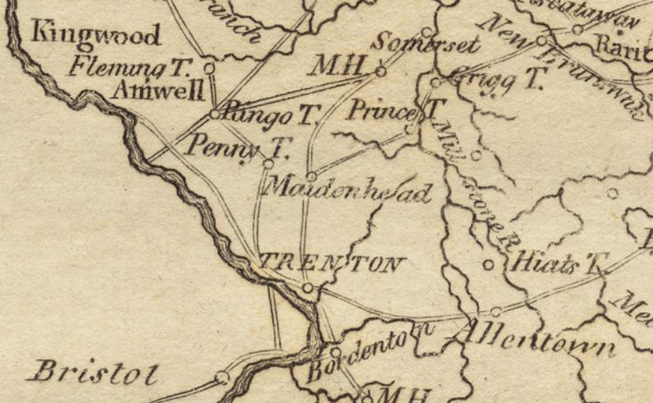
English: An extract of an 1806 map of New Jersey, depicting the area around New Brunswick and Trenton. Cropped, color contrast adjusted. This area was the site of numerous skirmishes in early 1777 during the American Revolutionary War. |
| Date | published 1806 |
| Source | http://maps.bpl.org/details_12444/?mtid=98 (call number G1200 .C37 1806) |
| Author | Matthew Carey |
Licensing
[edit]
|
This work is in the public domain in its country of origin and other countries and areas where the copyright term is the author's life plus 70 years or fewer.
| |
| This file has been identified as being free of known restrictions under copyright law, including all related and neighboring rights. | |
File history
Click on a date/time to view the file as it appeared at that time.
| Date/Time | Thumbnail | Dimensions | User | Comment | |
|---|---|---|---|---|---|
| current | 21:02, 20 January 2010 | | 923 × 570 (755 KB) | Magicpiano (talk | contribs) | == Summary == {{Information |Description={{en|1=An extract of an 1806 map of New Jersey, depicting the area around New Brunswick and Trenton. Cropped, color contrast adjusted. This area was t |
You cannot overwrite this file.
File usage on Commons
There are no pages that use this file.
File usage on other wikis
The following other wikis use this file:
- Usage on en.wikipedia.org
- Usage on ja.wikipedia.org