File:New Hampshire Congressional Districts, 113th Congress.tif
ナビゲーションに移動
検索に移動

この TIF ファイルのこの PNG プレビューのサイズ: 391 × 599 ピクセル. その他の解像度: 156 × 240 ピクセル | 313 × 480 ピクセル | 501 × 768 ピクセル | 668 × 1,024 ピクセル | 1,300 × 1,992 ピクセル。
元のファイル (1,300 × 1,992 ピクセル、ファイルサイズ: 461キロバイト、MIME タイプ: image/tiff)
キャプション
キャプション
このファイルの内容を1行で記述してください
概要[編集]
| 解説 |
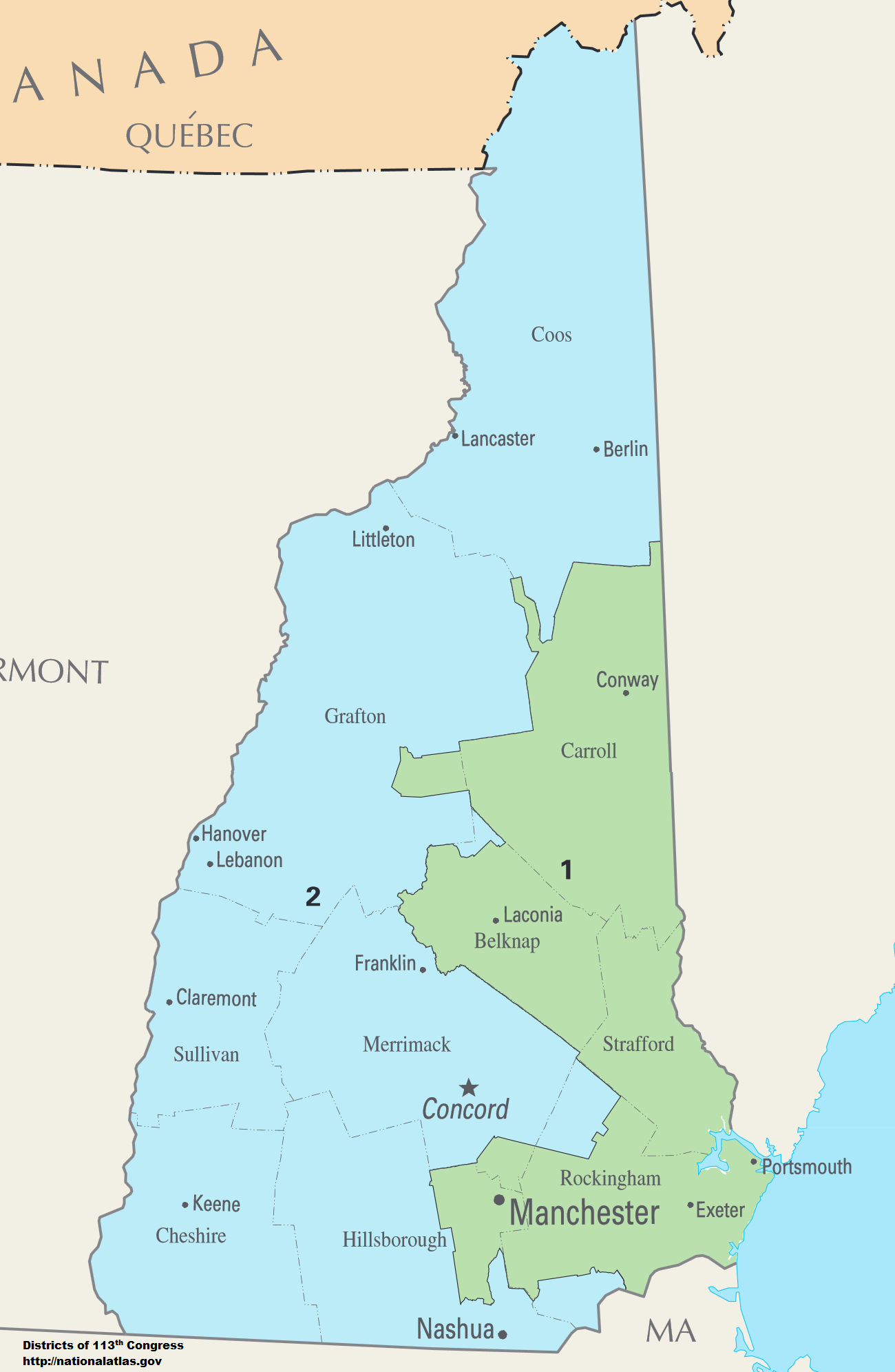
English: Map of Congressional Districts in the state of New Hampshire, reflecting district boundaries current to the 113th United States Congress. |
| 日付 | |
| 原典 | National Atlas of the United States (http://nationalatlas.gov/printable/congress.html) |
| 作者 | Department of the Interior |
ライセンス[編集]
This map was obtained from an edition of the National Atlas of the United States. Like almost all works of the U.S. federal government, works from the National Atlas are in the public domain in the United States.
Online access: NationalAtlas.gov | 1970 print edition: Library of Congress, Perry-Castañeda Library
|
ファイルの履歴
過去の版のファイルを表示するには、その版の日時をクリックしてください。
| 日付と時刻 | サムネイル | 寸法 | 利用者 | コメント | |
|---|---|---|---|---|---|
| 現在の版 | 2014年2月2日 (日) 06:00 |  | 1,300 × 1,992 (461キロバイト) | 7partparadigm (トーク | 投稿記録) | User created page with UploadWizard |
このファイルは上書きできません。
ファイルの使用状況
このファイルを使用しているページはありません。
グローバルなファイル使用状況
以下に挙げる他のウィキがこの画像を使っています:
- fa.wikipedia.org での使用状況
- ja.wikipedia.org での使用状況
- ru.wikipedia.org での使用状況
- simple.wikipedia.org での使用状況
- uk.wikipedia.org での使用状況
- zh.wikipedia.org での使用状況