File:Newfoundland1744.jpg
跳转到导航
跳转到搜索

本预览的尺寸:800 × 483像素。 其他分辨率:320 × 193像素 | 640 × 387像素 | 1,024 × 619像素 | 1,284 × 776像素。
原始文件 (1,284 × 776像素,文件大小:559 KB,MIME类型:image/jpeg)
说明
说明
添加一行文字以描述该文件所表现的内容
摘要[编辑]
| 描述 |
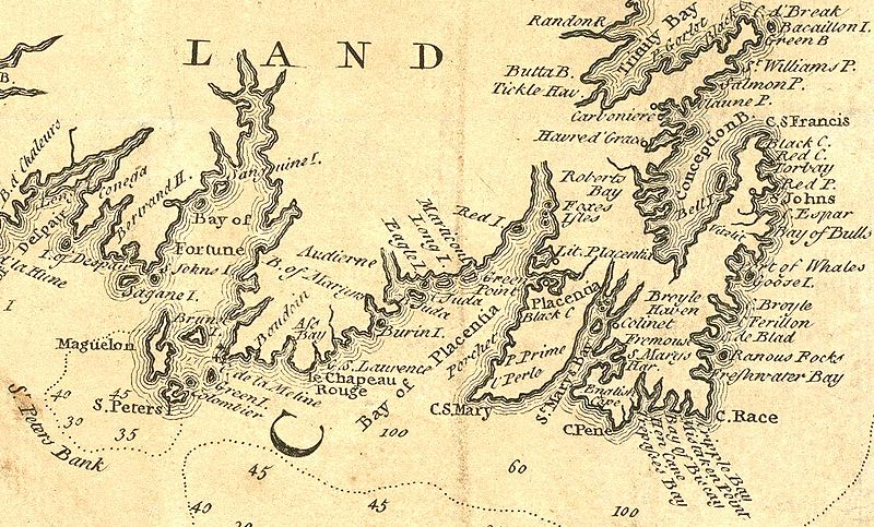
English: Extract from a 1746 map depicting southeastern Newfoundland. In addition to crop for selection, image has had levels and colors adjusted to improve contrast. |
| 日期 | |
| 来源 | Boston Public Library Norman Leventhal Map Center: http://maps.bpl.org/details_14079/ |
| 作者 | Jacques Bellin |
许可协议[编辑]
|
本作品在其来源国以及其他著作权期限是作者逝世后100年或以下的国家和地区属于公有领域。 | |
| 本文件已被确认为免除已知的著作权法限制(包括所有相关权利)。 | |
文件历史
点击某个日期/时间查看对应时刻的文件。
| 日期/时间 | 缩略图 | 大小 | 用户 | 备注 | |
|---|---|---|---|---|---|
| 当前 | 2010年4月6日 (二) 02:02 | | 1,284 × 776(559 KB) | Magicpiano(留言 | 贡献) | {{Information |Description={{en|1=Extract from a 1746 map depicting southeastern w:Newfoundland (island). In addition to crop for selection, image has had levels and colors adjusted to improve contrast. }} |Source=Boston Public Library Norman Leven |
您不可以覆盖此文件。
文件用途
没有页面使用本文件。
全域文件用途
以下其他wiki使用此文件:
- ar.wikipedia.org上的用途
- en.wikipedia.org上的用途
- fi.wikipedia.org上的用途
- fr.wikipedia.org上的用途
- it.wikipedia.org上的用途
- ja.wikipedia.org上的用途
- nn.wikipedia.org上的用途
- no.wikipedia.org上的用途
- ru.wikipedia.org上的用途
- www.wikidata.org上的用途
- zh.wikipedia.org上的用途