File:Nigerian covid 19 pandemic map.jpg
Jump to navigation
Jump to search

Size of this preview: 782 × 600 pixels. Other resolutions: 313 × 240 pixels | 626 × 480 pixels | 1,002 × 768 pixels | 1,200 × 920 pixels.
Original file (1,200 × 920 pixels, file size: 344 KB, MIME type: image/jpeg)
Captions
Captions
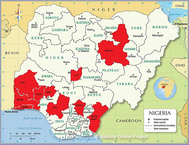
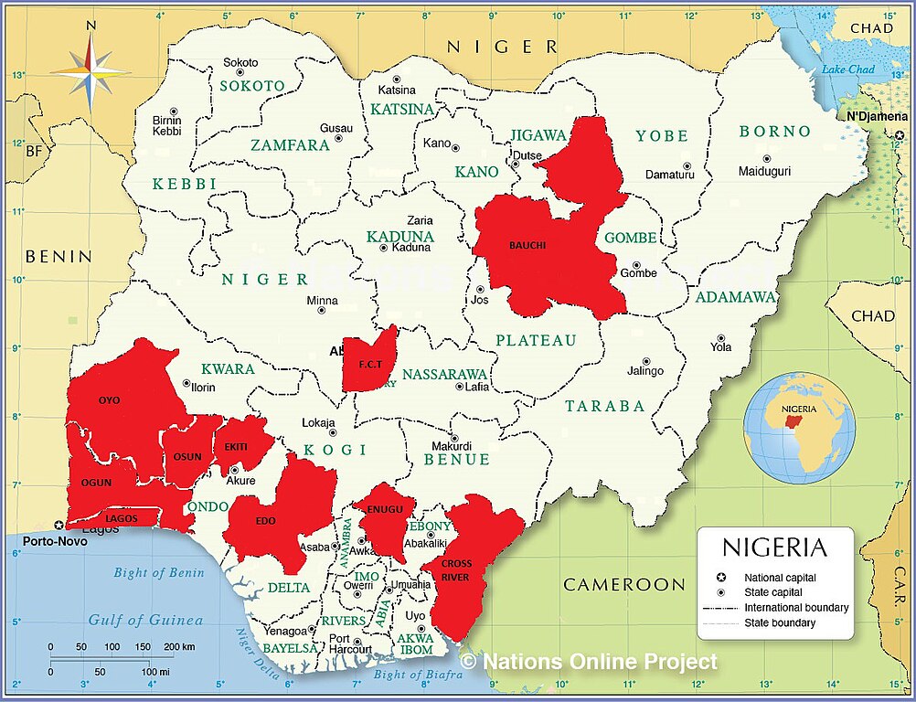
Nigerian map showing states having coronavirus as of 28 march 2020
Summary
[edit]
| Description |
English: Map of Nigeria showing states and Federal Capital Territory on red that have coronavirus
as of 28 March 2020. |
| Date | |
| Source | Own work |
| Author | Kid Keen 47 |
Licensing
[edit]
I, the copyright holder of this work, hereby publish it under the following license:
This file is licensed under the Creative Commons Attribution-Share Alike 4.0 International license.
- You are free:
- to share – to copy, distribute and transmit the work
- to remix – to adapt the work
- Under the following conditions:
- attribution – You must give appropriate credit, provide a link to the license, and indicate if changes were made. You may do so in any reasonable manner, but not in any way that suggests the licensor endorses you or your use.
- share alike – If you remix, transform, or build upon the material, you must distribute your contributions under the same or compatible license as the original.
File history
Click on a date/time to view the file as it appeared at that time.
| Date/Time | Thumbnail | Dimensions | User | Comment | |
|---|---|---|---|---|---|
| current | 18:27, 28 March 2020 | | 1,200 × 920 (344 KB) | Kid Keen 47 (talk | contribs) | Uploaded own work with UploadWizard |
You cannot overwrite this file.
File usage on Commons
There are no pages that use this file.
File usage on other wikis
The following other wikis use this file:
- Usage on pt.wikipedia.org
- Usage on www.wikidata.org