File:Nividic.jpg
跳至導覽
跳至搜尋

預覽大小:450 × 600 像素。 其他解析度:180 × 240 像素 | 360 × 480 像素 | 576 × 768 像素 | 768 × 1,024 像素 | 1,536 × 2,048 像素。
原始檔案 (1,536 × 2,048 像素,檔案大小:1.27 MB,MIME 類型:image/jpeg)
說明
說明
添加單行說明來描述出檔案所代表的內容
| 描述 |
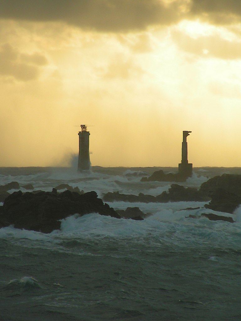
Français : Le phare de Nividic, à l’île d’Ouessant (Finistère, France), est situé sur la limite de partage des eaux entre la Manche et la mer d’Iroise dans l’océan Atlantique, un des zones avec le plus fort traffic de navigation dans le monde, et l’un des plus dangereux.
English: The Nividic lighthouse, at Ouessant island (Finistère, France), at the limit of waters between the English Channel and the Iroise Sea in the Atlantic Ocean, one of the places with the most important navigation traffic in the world, and one of the most dangerous. |
| 日期 | |
| 來源 | author |
| 作者 | Samuel Lamotte d'Incamps |
| 授權許可 (重用此檔案) |
cc-by-sa-2.0-fr 此檔案採用創用CC 姓名標示-相同方式分享 2.0 法國授權條款。
 |
檔案歷史
點選日期/時間以檢視該時間的檔案版本。
| 日期/時間 | 縮圖 | 尺寸 | 使用者 | 備註 | |
|---|---|---|---|---|---|
| 目前 | 2007年12月21日 (五) 01:14 | | 1,536 × 2,048(1.27 MB) | Verdy p(留言 | 貢獻) | rotate 2 degrees |
| 2007年12月19日 (三) 00:44 |  | 1,536 × 2,048(2.08 MB) | Verdy p(留言 | 貢獻) | cleaner | |
| 2005年5月2日 (一) 12:49 |  | 1,536 × 2,048(721 KB) | Slamotte(留言 | 貢獻) | Phare de Nividic Auteur : Samuel Lamotte d'Incamps Licence : GNU FDL |
無法覆蓋此檔案。
檔案用途
下列5個頁面有用到此檔案:
全域檔案使用狀況
以下其他 wiki 使用了這個檔案:
- af.wikipedia.org 的使用狀況
- br.wikipedia.org 的使用狀況
- crh.wikipedia.org 的使用狀況
- de.wikipedia.org 的使用狀況
- el.wikipedia.org 的使用狀況
- en.wikipedia.org 的使用狀況
- es.wikipedia.org 的使用狀況
- et.wikipedia.org 的使用狀況
- fr.wikipedia.org 的使用狀況
- fr.wikivoyage.org 的使用狀況
- gl.wikipedia.org 的使用狀況
- it.wikipedia.org 的使用狀況
- nl.wikipedia.org 的使用狀況
- no.wikipedia.org 的使用狀況
- www.wikidata.org 的使用狀況
- zh.wikipedia.org 的使用狀況